Category:U.S. Route 27 in Georgia (U.S. state)
Jump to navigation
Jump to search
section of United States Numbered Highway in Georgia, United States  | |||||
| Upload media | |||||
| Instance of | |||||
|---|---|---|---|---|---|
| Location | Georgia | ||||
| Transport network | |||||
| Owned by | |||||
| Maintained by | |||||
| Inception |
| ||||
| Length |
| ||||
| |||||
English: U.S. Route 27 (US 27) runs south-to-north through the U.S. state of Georgia near its western border with Alabama. The whole route is Governor's Road Improvement Program (GRIP) corridor EDS-27, providing the bulk of the Tallahassee - Chattanooga corridor. All of US 27 in Georgia is designated State Route 1 (SR 1) and is also designated as the Martha Berry Highway.
Subcategories
This category has the following 4 subcategories, out of 4 total.
U
Media in category "U.S. Route 27 in Georgia (U.S. state)"
The following 16 files are in this category, out of 16 total.
-
 Bluffton limit, US27 SB.JPG 4,320 × 3,240; 4.53 MB
-
 Bluffton Welcome, US27 Northbound.JPG 4,320 × 3,240; 4.57 MB
-
 GA green route concurrency.png 318 × 335; 140 KB
-
 GA20eUS27US411nGA101Signs-Rome (30929820320).jpg 2,400 × 1,600; 2.13 MB
-
 GA39 GA62 US27Bus Blakely Square.jpg 5,184 × 3,456; 6.2 MB
-
 GA62 US27 Intersection, Blakely.jpg 5,184 × 3,456; 4.91 MB
-
 Georgia state route 1 map.png 3,033 × 1,791; 553 KB
-
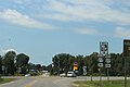
 Luthersville.jpg 4,368 × 2,912; 5.04 MB
-
 Rossville-Gordon-Ave-ga.jpg 3,840 × 2,910; 4.1 MB
-
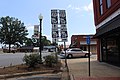
 Summerville-Commerce-Street-ga.jpg 3,815 × 2,870; 4.51 MB
-
 Tennessee-Georgia-state-line-Rossville.jpg 3,887 × 2,963; 5.66 MB
-
 US 27 Alternate.svg 600 × 600; 7 KB
-
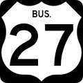 US 27 Business.svg 600 × 600; 11 KB
-
 US 27 Georgia 1926.svg 1,485 × 1,440; 30 KB
-
 US278eGA6eUS27nGA1nSignsRoadCurve (32065305474).jpg 1,200 × 800; 624 KB
-
 US411 US27 GA1 North GA53 East Signs (28491155832).jpg 1,200 × 800; 474 KB


.jpg)


.jpg)
.jpg)