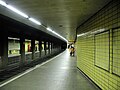
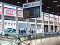
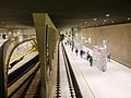
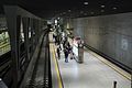
Category:U-Bahnhof Breslauer Platz/Hauptbahnhof
Jump to navigation
Jump to search
| Object location | | View all coordinates using: OpenStreetMap |
|---|

interchange Railway Station in Cologne district of Germany  | |||||
| Upload media | |||||
| Instance of |
| ||||
|---|---|---|---|---|---|
| Named after | |||||
| Location | Altstadt-Nord, Cologne-Innenstadt, Cologne, Cologne Government Region, North Rhine-Westphalia, Germany | ||||
| Transport network | |||||
| Owned by | |||||
| Operator | |||||
| Date of official opening |
| ||||
| Connecting line | |||||
| Adjacent station |
| ||||
| Interchange station | |||||
 | |||||
Media in category "U-Bahnhof Breslauer Platz/Hauptbahnhof"
The following 47 files are in this category, out of 47 total.
-
 2014-02-24&1448032014-02-23&143427 U-Bahn Haltestelle Breslauer Platz Beamen.Jpg 2,448 × 3,264; 2.29 MB
-
 Breslauer Platz Hbf U-Bahn-Eingang + S-Bahnsteig.jpg 1,916 × 1,342; 426 KB
-
 Breslauer Platz Notbahnsteig.JPG 1,024 × 768; 177 KB
-
 Breslauer Platz3.JPG 1,024 × 768; 140 KB
-
 Großflächenanzeiger Breslauer Platz, Stadtbahn Köln-4140.jpg 4,389 × 3,292; 9.06 MB
-
 Haltestelle Breslauer Platz - panoramio (1).jpg 2,048 × 1,536; 815 KB
-
 Haltestelle Breslauer Platz - panoramio.jpg 2,048 × 1,536; 619 KB
-
 J00 814 Bf Breslauer Platz - Hbf.jpg 5,760 × 3,840; 3.34 MB
-
 J00 815 Bf Breslauer Platz-Hbf, ET 2254.jpg 5,760 × 3,840; 3.53 MB
-
 J00 816 Streckentunnel Richtung Hbf-Dom.jpg 5,760 × 3,840; 3.28 MB
-
 J00 817 Streckentunnel von Rathaus.jpg 5,760 × 3,840; 2.92 MB
-
 J00 818 Bf Breslauer Platz-Hbf, Strecken Ri Dom-Hbf und Rathaus.jpg 5,760 × 3,840; 3.08 MB
-
 J00 819 Bf Breslauer Platz-Hbf, ET 2110.jpg 5,760 × 3,840; 3.81 MB
-
 J00 820 Bf Breslauer Platz-Hbf, ET 2110.jpg 5,760 × 3,840; 3.6 MB
-
 J00 821 Bf Breslauer Platz-Hbf, Abzw Richtung Rathaus.jpg 5,760 × 3,840; 3.29 MB
-
 J00 822 Bf Breslauer Platz - Hbf, Trennungsweiche.jpg 5,760 × 3,840; 4.25 MB
-
 K BreslauerPlatz 1513.jpg 1,800 × 1,200; 387 KB
-
 Köln Stadtbahnstation Breslauer Platz-Hauptbahnhof A.jpg 5,049 × 3,225; 8.3 MB
-
 Köln Stadtbahnstation Breslauer Platz-Hauptbahnhof B.jpg 4,974 × 3,204; 7.9 MB
-
 Köln Stadtbahnstation Breslauer Platz-Hauptbahnhof C.jpg 3,159 × 5,088; 8.33 MB
-
 Köln Stadtbahnstation Breslauer Platz-Hauptbahnhof D.jpg 4,914 × 3,174; 4.34 MB
-
 Köln Stadtbahnstation Breslauer Platz-Hauptbahnhof E.jpg 3,282 × 5,028; 8.73 MB
-
 Köln Stadtbahnstation Breslauer Platz-Hauptbahnhof F.jpg 3,249 × 5,139; 10.74 MB
-
 Köln Stadtbahnstation Breslauer Platz-Hauptbahnhof G.jpg 5,055 × 3,297; 8.79 MB
-
 Köln Stadtbahnstation Breslauer Platz-Hauptbahnhof H.jpg 5,022 × 3,429; 9.9 MB
-
 Köln Stadtbahnstation Breslauer Platz-Hauptbahnhof I.jpg 4,728 × 3,224; 4.28 MB
-
 Köln Stadtbahnstation Breslauer Platz-Hauptbahnhof J.jpg 5,124 × 3,381; 9.2 MB
-
 Köln UBahn Breslauer Platz.JPG 2,000 × 1,333; 177 KB
-
 Nord-Süd Stadtbahn, Breslauer Platz.jpg 2,560 × 1,920; 3.28 MB
-
 Stadtbahn Köln 14 5127 Breslauer Platz Hauptbahnhof 2405210717.jpg 4,096 × 1,888; 3.62 MB
-
 Stadtbahn Köln 16 5139 Breslauer Platz Hauptbahnhof 2405210719.jpg 4,096 × 1,888; 3.57 MB
-
 Stadtbahn Köln 16 5139 Breslauer Platz Hauptbahnhof 2405210720.jpg 4,096 × 1,888; 3.28 MB
-
 Stadtbahn Köln 18 2212 Breslauer Platz Hauptbahnhof 2405210712.jpg 4,096 × 1,888; 3.48 MB
-
 Stadtbahn Köln 18 2224 Breslauer Platz Hauptbahnhof 2405210712.jpg 4,096 × 1,888; 3.66 MB
-
 Stadtbahn Köln 18 2225 Breslauer Platz Hbf 2005291158.jpg 3,840 × 2,160; 2.68 MB
-
 Stadtbahn Köln 18 2319 Breslauer Platz Hbf 2005291156.jpg 3,840 × 2,160; 1.95 MB
-
 Stadtbahn Köln 18 2319 Breslauer Platz Hbf 2005291157.jpg 3,840 × 2,160; 2.68 MB
-
 Stadtbahn Köln 18 5104 Breslauer Platz Hauptbahnhof 2405210721.jpg 4,096 × 1,888; 3.44 MB
-
 Stadtbahn Köln 18 5104 Breslauer Platz Hauptbahnhof 2405210722.jpg 4,096 × 1,888; 3.22 MB
-
 Stadtbahn Köln 18 5125 Breslauer Platz Hauptbahnhof 2405210722.jpg 4,096 × 1,888; 4.06 MB
-
 Stadtbahn Köln 18 5207 Breslauer Platz Hauptbahnhof 2405210713.jpg 4,096 × 1,888; 3.33 MB
-
 Stadtbahn Köln Breslauer Platz Hbf 2005291151.jpg 3,840 × 2,160; 2.45 MB
-
 Stadtbahn Köln Breslauer Platz Hbf 2005291152.jpg 3,840 × 2,160; 2.88 MB
-
 Stadtbahn Köln Breslauer Platz Hbf 2005291153.jpg 3,840 × 2,160; 2.54 MB
-
 Stadtbahn Köln Breslauer Platz Hbf 2005291154.jpg 3,840 × 2,160; 2.88 MB
-
 Stadtbahn Köln Breslauer Platz Hbf 2005291155.jpg 3,840 × 2,160; 2.86 MB
-
 Stadtbahnkoeln-brplkopfbahnhof.jpg 1,280 × 960; 1.11 MB


.jpg)


