Category:Turkish-language maps
Jump to navigation
Jump to search
Türkçe: Türkçe hazırlanmış haritalar
Subcategories
This category has the following 5 subcategories, out of 5 total.
C
L
M
S
T
Media in category "Turkish-language maps"
The following 133 files are in this category, out of 133 total.
-
 1092 yılında Büyük Selçuklu Devleti haritası.png 3,024 × 2,608; 8.14 MB
-
 1092 yılında Büyük Selçuklu Devleti.png 3,024 × 2,608; 8.11 MB
-
 1092 yılında Büyük Selçuklu İmparatorluğu.png 3,024 × 2,608; 8.89 MB
-
 1600.png 450 × 371; 75 KB
-
 1735-1739 Osmanli-Rus Savasi.PNG 975 × 700; 56 KB
-
 1982 Türkiye referandum haritası.png 1,281 × 590; 35 KB
-
 2023 Wagner isyanı türkçe harita.png 1,920 × 1,045; 157 KB
-
 2050 dünya.png 1,419 × 1,095; 109 KB
-
 Ahameniş İmparatorluğu, MÖ 485.png 4,500 × 4,500; 2.13 MB
-
 Aktavın Kazakistandaki Konumu.JPG 800 × 512; 71 KB
-
 Alman işgali haritası.png 573 × 399; 163 KB
-
 Altınkum, Atakent, Atakum, Çatalçam, Kurupelit, Taflan ve merkez.svg 1,488 × 1,052; 194 KB
-
 Ancient2.map.jpeg 8,192 × 4,096; 8.67 MB
-
 Angelos Hanedanı'nın son döneminde Bizans İmparatorluğu.JPG 909 × 616; 262 KB
-
 Antik Mısır haritası.png 1,577 × 3,219; 307 KB
-
 Arktik Türkçe haritası.svg 1,010 × 1,267; 1.08 MB
-
 Avrupa 814.jpg 1,477 × 1,164; 383 KB
-
 Azawad map-turkish.jpg 660 × 706; 125 KB
-
 Ağcagüney, Çınarlık, Dikbıyık, Hürriyet ve Çarşamba.svg 1,052 × 1,488; 744 KB
-
 Ağrı districts.png 1,056 × 816; 25 KB
-
 Balikesir districts.png 1,056 × 816; 38 KB
-
 Ballıca, Çetinkaya, Doğanca, İkizpınar, Kolay ve Bafra.svg 2,105 × 1,488; 561 KB
-
 Barut imparatorlukları.jpg 1,200 × 675; 432 KB
-
 Başlıca İslâm çini ve keramik merkezleri.jpg 989 × 528; 200 KB
-
 Birleşik Arap Emirlikleri.png 636 × 323; 14 KB
-
 Bosna-Hersek'te dil haritası.png 896 × 1,162; 990 KB
-
 Buyuk saray mozaigi muzesi.png 717 × 812; 154 KB
-
 Byzantine Constantinople-tr.png 3,075 × 2,775; 3.08 MB
-
 Caucasus under USSR as of 1989.jpg 3,185 × 2,679; 1.57 MB
-
 Constantinople (FL37469623 2370306).jpg 12,741 × 9,681; 185.52 MB
-
 Constantinople-tr.png 1,023 × 832; 67 KB
-
 Dereköy, Yörükler ve 19 Mayıs.svg 1,052 × 1,488; 80 KB
-
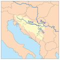
 Dinarik Alpler haritası.svg 1,857 × 1,503; 3.28 MB
-
 DobricOblast.png 527 × 347; 25 KB
-
 Départements de France Türkçe.jpg 588 × 550; 207 KB
-
 Dünya Dinleri.png 1,357 × 628; 44 KB
-
 Eldfell eruptiondiagram.png 486 × 463; 71 KB
-
 Eurogipsy.tr.png 1,166 × 1,036; 91 KB
-
 Europe countries map tr.png 1,475 × 1,200; 615 KB
-
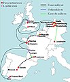
 Europe time zones map tr corrected.png 1,475 × 1,200; 1.05 MB
-
 Europe time zones map tr.png 1,475 × 1,200; 1.05 MB
-
 Gana bölgeler.jpg 412 × 579; 31 KB
-
 Gelibolu yarimadasi.png 615 × 533; 24 KB
-
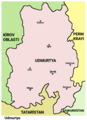
 Georgia Abkhazeti map (tr).png 560 × 300; 26 KB
-
 GYTMP HARITASI 01.png 602 × 673; 746 KB
-
 Gz-map-tr.png 330 × 354; 18 KB
-
 Günümüz Türk Devletleri.png 1,440 × 752; 137 KB
-
 Hazar Hanlığı 820.jpg 998 × 714; 251 KB
-
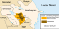
 Hazarlar (tr).png 637 × 553; 30 KB
-
 Hazarların düşüşü.png 593 × 447; 67 KB
-
 Holodomor World recognition-Türkçe.png 1,354 × 619; 38 KB
-
 Hr-harita.png 894 × 682; 106 KB
-
 Imia with legends tr.svg 570 × 588; 112 KB
-
 Istanbul Köppen Map-tr.png 800 × 424; 46 KB
-
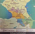 Kafkasya Cumhuriyetleri.jpg 2,163 × 2,102; 1.3 MB
-
 Karabağ çatışması harita.tif 1,667 × 830; 653 KB
-
 Karkamış antik kent şehir planı.png 3,700 × 3,700; 696 KB
-
 Kavimler Göçü 2.png 16,767 × 12,231; 26.53 MB
-

-
 Kazakistan eyaletleri.png 640 × 358; 52 KB
-
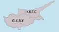 Kıbrıs haritası.png 1,000 × 541; 83 KB
-
 Kıbrıs haritası2.png 1,200 × 630; 374 KB
-
 Kosova (Civar).jpg 1,325 × 1,573; 177 KB
-
 Macaristan map.png 1,022 × 738; 61 KB
-
 Magellan-Harita-Tr.jpg 1,884 × 892; 193 KB
-
 Manchukuo maptr.png 600 × 708; 99 KB
-
 Mançukuo haritası 1939.svg 634 × 387; 2.21 MB
-
 Map of Chechnyatr.png 600 × 684; 72 KB
-
 Map of sinitic languages-tr.svg 441 × 940; 923 KB
-
 Mardin location districts.png 800 × 500; 54 KB
-
 Maris Caspii (Reiner Ottens).jpg 1,583 × 1,355; 642 KB
-
 Mavi Vatan.jpg 1,600 × 1,254; 187 KB
-
 Mc Kinley Dağı.png 738 × 501; 37 KB
-
 Mezitli harita.jpg 800 × 615; 50 KB
-
 Muslims schools tr.png 700 × 320; 21 KB
-
 Nagorno Karabakh03.tr.png 600 × 862; 99 KB
-
 Neighbourhoods of 19 Mayıs.svg 1,052 × 1,488; 102 KB
-
 Neighbourhoods of Atakum.svg 1,488 × 1,052; 229 KB
-
 Neighbourhoods of Bafra.svg 2,105 × 1,488; 709 KB
-
 Neighbourhoods of Yakakent.svg 744 × 1,052; 50 KB
-
 Neighbourhoods of Çarşamba.svg 1,052 × 1,488; 833 KB
-
 Neighbourhoods of Çatalca.svg 1,488 × 2,105; 353 KB
-
 Neighbourhoods of İlkadım.svg 1,488 × 2,105; 587 KB
-
 Neighbourhoods of Şişli.png 644 × 709; 62 KB
-
 Neighbourhoods of Şişli.svg 744 × 1,052; 73 KB
-
 Niger nehri maptr.png 900 × 566; 100 KB
-
 Nijer-haritası.png 2,200 × 1,667; 6.11 MB
-
 North america tr.png 1,052 × 1,393; 1.88 MB
-
 Original distribution of gray wolf (canis lupus) subspecies-tr.png 1,357 × 628; 42 KB
-
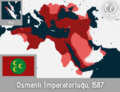 Osmanlı İmparatorluğu'nun en geniş sınırları, 1687.png 6,144 × 4,713; 2.44 MB
-
 Ossetia01 (tr).png 696 × 1,067; 49 KB
-
 Pacific Ocean (tr).png 330 × 330; 13 KB
-
 Pars dağılımı.gif 794 × 586; 31 KB
-
 Piros'un Yolu.png 591 × 459; 378 KB
-
 Pontic steppe region around 650 AD.tr.png 691 × 600; 137 KB
-
 Radyo oryantiring hakem haritası.png 600 × 550; 395 KB
-
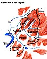 Roma'nın yedi tepesi.jpg 460 × 573; 58 KB
-
 Roma'nın İtalya'yı fethi.PNG 1,914 × 1,200; 183 KB
-
 Roma-Kartaca 218.png 1,108 × 823; 1.39 MB
-
 Rüzgar erozyonu risk dağılımı.jpg 3,000 × 1,941; 2.78 MB
-
 Savarivermap tr.png 300 × 300; 59 KB
-
 Seddülbahir - 27.04.JPG 800 × 599; 45 KB
-
 September 2020 Nagorno-Karabakh clashes TR.png 595 × 387; 82 KB
-
 Serbian expansion 1913tr.png 418 × 597; 207 KB
-
 SolarGIS-Solar-map-Cyprus-tr.png 1,000 × 726; 379 KB
-
 South america tr.jpg 1,556 × 2,000; 1.23 MB
-
 Sri Lanka provinces tr.png 694 × 877; 49 KB
-
 TAV İşletme Hizmetleri .jpg 8,000 × 4,500; 2.36 MB
-
 TAV İşletme Hizmetleri Harita.jpg 8,000 × 4,500; 2.32 MB
-
 TE Latrans portakal.png 5,006 × 2,152; 90 KB
-
 TE Latrans turkuaz.png 5,006 × 2,152; 91 KB
-
 Thrace and present-day state borderlines-tr.png 3,139 × 3,760; 979 KB
-
 Transport A380 TR.jpg 785 × 915; 120 KB
-
 Tskhinvali battles (tr).png 360 × 268; 108 KB
-
 Turkish Horizontal Log Map of the Observable Universe.jpg 6,116 × 1,500; 6.87 MB
-
 Udmurt03tr.png 600 × 831; 84 KB
-
 Umman Denizi.png 634 × 600; 112 KB
-
 VikiProje Arap Yarımadası Ana Çalışma Alanı.png 250 × 162; 5 KB
-
 VikiProje Arap yarımadası-afrika.png 250 × 162; 5 KB
-
 Vm-map tr.png 500 × 1,080; 309 KB
-
 Wiki-Canis lupus (tr).png 1,357 × 628; 44 KB
-
 Yamalia map.tr.png 600 × 648; 143 KB
-
 Yazı sistemleri türkçe.jpg 2,272 × 1,402; 428 KB
-
 Yeşilkent, İlkadım, Gazi ve merkez.svg 1,488 × 2,105; 542 KB
-
 Yıllık CO₂ emisyonları, OWID.svg 850 × 600; 150 KB
-
 Çanakkale Deniz Savaşları-Tahkimat.JPG 600 × 620; 61 KB
-
 Çimkent'in Kazakistandaki Konumu.png 1,406 × 900; 62 KB
-
 Çöle sürme taktiği.jpg 569 × 256; 51 KB
-
 Önceden rodinya.png 220 × 165; 26 KB
-
 İsrail'in genişlemesi 1946-2000.jpg 788 × 442; 124 KB
-
 İzmir Raylı Sistemler Şeması 2016.png 800 × 600; 76 KB
-
 Şamar Dağları.jpg 753 × 572; 34 KB
-
 دولت عليه نك آسيا طرفنده اولان ممالكى (FL4541536 2515006).jpg 11,286 × 8,656; 125.02 MB


.jpg)


.png)


.png)


.jpg)


.jpg)


_subspecies-tr.png)

.png)
.png)


.png)


.png)


.jpg)