Category:Tubney
Jump to navigation
Jump to search
village in the United Kingdom  | |||||
| Upload media | |||||
| Instance of | |||||
|---|---|---|---|---|---|
| Location | Fyfield and Tubney, Vale of White Horse, Oxfordshire, South East England, England | ||||
 | |||||
Tubney is a village about 4.5 miles (about 7 km) west of Abingdon, Oxfordshire, England. It is part of the civil parish of Fyfield and Tubney, which was part of Berkshire until the 1974 boundary changes transferred it to Oxfordshire.
Subcategories
This category has only the following subcategory.
T
- St Lawrence's Church, Tubney (3 F)
Media in category "Tubney"
The following 9 files are in this category, out of 9 total.
-
 Approach to Tubney - geograph.org.uk - 1700102.jpg 640 × 480; 91 KB
-
 Coming into Tubney - geograph.org.uk - 1430876.jpg 640 × 427; 54 KB
-
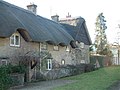 Cottages at Tubney - geograph.org.uk - 113771.jpg 640 × 481; 52 KB
-
 Road through Tubney - geograph.org.uk - 1430928.jpg 640 × 427; 68 KB
-

-
 Road to Tubney Church - geograph.org.uk - 1430901.jpg 640 × 427; 112 KB
-
 Old Milestone by the A420, north of Tubney (geograph 5622371).jpg 1,243 × 1,190; 235 KB
-
 Tubney village - geograph.org.uk - 1430911.jpg 640 × 427; 59 KB
-
 Young Roe deer - geograph.org.uk - 238542.jpg 640 × 480; 95 KB


.jpg)
