Category:Tropical cyclone breakpoint maps
Jump to navigation
Jump to search
Maps of breakpoints for tropical cyclone watches and warnings.
For more info, see: NHC page on tropical cyclone breakpoints
Media in category "Tropical cyclone breakpoint maps"
The following 14 files are in this category, out of 14 total.
-
 CaliforniaTropicalCycloneBreakpoints.png 564 × 550; 3 KB
-
 Hurricane warning breakpoints (Caribbean).gif 895 × 692; 132 KB
-
 Hurricane warning breakpoints (Chesapeake Bay area).gif 895 × 692; 118 KB
-
 Hurricane warning breakpoints (Cuba).gif 895 × 692; 115 KB
-
 Hurricane warning breakpoints (EPac).gif 895 × 692; 123 KB
-

-
 Hurricane warning breakpoints (Hispaniola).gif 895 × 692; 69 KB
-
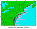 Hurricane warning breakpoints (Northeastern US).gif 895 × 692; 149 KB
-
 Hurricane warning breakpoints (Puerto Rico).gif 895 × 692; 72 KB
-
 Hurricane warning breakpoints (SE US).gif 895 × 692; 127 KB
-
 Hurricane warning breakpoints (US Gulf coast).gif 895 × 692; 127 KB
-
 Hurricane warning breakpoints (US Mid-Atlantic).gif 895 × 692; 144 KB
-
 Hurricanealleymap1.png 1,024 × 578; 123 KB
-
 Hurricanes Category 3 or greater within 100 miles of New Orleans.jpg 734 × 415; 72 KB

.gif)
.gif)
.gif)
.gif)
.gif)
.gif)
.gif)
.gif)
.gif)
.gif)
.gif)

