Category:Travel maps of the Netherlands
Jump to navigation
Jump to search
Countries of Europe: Albania · Andorra · Armenia‡ · Austria · Azerbaijan‡ · Belarus · Belgium · Bosnia and Herzegovina · Bulgaria · Croatia · Czech Republic · Denmark · Estonia · Finland · France‡ · Georgia‡ · Germany · Greece · Hungary · Iceland · Republic of Ireland · Italy · Kazakhstan‡ · Latvia · Liechtenstein · Lithuania · Luxembourg · Malta · Moldova · Monaco · Montenegro · Netherlands‡ · North Macedonia · Norway · Poland · Portugal‡ · Romania · Russia‡ · Serbia · Slovakia · Spain‡ · Sweden · Switzerland · Turkey‡ · Ukraine · United Kingdom · Vatican City
Specific status: Faroe Islands · Gibraltar – Limited recognition: Abkhazia‡ · Kosovo
‡: partly located in Europe
Specific status: Faroe Islands · Gibraltar – Limited recognition: Abkhazia‡ · Kosovo
‡: partly located in Europe
Subcategories
This category has the following 2 subcategories, out of 2 total.
Media in category "Travel maps of the Netherlands"
The following 37 files are in this category, out of 37 total.
-
 Amsterdam-map.png 1,959 × 1,679; 1.95 MB
-
 Amsterdam-map.svg 4,897 × 4,196; 2.25 MB
-
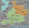 Eastern-netherlands-map.png 2,997 × 2,872; 1.61 MB
-
 Eastern-netherlands-map.svg 297 × 285; 1.1 MB
-
 Groningen (province) Wikivoyage Map.png 2,000 × 2,277; 951 KB
-
 Groningen (province) Wikivoyage Map.svg 1,484 × 1,689; 5.78 MB
-
 Hilversum-center-map.png 2,500 × 1,998; 1.23 MB
-
 Hilversum-center-map.svg 1,499 × 1,198; 1.25 MB
-
 Hilversum-full-map.png 1,379 × 1,008; 749 KB
-
 Hilversum-full-map.svg 1,379 × 1,008; 769 KB
-
 Netherlands-regions-fr.png 1,694 × 1,964; 675 KB
-
 Netherlands-regions-new.png 612 × 703; 287 KB
-
 Netherlands-regions-new.svg 599 × 687; 1.32 MB
-
 Netherlands-regions-ru.png 1,676 × 1,916; 1.18 MB
-
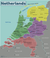
 Netherlands-regions.png 1,732 × 2,007; 680 KB
-
 Netherlands-regions.svg 1,694 × 1,963; 659 KB
-
 NL West Frisian Isl (nl).png 1,404 × 1,028; 142 KB
-
 NL West Frisian Isl (ru).png 2,001 × 1,482; 299 KB
-
 Noord-Brabant regios.png 1,372 × 737; 1.77 MB
-
 Northern-netherlands-map.png 3,000 × 2,145; 1.14 MB
-
 Northern-netherlands-map.svg 377 × 269; 1.1 MB
-
 Northholland-regions (nl).png 675 × 1,344; 173 KB
-
 Northholland-regions-ru.png 2,181 × 3,923; 1.02 MB
-
 Northholland-regions.png 675 × 1,344; 171 KB
-
 Northholland-regions.svg 428 × 852; 525 KB
-
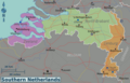 Southern-netherlands-map.png 3,001 × 1,916; 1.31 MB
-
 Southern-netherlands-map.svg 433 × 276; 1.11 MB
-
 Southholland regions map IT.png 7,748 × 6,508; 2.53 MB
-
 Southholland regions map IT.svg 763 × 641; 533 KB
-
 Southholland regions map.png 1,204 × 1,012; 286 KB
-
 Southholland regions map.svg 814 × 684; 244 KB
-
 The-Brouwer-Route.jpg 792 × 612; 177 KB
-
 Veluwerand Wikivoyage Map.png 3,675 × 1,800; 904 KB
-
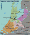 Western-netherlands-map.png 2,999 × 3,527; 2.01 MB
-
 Western-netherlands-map.svg 309 × 363; 1.13 MB
-
 WV; Rijn-Waalkwartier.png 2,200 × 1,990; 942 KB
-
 荷兰概图.png 2,004 × 2,301; 1.43 MB


_Wikivoyage_Map.png)
_Wikivoyage_Map.svg)


.png)
.png)


.png)


