Category:Travel maps of New South Wales
Jump to navigation
Jump to search
States of Australia: New South Wales · Queensland · South Australia · Tasmania · Victoria · Western Australia
Internal territories of Australia: Australian Capital Territory · Northern Territory
External territories of Australia: Christmas Island · Cocos (Keeling) Islands · Norfolk Island
Internal territories of Australia: Australian Capital Territory · Northern Territory
External territories of Australia: Christmas Island · Cocos (Keeling) Islands · Norfolk Island
Travel maps of New South Wales
Media in category "Travel maps of New South Wales"
The following 17 files are in this category, out of 17 total.
-
 Hunter, NSW map.png 2,344 × 1,953; 452 KB
-
 Hunter, NSW map.svg 750 × 625; 13.71 MB
-
 Illawarra region map.png 6,136 × 11,774; 3.04 MB
-
 Illawarra region map.svg 750 × 625; 3.18 MB
-
 Mungo NP static map.svg 744 × 1,052; 4.07 MB
-
 New England NSW regions map.png 1,262 × 1,048; 1.01 MB
-
 New England NSW regions map.svg 750 × 625; 1.9 MB
-
 New England regions map.png 1,648 × 1,374; 860 KB
-
 New England regions map.svg 750 × 625; 632 KB
-
 New South Wales regions map.png 1,592 × 1,386; 1.26 MB
-
 New South Wales regions map.svg 744 × 1,052; 1.66 MB
-
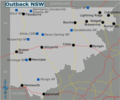 Outback NSW map.png 924 × 770; 208 KB
-
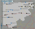 Outback NSW map.svg 750 × 625; 6.97 MB
-
 PortWalkPNG.png 3,000 × 2,000; 579 KB
-
 PortWalkSVG.svg 3,000 × 2,000; 1.4 MB
-
 Southeastern New South Wales regions map.png 1,330 × 1,399; 374 KB
-
 Southeastern New South Wales regions map.svg 750 × 625; 1.98 MB


