Category:Travel maps of England
Jump to navigation
Jump to search
Subcategories
This category has the following 2 subcategories, out of 2 total.
B
L
- Travel maps of London (38 F)
Media in category "Travel maps of England"
The following 60 files are in this category, out of 60 total.
-
 Berkshire map.png 1,202 × 443; 20 KB
-
 Bristol map.png 2,426 × 1,642; 1.96 MB
-
 Cheshire map.png 1,076 × 938; 23 KB
-
 Cleveland map.png 1,078 × 747; 27 KB
-
 Cornwall map.png 1,041 × 1,001; 24 KB
-
 County Durham map.png 1,132 × 829; 32 KB
-
 Devon map.png 1,203 × 1,096; 27 KB
-
 Dorset map.png 1,354 × 1,003; 32 KB
-
 East Anglia map.png 1,064 × 1,069; 37 KB
-
 East Midlands map.png 2,400 × 2,563; 1.55 MB
-
 East Midlands map.svg 1,461 × 1,266; 511 KB
-
 East of England map.png 2,971 × 2,597; 1.21 MB
-
 East of England map.svg 1,464 × 1,112; 434 KB
-
 East Sussex map.png 1,237 × 724; 63 KB
-
 East Yorkshire map.png 1,292 × 1,037; 26 KB
-
 Eng ttw all blue 300px labels.png 2,227 × 2,068; 1.79 MB
-
 England map.png 896 × 1,030; 31 KB
-
 England Regions map.png 2,000 × 2,201; 1.39 MB
-
 Essex map.png 1,430 × 1,115; 43 KB
-
 Gloucestershire map.png 1,154 × 950; 28 KB
-
 Greater Manchester map.png 1,035 × 740; 27 KB
-
 Guildford centre map.png 1,501 × 1,200; 485 KB
-
 Guildford centre map.svg 744 × 1,052; 575 KB
-
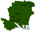 Hampshire map.png 1,331 × 1,177; 36 KB
-
 Herefordshire map.png 1,051 × 1,186; 27 KB
-
 Hertfordshire map.png 1,232 × 987; 32 KB
-
 Isle of Wight map.png 1,383 × 831; 27 KB
-
 Kent map.png 1,254 × 809; 28 KB
-
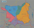
 Lancashire map.png 869 × 1,060; 24 KB
-
 Leeds map.png 1,563 × 1,302; 423 KB
-
 Leeds map.svg 750 × 625; 15.55 MB
-
 Leicestershire map.png 1,024 × 1,044; 85 KB
-
 Lincolnshire map.png 829 × 1,122; 68 KB
-
 Manchester District map.png 852 × 760; 208 KB
-
 Manchester District map.svg 835 × 746; 42 KB
-
 Merseyside map.png 995 × 1,145; 31 KB
-
 Norfolk map.png 1,361 × 861; 27 KB
-
 North East England map.png 2,494 × 2,444; 879 KB
-
 North East England map.svg 1,397 × 1,385; 2.32 MB
-
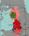
 North West England map.png 2,881 × 3,501; 1.58 MB
-
 North West England map.svg 1,385 × 1,705; 3.09 MB
-
 Northumberland map.png 777 × 1,091; 23 KB
-
 Print, map (BM 1912,1227.389).jpg 2,500 × 1,625; 222 KB
-
 Print, map (BM 1912,1227.390).jpg 2,500 × 1,274; 182 KB
-
 Print, map (BM 1912,1227.391 1).jpg 2,500 × 678; 213 KB
-
 Print, map (BM 1912,1227.391 2).jpg 678 × 2,500; 215 KB
-
 Print, map (BM 1912,1227.391).jpg 2,500 × 1,268; 172 KB
-
 Print, map (BM 1912,1227.392).jpg 2,500 × 1,391; 185 KB
-
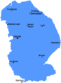
 Rutland map.png 968 × 1,001; 54 KB
-
 Somerset map.png 1,060 × 895; 20 KB
-
 South East England map.png 4,971 × 3,468; 2.55 MB
-
 South East England map.svg 743 × 567; 3.11 MB
-
 Suffolk map.png 1,343 × 875; 29 KB
-
 Surrey map.png 1,179 × 823; 24 KB
-
 West Country map.png 4,000 × 2,800; 1.54 MB
-
 West Country map.svg 2,972 × 1,996; 3.41 MB
-
 West Midlands county map.png 1,181 × 779; 27 KB
-
 West Midlands region map.png 1,600 × 1,838; 910 KB
-
 West Midlands region map.svg 1,057 × 1,123; 2.28 MB
-
 Wiltshire map.png 959 × 1,293; 29 KB


.jpg)
.jpg)
.jpg)
.jpg)


.jpg)
.jpg)