Category:Travel maps of Africa
Jump to navigation
Jump to search
Subcategories
This category has the following 44 subcategories, out of 44 total.
*
- Travel maps of West Africa (7 F)
A
B
C
D
E
G
I
K
L
M
- Travel maps of Mayotte (2 F)
N
R
S
- Travel maps of Somaliland (2 F)
T
Z
Media in category "Travel maps of Africa"
The following 69 files are in this category, out of 69 total.
-
 Africa raid 1933 Malakal map.jpg 938 × 1,200; 162 KB
-
 Africa raid 1934 Banciulescu map.jpg 938 × 1,200; 162 KB
-
 Africa raid 1935 Banciulescu map.jpg 938 × 1,200; 166 KB
-
 Africa raid 1935 Burnaia map.jpg 938 × 1,200; 162 KB
-
 Africa raid 1935 Cape Town map.jpg 938 × 1,200; 167 KB
-
 Africa regions (cs).svg 1,273 × 1,324; 62 KB
-
 Africa Visa Openness in 2016.svg 1,000 × 1,000; 186 KB
-
 Africacolour.PNG 287 × 336; 9 KB
-
 Afrika Karte.jpg 800 × 328; 166 KB
-
 Borobudur ship expedition route.jpg 1,440 × 810; 184 KB
-
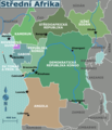 Central Africa regions map (cs).png 1,697 × 1,970; 654 KB
-
 Central Africa regions map (fr).png 1,823 × 2,098; 691 KB
-
 Central Africa regions map (ru).png 1,667 × 1,987; 526 KB
-
 Central Africa regions map.png 1,810 × 2,101; 678 KB
-
 Central Africa regions map.svg 940 × 477; 3.31 MB
-
 Destinos Iberia africa.gif 540 × 540; 14 KB
-
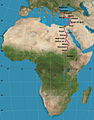
 East Africa regions map (cs).png 1,406 × 2,288; 796 KB
-
 East Africa regions map (fr).png 1,500 × 2,440; 732 KB
-
 East Africa regions map (ru).png 1,500 × 2,440; 735 KB
-
 East Africa regions map.png 1,998 × 2,148; 502 KB
-
 East Africa regions map.svg 73 × 119; 3.55 MB
-
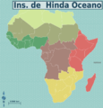
 East African islands.png 1,249 × 1,749; 182 KB
-
 Fourth trip to Africa by Viktor Pinchuk.jpg 991 × 1,030; 553 KB
-

-

-

-

-
 Map-Africa-Regions (eo 1).png 991 × 1,030; 231 KB
-
 Map-Africa-Regions (eo 2).png 991 × 1,030; 232 KB
-
 Map-Africa-Regions (eo 3).png 991 × 1,030; 237 KB
-
 Map-Africa-Regions (eo 4).png 991 × 1,030; 234 KB
-
 Map-Africa-Regions (eo 5).png 991 × 1,030; 220 KB
-
 Map-Africa-Regions (eo 6).png 991 × 1,030; 226 KB
-
 Map-Africa-Regions (eo 7).png 991 × 1,030; 220 KB
-
 Map-Africa-Regions (eo).png 991 × 1,030; 291 KB
-
 Map-Africa-Regions (fr).png 990 × 1,030; 356 KB
-
 Map-Africa-Regions (nl).png 990 × 1,030; 354 KB
-
 Map-Africa-Regions (pt).png 1,000 × 1,039; 410 KB
-
 Map-Africa-Regions (ru).png 3,254 × 3,383; 1.43 MB
-
 Map-Africa-Regions (zh-hans)-非洲地图.png 1,019 × 1,059; 339 KB
-
 Map-Africa-Regions.png 991 × 1,030; 2.93 MB
-
 Map-Africa-Regions.svg 1,273 × 1,324; 1.8 MB
-
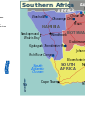
 Map-Africa-Southern Africa-Regions.png 974 × 831; 264 KB
-
 Map-Africa-Southern Africa-Regions.svg 744 × 1,052; 1.65 MB
-
 Map-Southern Africa-ru.png 1,313 × 823; 148 KB
-
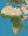
 North Africa regions map (cs).png 1,877 × 769; 350 KB
-
 North Africa regions map (fr).png 2,002 × 821; 317 KB
-
 North Africa regions map (ru).png 2,038 × 932; 376 KB
-
 North Africa regions map ka.svg 2,000 × 819; 87 KB
-
 North Africa regions map uk.png 2,000 × 826; 250 KB
-
 North Africa regions map uk.svg 2,000 × 819; 83 KB
-
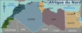
 North Africa regions map.png 2,000 × 819; 312 KB
-
 North Africa regions map.svg 940 × 477; 4.07 MB
-
 Risks-in-Africa December-25-2012.svg 1,000 × 1,000; 322 KB
-
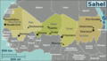
 Saharan Africa regions map (cs).png 1,875 × 1,077; 561 KB
-
 Saharan Africa regions map (fr).png 3,448 × 1,981; 1,006 KB
-
 Saharan Africa regions map (ru).png 3,008 × 1,731; 756 KB
-
 Saharan Africa regions map.png 2,000 × 1,149; 528 KB
-
 Saharan Africa regions map.svg 137 × 79; 2.25 MB
-
 Second trip to Africa by Viktor Pinchuk.jpg 3,049 × 2,131; 3.5 MB
-
 Southern Africa new map (fr).png 2,000 × 1,204; 574 KB
-
 Southern Africa new map (ru).png 2,000 × 1,204; 569 KB
-
 Southern Africa new map ka.svg 2,001 × 1,204; 107 KB
-
 Southern Africa new map uk.png 2,001 × 1,205; 411 KB
-
 Southern Africa new map uk.svg 2,001 × 1,204; 101 KB
-
 Southern Africa new map.png 2,000 × 1,204; 771 KB
-
 Southern Africa new map.svg 918 × 553; 1.48 MB
-
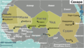
 Southern Africa regions map (cs).png 1,875 × 1,128; 656 KB
-
 West Africa regions map (cs).png 1,403 × 688; 394 KB


.svg)


.png)
.png)
.png)


.png)
.png)
.png)


.jpg)
.jpg)
.jpg)
.jpg)
.png)
.png)
.png)
.png)
.png)
.png)
.png)
.png)
.png)
.png)
.png)
.png)
-%E9%9D%9E%E6%B4%B2%E5%9C%B0%E5%9B%BE.png)


.png)


.png)
.png)
.png)


.png)
.png)


.png)
.png)
.png)
.png)