Category:Trail signs
Jump to navigation
Jump to search
Subcategories
This category has the following 11 subcategories, out of 11 total.
Media in category "Trail signs"
The following 127 files are in this category, out of 127 total.
-
 Wittemoor Stelen.jpg 1,536 × 2,048; 1.01 MB
-
-

-

-

-

-
 Auto Trail marker 2017-09-27 1441.jpg 4,608 × 3,072; 3.66 MB
-
 Barasoain Church Malolos 08.jpg 5,184 × 3,888; 6.09 MB
-
 Barasoain Church Malolos 10.jpg 5,184 × 3,888; 5.78 MB
-
 Barasoain Church Malolos 11.jpg 5,184 × 3,888; 6.66 MB
-
 Baxter-creek-signpost-mt-sterling-nc1.jpg 2,048 × 1,536; 1.11 MB
-
 BBHTJerichoConnectorSign1.jpg 1,536 × 2,048; 2.15 MB
-
 BBHTJerichoConnectorSign2.jpg 1,536 × 2,048; 1.99 MB
-
 BBHTJerichoTrailMattatuckJctSign1.jpg 1,536 × 2,048; 2.3 MB
-
 BBHTJerichoTrailSign1.jpg 1,536 × 2,048; 2.33 MB
-
 BBHTJerichoTrailSign2.jpg 1,536 × 2,048; 2.05 MB
-
 BBHTJerichoTrailSign3.jpg 2,048 × 1,536; 2.13 MB
-
 BBHTJerichoTrailSign4.jpg 2,048 × 1,536; 1.57 MB
-
 BBHTJerichoTrailSign6.jpg 2,048 × 1,536; 2.05 MB
-
 Bellingham, WA Railroad Avenue 1.jpg 2,648 × 1,696; 1.47 MB
-
 Bridal Falls, Allegany State Park, New York - 20211109 - 01.jpg 4,032 × 2,419; 8.09 MB
-
 Burujón, Las Barrancas 05.jpg 2,848 × 4,127; 6.12 MB
-

-
 CFPAHousatonicRangeTrailBlueTrailSign1.jpg 2,048 × 1,536; 2.27 MB
-
 CFPAHousatonicRangeTrailSign1.jpg 1,536 × 2,048; 1.46 MB
-
 CFPANipmuckTrailsignonBigelowHollowRoadAKACTRoute197nearBigelowHollowStatePark.jpg 2,592 × 1,936; 2.23 MB
-
 CHAMPLAIN NORTH RIDGE TRAIL.jpg 768 × 1,024; 284 KB
-
 Chimney Rock Trail (14517991233).jpg 3,264 × 2,448; 6.07 MB
-
 Chris's Trail at Loch Raven Reservoir.jpg 3,024 × 4,032; 4.64 MB
-
 Cross Ranch State Park, North Dakota (5069905556).jpg 1,920 × 1,080; 870 KB
-
 CST Sign.JPG 1,600 × 1,200; 139 KB
-
 Deonna mccready BR FB (16169975122).jpg 720 × 540; 94 KB
-
 Deonna mccready BR FB3 (15983289388).jpg 540 × 720; 133 KB
-
 Detall senyalització.JPG 768 × 1,088; 383 KB
-
 East Beach Trail Sign (5738524865).jpg 3,872 × 2,592; 1.25 MB
-
 Encumeada, Madeira, trailsign PR 1.3 to Pico Ruiro.jpg 2,921 × 2,191; 2.53 MB
-
 Faro de Fuencaliente, La Palma, trail sign.jpg 4,000 × 3,000; 3.79 MB
-
 Fort Worth Stockyards June 2016 65 (Chisholm Trail post).jpg 4,000 × 6,000; 6.91 MB
-
 Four Freedoms Trail Park Pinetta.jpg 3,072 × 2,304; 1.33 MB
-
 Frozen walk on Tipsoo trail (3022335090).jpg 3,264 × 2,448; 6.38 MB
-
 Hemlock Ridge Preserve (12) (13810836735).jpg 3,456 × 5,184; 12.78 MB
-
 Hooe Lake Trail Sign.jpg 3,840 × 2,160; 1.03 MB
-
 Housatonic rail trail head 072.JPG 2,048 × 1,536; 1.97 MB
-
 Housatonic rail trail head 073.JPG 2,048 × 1,536; 1.77 MB
-
 Hudson Highlands State Park QR code trail map.jpg 2,382 × 3,289; 3.58 MB
-
 Hungarian Pilgrimage Route sign, 2021 Nagytétény.jpg 1,704 × 2,272; 1.75 MB
-
 Iron Mountain trail post - geograph.org.uk - 901618.jpg 480 × 640; 104 KB
-
 Israel Hiking Map אלון בודד בשטח חקלאי.jpeg 1,200 × 1,600; 722 KB
-
 Israel Hiking Map מגדל תצפית קק"ל.jpeg 1,600 × 1,049; 739 KB
-
 It-pr-ldpD22.jpg 3,024 × 4,032; 3.14 MB
-
 It-pr-ldpD23.jpg 3,024 × 4,032; 5.41 MB
-
 It-pr-ldpD24.jpg 3,024 × 4,032; 6.14 MB
-
 It-pr-ldpVLA110.jpg 3,024 × 4,032; 4 MB
-
 It-pr-ldpVLA111.jpg 3,024 × 4,032; 3.37 MB
-
 It-pr-ldpVLA112.jpg 3,024 × 4,032; 2.86 MB
-
 It-pr-ldpVLA113.jpg 3,024 × 4,032; 3.25 MB
-
 It-pr-ldpVLA114.jpg 3,024 × 4,032; 3.29 MB
-
 It-pr-ldpVLA115-1.jpg 3,024 × 4,032; 3.61 MB
-
 It-pr-ldpVLA115-2.jpg 3,024 × 4,032; 3.28 MB
-
 It-pr-ldpVLA86.jpg 3,024 × 4,032; 4.49 MB
-
 It-pr-ldpVLA87.jpg 3,024 × 4,032; 3.63 MB
-
 It-pr-ldpVLA88.jpg 3,024 × 4,032; 4.31 MB
-
 Julie smith fc fb3 (16176474451).jpg 405 × 720; 95 KB
-
 Kampinoski Szlak Rowerowy-znak.jpg 460 × 343; 43 KB
-
 La Palma, path to Time, signs.jpg 4,000 × 3,000; 3.1 MB
-
 Las Tricias, La Palma, sign.jpg 2,398 × 1,798; 979 KB
-
 Leesylvania LE Travel Writer Becky Mihalovich LE email (15576033814).jpg 2,048 × 1,294; 599 KB
-
 Leon Sinks Recreation Area - Crossover Trail sign.jpg 1,200 × 900; 786 KB
-
 Leon Sinks Recreation Area - Hutchison's Spur sign.jpg 2,272 × 1,704; 2.21 MB
-
 Maah Daah Hey Trail Guide Post.jpg 944 × 611; 127 KB
-
 Mount Washington - 48320245367.jpg 1,824 × 2,736; 2.88 MB
-
 Musgrove Mill State Historic Site 05.jpg 5,520 × 3,684; 8.81 MB
-
 NY 25A EB; Begin Washington Spy Trail.jpg 3,648 × 2,736; 2.1 MB
-
 NY 25A EB; End Washington Spy Trail.jpg 3,648 × 2,736; 2.04 MB
-
 NY 25A WB; Begin Washington Spy Trail.jpg 3,648 × 2,736; 2.05 MB
-
 OC OldRoscreasign049.jpg 2,592 × 1,944; 1.65 MB
-
 Oznaczenie Rymanowskiego Szlaku Rowerowego na Przymiarkach.jpg 4,000 × 3,000; 2.8 MB
-
 Paul Bunyan State Trail, Minnesota (29695730308).jpg 7,002 × 4,536; 14.1 MB
-
 Pictograms-nps-misc-walk on boardwalk-2.svg 256 × 256; 7 KB
-
 Pictograms-nps-misc-walk on boardwalk.svg 256 × 256; 7 KB
-
 Puerto de Tazacorte, La Palma, trail signs.jpg 3,706 × 2,780; 3.94 MB
-
 Quinebaug Trail Sign at junction with Hell Hollow Road at Phillips Pond.jpg 1,936 × 2,592; 2.88 MB
-
 Ribeira do Seixal, Madeira, trail sign.jpg 4,000 × 3,000; 6.02 MB
-
 Roque de los Muchachos, trail sign.jpg 3,612 × 2,709; 2.29 MB
-
 Route Map 5620.jpg 4,608 × 3,072; 3.61 MB
-
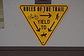 Rules of the trail yield triangle sign.jpg 6,000 × 4,000; 5.63 MB
-
 Rustic Trail Sign (14149473186).jpg 1,280 × 960; 593 KB
-
 San Andrés, La Palma, trail sign left.jpg 4,000 × 3,000; 4.47 MB
-
 San Andrés, La Palma, trail signs.jpg 4,000 × 3,000; 3.06 MB
-
 San Nicolás trail, sign.jpg 4,000 × 3,000; 4.79 MB
-
 Sign (11425367695).jpg 5,184 × 3,456; 9.04 MB
-
 Sign by Bluewater Lake trailhead.jpg 2,592 × 1,944; 1.42 MB
-

-
 Sign-1140273, Leixlip, Co. Kildare, Ireland.jpg 4,896 × 3,672; 8.71 MB
-
 Sign-1150014, Leixlip, Co. Kildare, Ireland.jpg 3,320 × 4,740; 2.27 MB
-
 Signs leading to the East Beach Trail (5739071616).jpg 3,872 × 2,592; 1.26 MB
-
 Skylt för Härnö Trail.jpg 2,448 × 3,264; 827 KB
-
 SouthernHighroadsTrail.jpg 3,072 × 2,304; 4.11 MB
-
 Southport Ferry Terminal (July 2023) 05.jpg 4,000 × 6,000; 6.09 MB
-
 TCB rail trail 5 miles post.jpg 6,000 × 4,000; 9.53 MB
-
 Tetenhusen-Owschlag - Ochsenweg 09 ies.jpg 5,616 × 3,744; 5.27 MB
-
 Three Creeks - Trail Closed Due To High Water.jpg 4,288 × 2,848; 8.47 MB
-
 Touruvuori nature trail 10.jpg 7,052 × 5,280; 12.33 MB
-
 Touruvuori nature trail 9.jpg 7,652 × 3,533; 15.18 MB
-
 Trail directions (13986001617).jpg 1,280 × 960; 602 KB
-
 Trail from La Fajana, La Palma, to Barlovento, start.jpg 4,000 × 3,000; 4.73 MB
-
 Trail from San Andrés, La Palma, to Los Sauces, sign.jpg 4,000 × 3,000; 3.04 MB
-
 Trail sign in Pou des Lleó, Ibiza.jpg 3,781 × 2,836; 3.75 MB
-
 Trail sign.jpg 2,048 × 1,536; 682 KB
-
-
 Trail signs in Santo Domingo, La Palma.jpg 3,882 × 2,912; 3.41 MB
-
 Trail signs, Tegernsee.jpg 3,916 × 2,937; 5.32 MB
-
 Trail to Puertito, La Palma, signs.jpg 4,000 × 3,000; 4.38 MB
-
 Trailhead.JPG 2,048 × 1,536; 2.07 MB
-
 Trailsign PR 2 in Lombo Urzal, Madeira.jpg 3,426 × 2,570; 2.71 MB
-
 Trailsignsquaw.jpg 4,608 × 3,456; 5.59 MB
-
 U.S. Route 6 in New York (state) PICT0427 (3285700172).jpg 1,600 × 1,200; 470 KB
-
 Uploaded by PE (11928170495).jpg 3,888 × 2,592; 3.35 MB
-
 Walking sticks transect violation? (3753260383).jpg 2,048 × 1,536; 563 KB
-
 Washington Spy Trail sign, Flower Hill.jpg 6,000 × 4,000; 9.32 MB
-
 Wegweiser in Arriach, Villach Land, Kärnten.jpg 1,500 × 640; 645 KB
-
 Where red means go (24180510715).jpg 4,000 × 6,000; 13.57 MB
-
 Yale-MyersForestSignsAtNipmuckTrailNorthEntrance.jpg 2,592 × 1,936; 2.44 MB
-
 Yoholo Mico, The Creek Indian Trail trailhead.JPG 4,320 × 3,240; 4.35 MB
-
 York River State Park (6620326959).jpg 1,457 × 1,203; 314 KB
-
 York River State Park (6620327791).jpg 1,366 × 1,457; 396 KB
-
 YR Group photo (11709499263).jpg 4,288 × 2,848; 5.17 MB


_in_Great_Smoky_Mountains_National_Park,_within_Swain_County,_North_Carolina.jpg)


,_2009,_Sul_sentiero_Giustino_Fortunato._(21788246773).jpg)


.jpg)

.jpg)

.jpg)
.jpg)

.jpg)


.jpg)

.jpg)
_(13810836735).jpg)


.jpg)


.jpg)


.jpg)


.jpg)


.jpg)


.jpg)


_05.jpg)


.jpg)


_Lombardy_-_Italy._13-10-2019.jpg)


_PICT0427_(3285700172).jpg)
.jpg)


.jpg)


.jpg)
.jpg)
.jpg)
.jpg)