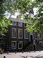
Category:Townhall Wijk bij Duurstede
Jump to navigation
Jump to search
| Object location | | View all coordinates using: OpenStreetMap |
|---|
 | |||||
| Upload media | |||||
| Instance of | |||||
|---|---|---|---|---|---|
| Location | Wijk bij Duurstede, Utrecht, Netherlands | ||||
| Street address |
| ||||
| Located on street | |||||
| Occupant | |||||
| Heritage designation |
| ||||
 | |||||
|
This is a category about rijksmonument number 39696
|
| Address |
|
Media in category "Townhall Wijk bij Duurstede"
The following 37 files are in this category, out of 37 total.
-
 1209 Wijk bij Duurstede 016.JPG 3,648 × 2,734; 1.71 MB
-
 Exterieur OVERZICHT - Wijk bij Duurstede - 20312360 - RCE.jpg 1,197 × 1,200; 397 KB
-
 Exterieur OVERZICHT MARKT MET HARDSTENEN POMP - Wijk bij Duurstede - 20339979 - RCE.jpg 1,176 × 1,200; 415 KB
-

-
 Exterieur VOORGEVEL - Wijk bij Duurstede - 20287682 - RCE.jpg 1,200 × 1,194; 354 KB
-
 Het voormalige stadhuis te Wijk bij Duurstede..jpg 2,000 × 3,008; 1.57 MB
-
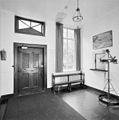
 INTERIEUR, BEGANE GROND, HAL - Wijk bij Duurstede - 20287683 - RCE.jpg 1,200 × 1,197; 259 KB
-

-

-
 INTERIEUR, EERSTE VERDIEPING, OVERZICHT HAL - Wijk bij Duurstede - 20287687 - RCE.jpg 1,188 × 1,200; 253 KB
-

-
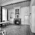 INTERIEUR, EERSTE VERDIEPING, RAADZAAL, SCHOUW - Wijk bij Duurstede - 20287689 - RCE.jpg 1,200 × 1,200; 268 KB
-
 INTERIEUR, EERSTE VERDIEPING, RAADZAAL, SCHOUW - Wijk bij Duurstede - 20287691 - RCE.jpg 1,195 × 1,200; 281 KB
-
 INTERIEUR, EERSTE VERDIEPING, TRAPOPGANG - Wijk bij Duurstede - 20287684 - RCE.jpg 1,200 × 1,171; 197 KB
-
 INTERIEUR, EERSTE VERIEPING, HAL, VOORDEUR - Wijk bij Duurstede - 20287688 - RCE.jpg 1,200 × 1,171; 232 KB
-

-

-
 INTERIEUR, TWEEDE VERDIEPING, OVERZICHT ZAAL - Wijk bij Duurstede - 20287694 - RCE.jpg 1,200 × 1,181; 271 KB
-
 INTERIEUR, TWEEDE VERDIEPING, OVERZICHT ZAAL - Wijk bij Duurstede - 20287695 - RCE.jpg 1,195 × 1,200; 257 KB
-

-

-
 INTERIEUR, ZOLDER (RECHTS), KAPCONSTRUCTIE - Wijk bij Duurstede - 20287696 - RCE.jpg 1,200 × 1,200; 262 KB
-

-
 Markt 24 met bruidspaar uitgevoerd door levende standbeelden Mon 39696.jpg 958 × 1,321; 390 KB
-
 Markt 24 met levende standbeelden Mon 39696.jpg 1,712 × 2,288; 1.03 MB
-
 Markt 24 Mon 39696 Levende standbeelden bruidspaar.jpg 1,035 × 1,506; 173 KB
-
 Markt 24 Mon 39696 Wapens in raadzaal.jpg 1,712 × 2,288; 1.09 MB
-
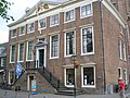
 Markt 24 Mon 39696.jpg 1,712 × 2,288; 1.09 MB
-

-

-
 Stadhuis Markt-24 Wijk-bij-Duurstede Nederland.JPG 2,592 × 1,944; 3.12 MB
-
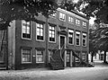 Voorgevel - Wijk bij Duurstede - 20213318 - RCE.jpg 1,200 × 887; 275 KB
-
 WbD EF Markt 24 RM 39696.JPG 1,712 × 2,288; 1.18 MB
-
 WbD EF Markt nr 24 RM 39696.JPG 1,712 × 2,288; 1.38 MB
-
 Wijk bij Duurstede, Netherlands - panoramio (47).jpg 2,048 × 1,148; 553 KB
-
 Wijk bij Duurstede, Netherlands - panoramio (6).jpg 2,048 × 1,148; 513 KB
-
 Wijk bij Duurstede-stadhuis.JPG 3,008 × 2,000; 1.51 MB


,_KAPCONSTRUCTIE,_DETAIL_-_Wijk_bij_Duurstede_-_20287699_-_RCE.jpg)
,_OVERZICHT_MET_KAPCONSTRUCTIE_-_Wijk_bij_Duurstede_-_20287698_-_RCE.jpg)
,_KAPCONSTRUCTIE_-_Wijk_bij_Duurstede_-_20287696_-_RCE.jpg)
,_KAPCONSTRUCTIE,_DETAIL_-_Wijk_bij_Duurstede_-_20287697_-_RCE.jpg)


.jpg)
.jpg)
