Category:Town hall, Varnsdorf
Jump to navigation
Jump to search
 | |||||
| Upload media | |||||
| Instance of | |||||
|---|---|---|---|---|---|
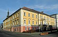
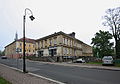
| Location | Varnsdorf, Děčín District, Ústí nad Labem Region, Czechia | ||||
 | |||||
| Object location | | View all coordinates using: OpenStreetMap |
|---|
Media in category "Town hall, Varnsdorf"
The following 15 files are in this category, out of 15 total.
-
 Radnice ve Varnsdorfu.JPG 1,982 × 1,193; 775 KB
-
 Varnsdorf radnice 1.jpg 2,048 × 1,078; 1.65 MB
-
 Varnsdorf radnice 2.jpg 2,048 × 1,347; 2.62 MB
-
 Varnsdorf radnice 3.jpg 2,048 × 1,174; 2.01 MB
-
 Varnsdorf-Radnica 8506.JPG 5,184 × 3,456; 5.8 MB
-
 Varnsdorf-Radnica 8508.JPG 3,456 × 5,184; 5.28 MB
-
 Varnsdorf-Radnica 8509.JPG 5,184 × 3,456; 9.1 MB
-
 Varnsdorf-Rathaus-1.jpg 3,546 × 1,995; 2.7 MB
-
 Varnsdorf-Rathaus-2.jpg 3,335 × 2,106; 2.56 MB
-
 Varnsdorf-Rathaus-3.jpg 3,564 × 2,376; 2.19 MB
-
 Varnsdorf-Rathaus-4.jpg 4,367 × 2,535; 2.48 MB
-
 Varnsdorf-Rathaus-5.jpg 2,624 × 2,334; 2.03 MB
-
 Varnsdorf-Rathaus-6.jpg 2,339 × 3,187; 2.11 MB
-
 Varnsdorf-Sokolhouse 8560.JPG 3,269 × 2,279; 1.4 MB
-
 Varnsdorf-Town hall 8599.JPG 5,184 × 3,456; 5.67 MB


