Category:Towersey
Jump to navigation
Jump to search
English: Towersey is a village about east of Thame in Oxfordshire. The village was part of Buckinghamshire for most of its history, but the boundary was moved in 1933 when Towersey was swapped for Kingsey.
village and civil parish in South Oxfordshire district, Oxfordshire, England  | |||||
| Upload media | |||||
| Instance of | |||||
|---|---|---|---|---|---|
| Location | South Oxfordshire, Oxfordshire, South East England, England | ||||
| Area |
| ||||
| official website | |||||
 | |||||
Subcategories
This category has the following 2 subcategories, out of 2 total.
T
Media in category "Towersey"
The following 103 files are in this category, out of 103 total.
-
 Aglais io - geograph.org.uk - 41738.jpg 640 × 480; 125 KB
-
 B4445 junction near Westbrook Farm - geograph.org.uk - 4857106.jpg 640 × 480; 43 KB
-
 B4445 towards Thame - geograph.org.uk - 5947441.jpg 1,024 × 684; 164 KB
-
 B4445 towards Thame - geograph.org.uk - 5947446.jpg 1,024 × 684; 216 KB
-
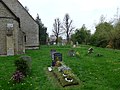
 Behind the churchyard, Towersey - geograph.org.uk - 5371698.jpg 640 × 360; 91 KB
-
 Bird House at Penn Farm - geograph.org.uk - 3989069.jpg 1,024 × 768; 207 KB
-
 Bridge in a Field - geograph.org.uk - 6034460.jpg 5,184 × 3,456; 5.24 MB
-
 Chinnor Road - geograph.org.uk - 6216291.jpg 6,000 × 4,000; 5.03 MB
-
 Chinnor Road south of Thame - geograph.org.uk - 4877335.jpg 2,020 × 1,498; 570 KB
-
 Chinnor Road south of Thame - geograph.org.uk - 5501024.jpg 1,960 × 1,412; 735 KB
-
 Chinnor Road, Towersey - geograph.org.uk - 3988387.jpg 1,600 × 1,226; 520 KB
-
 Churchyard and Church Farm, Towersey - geograph.org.uk - 5371703.jpg 640 × 360; 108 KB
-
 Churchyard of St Catherine's, Towersey - geograph.org.uk - 6216285.jpg 6,000 × 4,000; 5.58 MB
-
 Corn field near Towersey - geograph.org.uk - 33987.jpg 480 × 640; 137 KB
-
 Cottages and bungalow, Towersey - geograph.org.uk - 5371715.jpg 640 × 360; 83 KB
-
 Court Close Road, Towersey - geograph.org.uk - 3988486.jpg 1,600 × 1,282; 843 KB
-
 Equestrian facilities near Towersey - geograph.org.uk - 6216293.jpg 6,000 × 4,000; 4.94 MB
-
 Farmland and footpath, Towersey - geograph.org.uk - 2233407.jpg 640 × 480; 187 KB
-
 Farmland, Towersey - geograph.org.uk - 2233378.jpg 640 × 427; 142 KB
-
 Farmland, Towersey - geograph.org.uk - 2233424.jpg 640 × 480; 137 KB
-
 Field by Chinnor Road near Thame - geograph.org.uk - 5501023.jpg 2,048 × 1,536; 1.6 MB
-
 Field east of Thame - geograph.org.uk - 6075505.jpg 1,024 × 768; 113 KB
-
 Field near Thame - geograph.org.uk - 6216518.jpg 6,000 × 4,000; 3.69 MB
-
 Fields near Towersey - geograph.org.uk - 6216294.jpg 5,799 × 3,866; 3.91 MB
-
 Former Railway Halt, Towersey - geograph.org.uk - 2186804.jpg 1,468 × 1,228; 564 KB
-
 Grange Farm, Towersey - geograph.org.uk - 33926.jpg 640 × 479; 56 KB
-

-
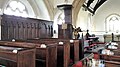
 Inside St Catherine, Towersey (i) - geograph.org.uk - 4099829.jpg 640 × 480; 56 KB
-
 Inside St Catherine, Towersey (ii) - geograph.org.uk - 4099830.jpg 640 × 472; 66 KB
-
 Inside St Catherine, Towersey (iii) - geograph.org.uk - 4099831.jpg 480 × 640; 47 KB
-
 Inside St Catherine, Towersey (iv) - geograph.org.uk - 4099834.jpg 480 × 640; 41 KB
-
 Inside St Catherine, Towersey (iv) - geograph.org.uk - 4099835.jpg 640 × 480; 65 KB
-
 Inside St Catherine, Towersey (ix) - geograph.org.uk - 4099842.jpg 475 × 640; 63 KB
-
 Inside St Catherine, Towersey (v) - geograph.org.uk - 4099836.jpg 640 × 480; 71 KB
-
 Inside St Catherine, Towersey (vi) - geograph.org.uk - 4099837.jpg 480 × 640; 53 KB
-
 Inside St Catherine, Towersey (vii) - geograph.org.uk - 4099839.jpg 640 × 480; 47 KB
-
 Inside St Catherine, Towersey (viii) - geograph.org.uk - 4099841.jpg 640 × 480; 56 KB
-
 Lane north of Towersey churchyard - geograph.org.uk - 5371709.jpg 640 × 360; 93 KB
-
 Old Barns at New Close Farm - geograph.org.uk - 3989078.jpg 1,600 × 1,200; 526 KB
-
 Old railway bridge, Towersey - geograph.org.uk - 4706178.jpg 640 × 480; 125 KB
-

-

-
 Path to Kingsey - geograph.org.uk - 6216273.jpg 6,000 × 4,000; 6.27 MB
-
 Phoenix Trail east of Thame (2) - geograph.org.uk - 6075506.jpg 1,024 × 768; 134 KB
-
 Phoenix Trail east of Thame (3) - geograph.org.uk - 6075509.jpg 1,024 × 768; 173 KB
-
 Phoenix Trail.jpg 640 × 480; 148 KB
-
 Ploughed and planted field near Thame - geograph.org.uk - 6216505.jpg 6,000 × 4,000; 4.71 MB
-
 Pollarded Trees by the Cuttle Brook - geograph.org.uk - 6036878.jpg 5,184 × 3,456; 3.28 MB
-
 Railway bridge Towersey - geograph.org.uk - 3904283.jpg 4,320 × 3,240; 4.41 MB
-
 Red Signal - geograph.org.uk - 713004.jpg 640 × 425; 62 KB
-
 Seat on the Phoenix Trail - geograph.org.uk - 6216297.jpg 6,000 × 4,000; 3.7 MB
-

-
 Silver birch trees and finger post - geograph.org.uk - 3904365.jpg 2,627 × 1,857; 2.48 MB
-

-
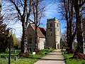 St Catherine's church Towersey - geograph.org.uk - 3904238.jpg 4,320 × 3,240; 6.58 MB
-
 St Catherine's Church, Towersey - geograph.org.uk - 6216288.jpg 6,000 × 4,000; 5.84 MB
-
 St Catherine's, Towersey - geograph.org.uk - 5371755.jpg 640 × 360; 116 KB
-
 St Catherine's, Towersey - geograph.org.uk - 5371762.jpg 640 × 360; 108 KB
-
 St Catherine's, Towersey - geograph.org.uk - 5371784.jpg 640 × 360; 55 KB
-
 St Catherine's, Towersey, chancel - geograph.org.uk - 5371786.jpg 640 × 360; 49 KB
-
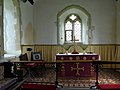 St Catherine, Towersey, altar - geograph.org.uk - 4099850.jpg 640 × 480; 65 KB
-

-
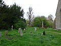
 St Catherine, Towersey, churchyard (b) - geograph.org.uk - 4099801.jpg 640 × 480; 115 KB
-
 St Catherine, Towersey, churchyard (c) - geograph.org.uk - 4099802.jpg 480 × 640; 100 KB
-

-

-
-

-

-
 St Catherine, Towersey, churchyard (i) - geograph.org.uk - 4099817.jpg 640 × 480; 107 KB
-

-

-
 St Catherine, Towersey, churchyard (k) - geograph.org.uk - 4099824.jpg 640 × 480; 107 KB
-
-

-
 St Catherine, Towersey, font - geograph.org.uk - 4099828.jpg 480 × 640; 57 KB
-
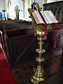 St Catherine, Towersey, lectern - geograph.org.uk - 4099848.jpg 480 × 640; 58 KB
-
 St Catherine, Towersey, path - geograph.org.uk - 4099774.jpg 640 × 480; 114 KB
-
 St Catherine, Towersey, pulpit - geograph.org.uk - 4099845.jpg 480 × 640; 50 KB
-
 St Catherine, Towersey, south door - geograph.org.uk - 4099846.jpg 640 × 480; 59 KB
-
 Stand of trees near Kingston Hayes - geograph.org.uk - 6212763.jpg 6,000 × 4,000; 4.24 MB
-
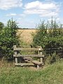 Stile on footpath near Towersey - geograph.org.uk - 33980.jpg 480 × 640; 135 KB
-
 Thame light industry across pasture - geograph.org.uk - 33923.jpg 640 × 480; 70 KB
-
 Thatched cottage in Towersey - geograph.org.uk - 6216283.jpg 6,000 × 4,000; 4.76 MB
-
 The lane up to Grange Farm - geograph.org.uk - 713052.jpg 640 × 425; 69 KB
-
 The Phoenix Trail - geograph.org.uk - 6216493.jpg 6,000 × 4,000; 5.9 MB
-
 The Phoenix Trail - geograph.org.uk - 713045.jpg 640 × 425; 86 KB
-
 The Three Horseshoes pub, Towersey - geograph.org.uk - 3904245.jpg 4,320 × 3,240; 5.28 MB
-
 Towersey close - geograph.org.uk - 5371723.jpg 640 × 360; 98 KB
-
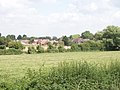 Towersey from the Phoenix Trail - geograph.org.uk - 32920.jpg 640 × 480; 118 KB
-
 Towersey Village Hall - geograph.org.uk - 3988468.jpg 3,864 × 2,748; 1.57 MB
-
 Towersey, St Catherine - geograph.org.uk - 4460968.jpg 4,608 × 3,456; 5.21 MB
-
 Transport Monitoring - geograph.org.uk - 4376671.jpg 1,600 × 1,200; 605 KB
-
 View through the Seating - geograph.org.uk - 3988373.jpg 4,000 × 3,000; 2.53 MB
-
-
 Water Road, Towersey - geograph.org.uk - 5371741.jpg 640 × 360; 69 KB
-
 Wheat field near Towersey - geograph.org.uk - 6216282.jpg 6,000 × 4,000; 4.47 MB
-
 Windmill Road - geograph.org.uk - 4706165.jpg 640 × 480; 151 KB
-
 Windmill Road enters Towersey - geograph.org.uk - 4706168.jpg 640 × 480; 86 KB
-
 Windmill Road Towersey - geograph.org.uk - 712976.jpg 640 × 425; 68 KB
-
 Approaching the A4129 junction - geograph.org.uk - 712983.jpg 640 × 425; 73 KB
-
 Chinnor Road B4445 - geograph.org.uk - 713075.jpg 640 × 425; 70 KB
-
 Entering Towersey - geograph.org.uk - 713034.jpg 640 × 425; 93 KB


_-_geograph.org.uk_-_4099829.jpg)
_-_geograph.org.uk_-_4099830.jpg)
_-_geograph.org.uk_-_4099831.jpg)
_-_geograph.org.uk_-_4099834.jpg)
_-_geograph.org.uk_-_4099835.jpg)
_-_geograph.org.uk_-_4099842.jpg)
_-_geograph.org.uk_-_4099836.jpg)
_-_geograph.org.uk_-_4099837.jpg)
_-_geograph.org.uk_-_4099839.jpg)
_-_geograph.org.uk_-_4099841.jpg)


_-_geograph.org.uk_-_6075506.jpg)
_-_geograph.org.uk_-_6075509.jpg)


_-_geograph.org.uk_-_3937599.jpg)


_-_geograph.org.uk_-_4099799.jpg)
_-_geograph.org.uk_-_4099801.jpg)
_-_geograph.org.uk_-_4099802.jpg)
_-_geograph.org.uk_-_4099803.jpg)
_-_geograph.org.uk_-_4099804.jpg)
_-_geograph.org.uk_-_4099807.jpg)
_-_geograph.org.uk_-_4099811.jpg)
_-_geograph.org.uk_-_4099815.jpg)
_-_geograph.org.uk_-_4099817.jpg)
_-_geograph.org.uk_-_4099818.jpg)
_-_geograph.org.uk_-_4099821.jpg)
_-_geograph.org.uk_-_4099824.jpg)
_-_geograph.org.uk_-_4099826.jpg)
_-_geograph.org.uk_-_4099827.jpg)


