Category:Tower mills in the East Riding of Yorkshire
Jump to navigation
Jump to search
Subcategories
This category has the following 17 subcategories, out of 17 total.
B
- Black Mill, Beverley Westwood (49 F)
- Burton Pidsea Windmill (5 F)
G
- Garton Mill (6 F)
- Shuffleton Windmill, Goole (4 F)
- Timms Mill, Goole (7 F)
H
- Cliff Mill, Hessle (23 F)
K
- New Mill, Keyingham (3 F)
- Old Mill, Keyingham (2 F)
- The Mill, Holderness Road (15 F)
L
- Lelley Windmill (13 F)
M
- Mappleton Mill (3 F)
N
- Old Mill, Nafferton (3 F)
P
- Black Mill, Patrington (11 F)
R
- Black Mill, Rimswell (5 F)
S
- Skidby Mill (37 F)
U
Y
- Yokefleet Mill (12 F)
Media in category "Tower mills in the East Riding of Yorkshire"
The following 48 files are in this category, out of 48 total.
-
 A disused windmill Hutton Cranswick.jpg 640 × 427; 382 KB
-
 Bainton Mill, East Riding-geograph.org-1684284.jpg 514 × 640; 190 KB
-
 Black Mill and Withernsea Lighthouse.jpg 3,264 × 2,448; 1.28 MB
-
 Black Mill Waxholme.jpg 3,024 × 4,032; 3.03 MB
-
 Buckton Mill, Buckton.jpg 640 × 480; 80 KB
-
 Buckton Mill, East Riding-geograph.org-3554421.jpg 3,187 × 2,382; 2.31 MB
-
 Common Mill, Seaton Ross.jpg 640 × 480; 121 KB
-
-

-
 Easington Windmill 1905 (archive ref PO-1-36-1) (27966804834).jpg 873 × 543; 93 KB
-
-
-
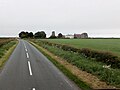
 Entrance to Mill Farm - geograph.org.uk - 1422182.jpg 640 × 496; 107 KB
-
 Etton Mill.jpg 640 × 480; 120 KB
-
 Foston on the Wolds Mill.jpg 640 × 500; 74 KB
-
 Goole fields Windmill - geograph.org.uk - 1198628.jpg 640 × 480; 47 KB
-
 Goole Mill - geograph.org.uk - 2549814.jpg 1,600 × 1,161; 226 KB
-
 Havenside Windmill, Patrington - geograph.org.uk - 186713.jpg 640 × 480; 90 KB
-
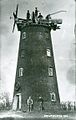
 Hornsea Brickyard Mill 1870 (archive ref DDX1687-3-2) (29122664166).jpg 938 × 690; 169 KB
-
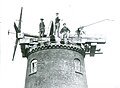
 Hornsea Windmill 1900 (archive ref PO-1-65-46) (28583977665).jpg 814 × 561; 134 KB
-
 Hutton Balk - geograph.org.uk - 1055630.jpg 640 × 427; 298 KB
-
 Hutton Cranswick Mill.jpg 640 × 480; 82 KB
-
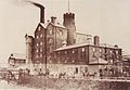
 John Ward of Hull - Stoneferry.jpg 2,235 × 1,640; 796 KB
-
 Kilham.jpg 640 × 480; 71 KB
-
 Kilpin Brick Ponds - geograph.org.uk - 472893.jpg 640 × 448; 87 KB
-
 Kilpin Brick Ponds - geograph.org.uk - 472901.jpg 478 × 640; 123 KB
-

-
 Mill Farm - geograph.org.uk - 813996.jpg 640 × 478; 262 KB
-
 Mill Farm, Etton - geograph.org.uk - 739778.jpg 640 × 452; 62 KB
-
 Mill Farm, near Etton - geograph.org.uk - 683312.jpg 640 × 444; 186 KB
-
 Mill Farm, Wressle (geograph 5600672).jpg 5,376 × 3,024; 2.59 MB
-
 Minor road Junction near Etton - geograph.org.uk - 1422174.jpg 640 × 480; 55 KB
-
 New Mill, Seaton Ross.jpg 640 × 480; 68 KB
-
 No Shootin - geograph.org.uk - 471851.jpg 640 × 480; 114 KB
-
 North of Seaton Ross - geograph.org.uk - 1367951.jpg 640 × 423; 175 KB
-
 Old Goole Mill.jpg 640 × 480; 204 KB
-
 Old Mill Silhouette - geograph.org.uk - 208297.jpg 640 × 480; 109 KB
-
 Old Mill, Seaton Ross.jpg 640 × 417; 48 KB
-
 Old Windmill at Mill Farm - geograph.org.uk - 1115279.jpg 640 × 480; 75 KB
-
 Pump Brickyard Farm North Howden.jpg 640 × 464; 86 KB
-
 Sewerby Mill, East Riding-geograph.org-2925782.jpg 640 × 480; 49 KB
-
 Speeton Mill 1920 (archive ref SP-2-346) (28551191816).jpg 874 × 522; 270 KB
-
 The Old Mill at Newsham Farm - geograph.org.uk - 1208782.jpg 640 × 480; 93 KB
-
 The Old Mill Caravan Park - geograph.org.uk - 1207499.jpg 640 × 480; 55 KB
-
 The Old Mill, New Ellerby - geograph.org.uk - 721559.jpg 640 × 480; 119 KB
-
 Walkington Windmill 1912 (archive ref PC43-112) (28299739090).jpg 842 × 633; 303 KB
-
 Yapham Grange - geograph.org.uk - 211238.jpg 640 × 479; 53 KB
-
 Yapham Mill (geograph 1845985).jpg 640 × 475; 48 KB


_(24778182084).jpg)

_(27966804834).jpg)
_1913_(archive_ref_DDEY-1-67)_(28583977755).jpg)
_1913_(archive_ref_DDEY-1-67)_(28551191326).jpg)


_(29122664166).jpg)
_(28583977665).jpg)


_(30383272301).jpg)


.jpg)


_(28551191816).jpg)


_(28299739090).jpg)

.jpg)