Category:Topographic maps of natural regions of Germany
Jump to navigation
Jump to search
Countries of Europe: Germany
Subcategories
This category has the following 2 subcategories, out of 2 total.
Media in category "Topographic maps of natural regions of Germany"
The following 14 files are in this category, out of 14 total.
-
 Brandenburg Landschaften.png 999 × 986; 1.14 MB
-
 Deutschland Landschaften 2xA3.pdf 2,481 × 1,754, 2 pages; 33.78 MB
-
 Deutschland Landschaften.png 2,267 × 2,896; 10.64 MB
-
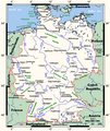 Germanymap.png 990 × 1,178; 67 KB
-
 Germanymap2.png 932 × 1,143; 79 KB
-
 Karte der naturräumlichen Untereinheiten der Donau-Iller-Lech-Platte.jpg 2,691 × 2,365; 1.41 MB
-
 Karte der naturräumlichen Untereinheiten der Donau-Iller-Lech-Platte.svg 1,909 × 1,525; 33.33 MB
-
 Naturraumkarte Harz.png 1,410 × 1,033; 1.87 MB
-
 Naturraumkarte Noerdliches Harzvorland.png 2,169 × 1,688; 3.17 MB
-
 Naturraumkarte Rhoen.png 1,090 × 1,248; 2.25 MB
-
 Naturraumkarte Thueringer Becken.png 1,935 × 1,461; 3.78 MB
-
 Naturraumkarte Thueringer Wald.png 934 × 898; 1.21 MB
-
 Naturraumkarte Thueringisch-Fraenkisches Mittelgebirge mit Vogtland.png 2,111 × 1,693; 4.63 MB
-
 Uebersicht Brandenburg.png 1,315 × 1,518; 367 KB


