Category:Topographic maps of Washington (state)
Jump to navigation
Jump to search
States of the United States: Alabama · Alaska · Arizona · Arkansas · California · Colorado · Connecticut · Delaware · Florida · Georgia · Hawaii · Idaho · Illinois · Indiana · Iowa · Kansas · Kentucky · Louisiana · Maine · Maryland · Massachusetts · Michigan · Minnesota · Mississippi · Missouri · Montana · Nebraska · Nevada · New Hampshire · New Jersey · New Mexico · New York · North Carolina · North Dakota · Ohio · Oklahoma · Oregon · Pennsylvania · Rhode Island · South Carolina · South Dakota · Tennessee · Texas · Utah · Vermont · Virginia · Washington · West Virginia · Wisconsin · Wyoming – Washington, D.C.
American Samoa · Puerto Rico · United States Virgin Islands
American Samoa · Puerto Rico · United States Virgin Islands
Subcategories
This category has the following 3 subcategories, out of 3 total.
Media in category "Topographic maps of Washington (state)"
The following 56 files are in this category, out of 56 total.
-
 1902 USGS topo map of Baring, Washington.jpg 3,000 × 3,000; 3.94 MB
-
 Big Horn topographic blank map.png 800 × 800; 672 KB
-
 Cascade Range map protected areas map-fr.svg 403 × 693; 3.63 MB
-
 Cascade Range map protected areas map-it.svg 403 × 693; 3.14 MB
-
 Channeled Scablands east WA 46to48N 117to120W Topo Rainbow Zebra 3774.jpg 10,800 × 7,200; 61.44 MB
-
 Digital-elevation-map-washington.gif 980 × 660; 409 KB
-
 Gallatin Range.JPG 629 × 335; 89 KB
-
 Kuehn95-fig46a.png 256 × 322; 128 KB
-
 Lakewood 1911.jpg 639 × 425; 64 KB
-
 Location of Beebe Bridge, Chelan, Washington.png 945 × 755; 1.69 MB
-
 Mount Adams bedrock topographic map-fr.svg 785 × 799; 728 KB
-
 Mount Adams Region topographic map-fr 2.svg 513 × 669; 3.03 MB
-
 Mount Adams Region topographic map-fr.svg 751 × 870; 3.02 MB
-
 Mount Adams Relief Map, SRTM-1.jpg 1,600 × 1,200; 1.45 MB
-
 Mount Adams topographic map-fr.svg 785 × 799; 964 KB
-
 Mount Rainier Hazard Map-blank.svg 1,059 × 1,266; 2.42 MB
-
 Mount Rainier Hazard Map-fr.svg 1,059 × 1,266; 2.46 MB
-
 Mount St. Helens Relief Map, SRTM-1.jpg 1,600 × 1,200; 1.49 MB
-
 Northern Washington Cascade Mtns Topo Rainbow Zebra 1326.png 5,685 × 3,875; 32.95 MB
-
 Olympic National Park WA Topo Rainbow Zebra 1428.png 6,550 × 3,815; 25.59 MB
-
 OWL-location.png 235 × 172; 222 KB
-
 OWL-shadedrelief.png 235 × 172; 222 KB
-
 Raisz 1941 Olympic Peninsula Puget Sound.png 1,241 × 920; 2.02 MB
-
 Seattle - Denny Park topographical map, circa 1893 (49070435227).jpg 700 × 1,148; 101 KB
-
 South Washington Cascade Range topographic map-fr.svg 720 × 722; 6.86 MB
-
 South Washington protected areas map-fr.svg 720 × 722; 6.86 MB
-

-

-

-

-

-

-

-

-

-

-

-

-

-

-

-
-
 United States Geological Survey Map Chehalis River, Published 1992.jpg 5,732 × 4,079; 6.14 MB
-
 United States Geological Survey Map Mount Rainier, Published 1971.jpg 10,098 × 9,905; 11.38 MB
-
 United States Geological Survey Map Olympic National Park, Published 1957.jpg 13,346 × 9,868; 13.91 MB
-
 USGS 100k topo Grays River 1981 excerpt.jpg 2,400 × 2,822; 5.37 MB
-
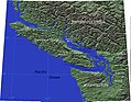 Vancouver-island-relief.jpg 866 × 673; 154 KB
-
 Washington areas Columbia map-fr.svg 1,031 × 675; 7.04 MB
-
 Washington areas map-fr.svg 1,031 × 675; 7.06 MB
-
 Washington municipal corporation topographic map-fr.svg 596 × 389; 7.43 MB
-
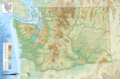
 Washington topographic blank map-2.png 1,031 × 675; 910 KB
-
 Washington topographic blank map.png 1,031 × 675; 1,002 KB
-
 Washington topographic map-fr.png 1,031 × 675; 1.01 MB
-
 Washington topographic map-fr.svg 1,031 × 675; 6.52 MB
-
 Wpdms nasa topo columbia river gorge.jpg 1,710 × 1,704; 322 KB
-
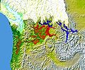 Wpdms nasa topo missoula floods.jpg 464 × 384; 49 KB


.jpg)


_-_DPLA_-_2641c3d58c1639d8b45e019e90b6a6ea.jpg)


