Category:Topographic maps of Haute-Loire
Jump to navigation
Jump to search
Subcategories
This category has the following 2 subcategories, out of 2 total.
*
- Orthophotos of Haute-Loire (15 F)
Media in category "Topographic maps of Haute-Loire"
The following 12 files are in this category, out of 12 total.
-
 43-Haute-Loire-carte-R1.jpg 724 × 503; 207 KB
-
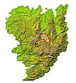
 Haute-Loire department relief location map.jpg 1,239 × 919; 1.18 MB
-
 Lac de Saint-Front (Haute-Loire) OSM.png 726 × 666; 215 KB
-
 Lac du Bouchet OSM.png 585 × 616; 255 KB
-
 MC Brivadois.jpg 714 × 784; 231 KB
-
 MC Mézenc.jpg 714 × 784; 247 KB
-
 Mont d'Alambre OSM.png 682 × 587; 324 KB
-
 Mont Devès OSM.png 639 × 651; 402 KB
-
 Mont Mézenc OSM.png 386 × 318; 163 KB
-
 Plan de Loudes.png 3,252 × 2,972; 1.38 MB
-
 Vallée de l'Ance map Lambert-93 topographic-blank.svg 327 × 584; 4.54 MB
-
 Violette (Alagnon) OSM.png 1,108 × 1,202; 2.21 MB


_OSM.png)


_OSM.png)