Category:Topographic maps of Greenland
Jump to navigation
Jump to search
Media in category "Topographic maps of Greenland"
The following 10 files are in this category, out of 10 total.
-
 Cambios en la capa de hielo de Groenlandia.jpg 540 × 450; 56 KB
-
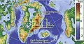
 Crown Prince Frederick Range-pclmaps-oclc-8322829 c 13.jpg 1,692 × 1,165; 741 KB
-
 F1 large2.JPG 432 × 232; 33 KB
-
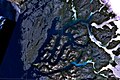 Godthaabsfjord.jpg 990 × 664; 568 KB
-
 Greenland in North America (relief) (-mini map).svg 1,181 × 1,185; 4.84 MB
-
 Greenland in North America (relief).svg 1,181 × 1,185; 4.82 MB
-
 North Greenland section-txu-pclmaps-oclc-8322829 a 1.jpg 3,056 × 3,641; 3.39 MB
-
 Operational Navigation Chart D-16, 4th edition.jpg 9,254 × 6,680; 10.33 MB
-
 Petermann Glacier, Greenland ESA383315.jpg 5,400 × 5,400; 7.13 MB
-
 Topographic map of Greenland bedrock.jpg 802 × 1,042; 267 KB


_(-mini_map).svg)
.svg)


