Category:Tintern
Jump to navigation
Jump to search
village in Wye Valley, Monmouthshire, United Kingdom  | |||||
| Upload media | |||||
| Instance of | |||||
|---|---|---|---|---|---|
| Location | Wye Valley, Monmouthshire, Wales | ||||
| official website | |||||
 | |||||
Cymraeg: Pentref ar lan orllewinol Afon Gwy yn Sir Fynwy, de-ddwyrain Cymru, yw Tyndyrn (Saesneg: Tintern). Mae'n gorwedd bron ar y ffin â Lloegr, tua 5 milltir i'r gogledd o dref Cas-gwent. Mae'n lle sy'n boblogaidd iawn gan dwristiaid, sy'n cael eu denu yno i weld adfeilion rhamantaidd Abaty Tyndyrn, sy'n gorwedd ger y pentref.
English: Tintern is a village on the west bank of the River Wye in Monmouthshire, Wales, close to the border with England, about 5 miles north of Chepstow. It is popular with tourists, who visit for the natural scenery and the ruined Tintern Abbey.
Subcategories
This category has the following 8 subcategories, out of 8 total.
B
- Black Cliff Wood (8 F)
R
S
- St Mary's Church, Tintern (21 F)
- St Michael's Church, Tintern (7 F)
T
- Tintern railway station (42 F)
- Tintern Tunnel (6 F)
- Tintern Wireworks Bridge (47 F)
Media in category "Tintern"
The following 200 files are in this category, out of 258 total.
(previous page) (next page)-
 2010 Wales Monmouthshire Community Tintern map.svg 512 × 682; 699 KB
-
 A green lane - geograph.org.uk - 2937734.jpg 640 × 480; 360 KB
-
 A pair of roe deer - geograph.org.uk - 2128608.jpg 1,024 × 681; 148 KB
-
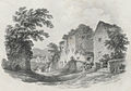
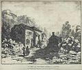 A View near Tintern Abbey in South Wales (1129747).jpg 1,000 × 858; 206 KB
-
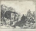 A View near Tintern Abbey in South Wales.jpeg 750 × 644; 194 KB
-
 A466 at the quarry entrance - geograph.org.uk - 3004721.jpg 1,024 × 768; 380 KB
-
 Abbey Mill grounds, Tintern - geograph.org.uk - 2544827.jpg 2,112 × 2,816; 2.17 MB
-
 Abbey Mill, Tintern (9634).jpg 4,288 × 2,848; 6.32 MB
-
 Abbey Mill, Tintern (9635).jpg 4,288 × 2,848; 6.92 MB
-
 Above Tintern - geograph.org.uk - 2126803.jpg 1,024 × 681; 287 KB
-

-
 Angiddy River Early Autumn.jpg 2,666 × 4,000; 11.44 MB
-
 Angiddy Stream at Tintern.jpg 5,184 × 3,456; 6.85 MB
-
 Angidy ironworks, Tintern - geograph.org.uk - 2544837.jpg 2,816 × 2,112; 2.52 MB
-
 Angidy ironworks, Tintern - geograph.org.uk - 2544843.jpg 2,816 × 2,112; 2.39 MB
-
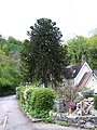 Araucaria tree and house - geograph.org.uk - 1286792.jpg 480 × 640; 105 KB
-
 Autumn colours - geograph.org.uk - 2129304.jpg 1,024 × 681; 333 KB
-
 Barn at Fairoak - geograph.org.uk - 1555323.jpg 640 × 480; 96 KB
-
 Barn on the way to Penterry Farm - geograph.org.uk - 1572930.jpg 640 × 480; 87 KB
-
 Beaufort Pond Dam, Tintern.jpg 4,000 × 3,000; 4.73 MB
-
 Beech tree and stile - geograph.org.uk - 2129308.jpg 1,024 × 681; 252 KB
-
 Below Hale Wood - geograph.org.uk - 2129295.jpg 1,024 × 681; 341 KB
-

-

-
 Church path - geograph.org.uk - 1372421.jpg 426 × 640; 122 KB
-
 Coed Beddick - geograph.org.uk - 1286844.jpg 480 × 640; 147 KB
-
 Collecting tin Tintern Abbey - geograph.org.uk - 721075.jpg 480 × 640; 127 KB
-
 Commemorative plaque - geograph.org.uk - 1479883.jpg 640 × 457; 381 KB
-
 Converted chapel in Tintern - geograph.org.uk - 803675.jpg 640 × 426; 68 KB
-
 Converted farm buildings, Trelleck Grange - geograph.org.uk - 2726975.jpg 1,024 × 680; 225 KB
-
 Cottages and farmland - geograph.org.uk - 2129316.jpg 1,024 × 681; 220 KB
-
 Country road near Banton - geograph.org.uk - 2127457.jpg 681 × 1,024; 292 KB
-
 Country road to Cobbler's Plain - geograph.org.uk - 2727919.jpg 680 × 1,024; 248 KB
-
 Crossroad sign - geograph.org.uk - 3485012.jpg 2,592 × 1,944; 999 KB
-
 Crown Lodge, Tintern.jpg 4,000 × 3,000; 1.26 MB
-

-
 Derelict barn near Tintern - geograph.org.uk - 84719.jpg 640 × 480; 160 KB
-
 Drive to Llan-y-nant - geograph.org.uk - 2727924.jpg 1,024 × 680; 180 KB
-
 Edward VII postbox, Tintern - geograph.org.uk - 3049520.jpg 304 × 640; 53 KB
-

-
 Evening at the Pond by Tintern Cross - geograph.org.uk - 202906.jpg 640 × 480; 398 KB
-
 Farmland around Trelleck Grange - geograph.org.uk - 2129330.jpg 1,024 × 681; 191 KB
-
 Farmland near Trelleck Grange - geograph.org.uk - 2726991.jpg 1,024 × 680; 233 KB
-
 Fedw Pool - geograph.org.uk - 3189085.jpg 1,024 × 680; 157 KB
-
 Fedw Wood - geograph.org.uk - 2127460.jpg 1,024 × 681; 309 KB
-

-
 Fields above Tintern - geograph.org.uk - 2938270.jpg 640 × 360; 194 KB
-
 Fishing pool near Tintern Cross - geograph.org.uk - 3101386.jpg 640 × 480; 115 KB
-
 Football pitch, Tintern - geograph.org.uk - 3049534.jpg 640 × 480; 86 KB
-
 Footpath near The Cot - geograph.org.uk - 2129285.jpg 1,024 × 681; 269 KB
-
 Footpath through Kit's Wood - geograph.org.uk - 2129343.jpg 681 × 1,024; 309 KB
-
 Footpath to Tintern - geograph.org.uk - 2126874.jpg 1,024 × 681; 222 KB
-
 Footpath to Tintern Cross - geograph.org.uk - 1288815.jpg 640 × 480; 138 KB
-
 Forest Reflection in the Wye.jpg 2,592 × 3,456; 9.2 MB
-
 Former Chapel at St Briavels Common - geograph.org.uk - 86315.jpg 640 × 426; 128 KB
-
 Former Methodist Church, Tintern - geograph.org.uk - 3049574.jpg 640 × 470; 82 KB
-
 Fountain Inn - geograph.org.uk - 2129320.jpg 1,024 × 681; 189 KB
-
 Fryer's Wharf and slipway at Tintern - geograph.org.uk - 3091043.jpg 640 × 480; 146 KB
-
 Furnace Dam, Tintern 01.jpg 3,000 × 4,000; 3.87 MB
-
 Furnace Dam, Tintern 02.jpg 4,000 × 3,000; 4.92 MB
-
 General view Tintern England.jpg 1,060 × 832; 172 KB
-
 General view, Tintern, England-LCCN2002708161.jpg 3,639 × 2,727; 3.31 MB
-
 General view, Tintern, England-LCCN2002708161.tif 3,639 × 2,727; 28.39 MB
-
 Grade II listed The Anchor, Tintern - geograph.org.uk - 3049469.jpg 640 × 422; 85 KB
-
 Hale Woods - geograph.org.uk - 2938276.jpg 640 × 360; 237 KB
-
 Hill above Tintern.jpg 4,896 × 3,264; 7.72 MB
-
 House and church, Trelleck Grange - geograph.org.uk - 2727909.jpg 1,024 × 680; 246 KB
-
 Into the valley - geograph.org.uk - 1372412.jpg 640 × 426; 102 KB
-
 Iron forge at tintern.jpg 733 × 609; 239 KB
-
 Iron Mills - A View near Tintern Abbey, Monmouthshire.jpeg 750 × 562; 124 KB
-
 Lane downhill to Tintern - geograph.org.uk - 2281104.jpg 800 × 600; 450 KB
-

-
 Leaping deer (1) - geograph.org.uk - 2128593.jpg 1,024 × 677; 242 KB
-
 Leaping deer (2) - geograph.org.uk - 2128597.jpg 1,024 × 701; 225 KB
-
 Logging road, The Oaks - geograph.org.uk - 2937740.jpg 640 × 480; 334 KB
-

-
 Looking down on Brockweir - geograph.org.uk - 707595.jpg 436 × 639; 68 KB
-
 Looking south from Tintern Abbey - geograph.org.uk - 1705988.jpg 1,024 × 768; 369 KB
-
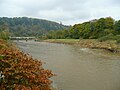 Looking upstream at Tintern - geograph.org.uk - 1034369.jpg 640 × 480; 79 KB
-
 Lower Barn, Trelleck Grange - geograph.org.uk - 2727930.jpg 1,024 × 680; 244 KB
-
 Manufacture of Brass - Trelleck Road Tintern.jpg 2,000 × 1,500; 1.35 MB
-
 Manufacture of Brass.jpg 2,000 × 1,500; 1.26 MB
-
 Mast site in Caswell Wood above Tintern - geograph.org.uk - 507848.jpg 640 × 480; 174 KB
-
 MG at Tintern (9632).jpg 4,288 × 2,848; 6.2 MB
-

-

-
 Millennium standing stone, Trelleck Grange - geograph.org.uk - 2726963.jpg 680 × 1,024; 245 KB
-
 Millstone and Abbey - geograph.org.uk - 1479886.jpg 640 × 457; 368 KB
-
 Millstones on a roundabout, Tintern - geograph.org.uk - 3049494.jpg 640 × 480; 90 KB
-
 Mirrored tree - geograph.org.uk - 3189089.jpg 680 × 1,024; 263 KB
-
 Mirrored trees - geograph.org.uk - 3189087.jpg 1,024 × 680; 247 KB
-
 Misty Morning. - geograph.org.uk - 735689.jpg 640 × 424; 84 KB
-

-
 Monmouthshire countryside - geograph.org.uk - 2726311.jpg 1,024 × 680; 168 KB
-
 Near Tintern in Monmouthshire.jpeg 750 × 526; 139 KB
-
 Near Tintern, A466 towards Chepstow - geograph.org.uk - 1090950.jpg 640 × 480; 96 KB
-
 New barn, Penterry Farm - geograph.org.uk - 2126800.jpg 1,024 × 681; 226 KB
-
 Offa's Dyke Path signpost above Brockweir - geograph.org.uk - 56244.jpg 640 × 426; 132 KB
-
 Old cottage, Tintern - geograph.org.uk - 1980658.jpg 3,296 × 2,472; 1.85 MB
-
 Old cottages in Tintern - geograph.org.uk - 2344372.jpg 640 × 480; 135 KB
-
 Old mill wheel at Abbey Mill, Tintern - geograph.org.uk - 703330.jpg 480 × 640; 207 KB
-
 Old stone embankment on the old lane through Buckle Wood - geograph.org.uk - 3484979.jpg 2,592 × 1,944; 1.43 MB
-
 On the Wye Valley Walk in April - geograph.org.uk - 2344596.jpg 640 × 480; 94 KB
-
 Outhouses, Tintern - geograph.org.uk - 2935277.jpg 2,048 × 1,536; 865 KB
-
 Overgrown path - geograph.org.uk - 3101294.jpg 640 × 480; 142 KB
-

-
 Path across pasture between woodland - geograph.org.uk - 3101236.jpg 640 × 480; 81 KB
-
 Path into Coed Beddick - geograph.org.uk - 2281107.jpg 800 × 600; 452 KB
-
 Path junction or crossroads - geograph.org.uk - 3101280.jpg 640 × 480; 128 KB
-
 Path out of the top of Limekiln Wood - geograph.org.uk - 3101269.jpg 640 × 480; 125 KB
-
 Path, Hale Woods - geograph.org.uk - 2938265.jpg 640 × 480; 355 KB
-
 Pierced wall, Tintern - geograph.org.uk - 2935265.jpg 2,048 × 1,536; 1.02 MB
-
 Plaque on Millennium Stone - geograph.org.uk - 2726964.jpg 1,024 × 680; 216 KB
-
 Pool at Trelleck Grange - geograph.org.uk - 2726995.jpg 1,024 × 680; 214 KB
-
 Pool near Great House - geograph.org.uk - 2727000.jpg 1,024 × 680; 194 KB
-
 Postbox at Abbey Mill - geograph.org.uk - 703313.jpg 640 × 480; 170 KB
-
 Quayside Cottage, Tintern - geograph.org.uk - 3049636.jpg 640 × 530; 63 KB
-
 Quernstones in Tintern.jpg 3,264 × 4,896; 8.54 MB
-
 Ravensnest Wood - geograph.org.uk - 2129288.jpg 1,024 × 681; 326 KB
-
 Redding's Farm, above Tintern - geograph.org.uk - 812728.jpg 640 × 426; 82 KB
-
 Reflections in Fedw Pool - geograph.org.uk - 3191168.jpg 1,024 × 680; 222 KB
-
 River Wye Reflection.jpg 2,592 × 3,456; 7.85 MB
-
 Road junction near Trelleck Grange - geograph.org.uk - 2129322.jpg 1,024 × 681; 225 KB
-
 Road through Llanishen Cross - geograph.org.uk - 2339632.jpg 640 × 480; 103 KB
-
 Road to Great House Farm - geograph.org.uk - 2730448.jpg 680 × 1,024; 274 KB
-
 Road to Penterry Farm - geograph.org.uk - 2126866.jpg 1,024 × 681; 227 KB
-
 Rolling countryside, Trelleck Grange - geograph.org.uk - 2727917.jpg 1,024 × 680; 247 KB
-
 Royal Enfield at Tintern Abbey - geograph.org.uk - 2922981.jpg 640 × 480; 230 KB
-
 Ruin near Wain-y-Parc - geograph.org.uk - 1288793.jpg 640 × 480; 113 KB
-
 Sheep grazing on bank of River Wye - geograph.org.uk - 3208172.jpg 3,035 × 2,009; 6.4 MB
-
 Small waterfall west of Tintern - geograph.org.uk - 301265.jpg 640 × 427; 131 KB
-
 St Anne's House, Tintern.jpg 640 × 511; 95 KB
-
 St Briavels Common - geograph.org.uk - 86319.jpg 640 × 426; 165 KB
-
 Stile near Gaer Hill - geograph.org.uk - 2127458.jpg 1,024 × 681; 336 KB
-
 Stile on the way to the Devil's Pulpit - geograph.org.uk - 480083.jpg 640 × 480; 143 KB
-
 Stiles on Beeches Farm - geograph.org.uk - 507804.jpg 640 × 480; 176 KB
-
 Stone built cottage in Tintern - geograph.org.uk - 803670.jpg 640 × 426; 97 KB
-
 Telephone box at Llanishen Cross - geograph.org.uk - 1936722.jpg 3,008 × 2,000; 1.52 MB
-
 The Abbey Hotel at Tintern - geograph.org.uk - 2619858.jpg 640 × 480; 97 KB
-
 The Anchor at Tintern - geograph.org.uk - 1936663.jpg 3,008 × 2,000; 1.3 MB
-
 The Anchor Hotel - geograph.org.uk - 1595398.jpg 640 × 480; 75 KB
-
 The Anchor Inn, Tintern, Wales.jpg 3,392 × 2,850; 2.38 MB
-
 The Anchor, near Tintern Abbey - geograph.org.uk - 2544833.jpg 2,112 × 2,816; 1.86 MB
-
 The Anchor, Tintern - geograph.org.uk - 703326.jpg 640 × 443; 126 KB
-
 The Angidy River, Tintern - geograph.org.uk - 803690.jpg 426 × 640; 90 KB
-
 The Cot - geograph.org.uk - 2127274.jpg 1,024 × 681; 262 KB
-
 The Italian Garden, Tintern - geograph.org.uk - 3049539.jpg 640 × 513; 88 KB
-
 The Moon and Sixpence - geograph.org.uk - 1352159.jpg 640 × 426; 71 KB
-
 The Moon ^ Sixpence pub, Tintern - geograph.org.uk - 3091061.jpg 640 × 480; 100 KB
-
 The old lane emerges from Buckle Wood - geograph.org.uk - 3484997.jpg 2,592 × 1,944; 1.69 MB
-

-
 The old sunken lane south of Cross Farm - geograph.org.uk - 3485002.jpg 2,592 × 1,944; 1.71 MB
-
 The Royal George Hotel at Tintern - geograph.org.uk - 703321.jpg 640 × 439; 117 KB
-
 The Royal George Hotel, Tintern - geograph.org.uk - 1980651.jpg 3,296 × 2,472; 1.85 MB
-
 The Royal George Hotel, Tintern - geograph.org.uk - 2126763.jpg 1,024 × 681; 201 KB
-
 The Royal George Hotel, Tintern - geograph.org.uk - 3049712.jpg 640 × 449; 64 KB
-
 The White Monk, Tintern - geograph.org.uk - 2711477.jpg 640 × 385; 64 KB
-
 The wooded gorge of the river Wye - geograph.org.uk - 2088397.jpg 640 × 480; 118 KB
-
 The Wye Valley Hotel at Tintern - geograph.org.uk - 3091057.jpg 640 × 480; 84 KB
-
 The Wye Valley Hotel, Tintern - geograph.org.uk - 301271.jpg 640 × 427; 94 KB
-

-
 The Wye Valley Walk in Limekiln Wood - geograph.org.uk - 2344578.jpg 640 × 480; 167 KB
-

-
 The Wye Valley Walk in Limekiln Woods - geograph.org.uk - 2344498.jpg 640 × 480; 154 KB
-
 Tintern - commemorative plaque - geograph.org.uk - 483275.jpg 640 × 435; 149 KB
-
 Tintern - Converted Church or Chapel^ - geograph.org.uk - 204865.jpg 640 × 480; 376 KB
-
 Tintern - landslip - geograph.org.uk - 1044782.jpg 640 × 480; 128 KB
-

-
 Tintern - path to the Devil's Pulpit - geograph.org.uk - 507874.jpg 640 × 480; 165 KB
-
-

-
 Tintern - stile to riverside walk - geograph.org.uk - 507818.jpg 640 × 480; 149 KB
-
 Tintern - the "Italian Garden" cafe - geograph.org.uk - 2526792.jpg 1,181 × 787; 647 KB
-
 Tintern - the Catbrook road junction - geograph.org.uk - 494198.jpg 640 × 480; 103 KB
-
 Tintern - the Raglan road junction - geograph.org.uk - 507774.jpg 640 × 480; 94 KB
-
 Tintern - Wye Valley Hotel - geograph.org.uk - 1044651.jpg 640 × 480; 99 KB
-
 Tintern Abbey - geograph.org.uk - 1479888.jpg 640 × 457; 357 KB
-
 Tintern Abbey Sewage Pumping Station - geograph.org.uk - 3049658.jpg 640 × 460; 100 KB
-

-
 Tintern Abbey, Tintern and the River Wye - geograph.org.uk - 11219.jpg 640 × 511; 139 KB
-

-
 Tintern Limekiln.jpg 4,096 × 3,072; 7.46 MB
-
 Tintern stone work - geograph.org.uk - 3385833.jpg 640 × 427; 94 KB
-
 Tintern Village and Woods.jpg 5,184 × 3,456; 7.18 MB
-
 Tintern Village Hall - geograph.org.uk - 3582048.jpg 800 × 600; 94 KB
-
 Tintern Village Reflecting.jpg 5,184 × 3,456; 6.64 MB
-
 Tintern village.jpg 2,000 × 1,335; 3.41 MB
-
Tintern waterwheel.ogv 9.7 s, 480 × 640; 8.95 MB
-
 Tintern, Monmouthshire (1133721).jpg 1,000 × 1,399; 494 KB
-
 Tintern, Monmouthshire (22823735027).jpg 3,888 × 2,592; 5.28 MB
-
 Tintern.jpeg 750 × 478; 141 KB
-
 Track to Barbadoes Hill - geograph.org.uk - 507786.jpg 640 × 480; 119 KB
-
 Track to Reddings Farm - geograph.org.uk - 3004715.jpg 1,024 × 577; 310 KB
-
 Tree in hedgerow - geograph.org.uk - 2127456.jpg 1,024 × 681; 187 KB
-
 Tree-lined country lane - geograph.org.uk - 2726363.jpg 680 × 1,024; 278 KB
-

-
 Victorian letterbox - geograph.org.uk - 2726978.jpg 680 × 1,024; 171 KB
-
 View from the signal box - geograph.org.uk - 683497.jpg 640 × 480; 79 KB
-
 View through trees, Trelleck Grange - geograph.org.uk - 2727903.jpg 1,024 × 680; 350 KB
-
 View to Cobbler's Plain - geograph.org.uk - 2726967.jpg 1,024 × 680; 252 KB


.jpg)


.jpg)
.jpg)


_-_geograph.org.uk_-_2128593.jpg)
_-_geograph.org.uk_-_2128597.jpg)


.jpg)
_-_geograph.org.uk_-_204890.jpg)


.jpg)
.jpg)


