Category:Timber framing in Oxfordshire
Jump to navigation
Jump to search
Ceremonial counties of England: Bedfordshire · Berkshire · Buckinghamshire · Cambridgeshire · Cheshire · Cornwall · Cumbria · Derbyshire · Devon · Dorset · Durham · East Riding of Yorkshire · East Sussex · Essex · Gloucestershire · Greater London · Greater Manchester · Hampshire · Herefordshire · Hertfordshire · Kent · Lancashire · Leicestershire · Lincolnshire · Merseyside · Norfolk · North Yorkshire · Northamptonshire · Northumberland · Nottinghamshire · Oxfordshire · Shropshire · Somerset · South Yorkshire · Staffordshire · Suffolk · Surrey · Tyne and Wear · Warwickshire · West Midlands · West Sussex · West Yorkshire · Wiltshire · Worcestershire
City-counties: Bristol ·
Former historic counties: Huntingdonshire · Sussex · Yorkshire
Other former counties:
City-counties: Bristol ·
Former historic counties: Huntingdonshire · Sussex · Yorkshire
Other former counties:
Subcategories
This category has the following 6 subcategories, out of 6 total.
Media in category "Timber framing in Oxfordshire"
The following 190 files are in this category, out of 190 total.
-
 Abingdon OckStreet 143.jpg 1,280 × 1,020; 686 KB
-
-
 Stert Street, Abingdon - geograph.org.uk - 1439401.jpg 640 × 508; 78 KB
-
 Adwell Church, Oxfordshire-5846398356.jpg 1,920 × 2,560; 2.74 MB
-
 Adwell StMary.jpg 2,640 × 1,980; 2.61 MB
-
 Appleton BadswellLane Cottage&AppleTreeCottage.JPG 2,900 × 1,740; 2.3 MB
-
 Appleton BadswellLane22.JPG 2,940 × 1,960; 2.03 MB
-
 Appleton EatonRd MayTreeCottage.JPG 2,590 × 1,850; 1.53 MB
-
 Appleton NethertonRd Barn.JPG 2,700 × 1,800; 1.65 MB
-
 Appleton NethertonRd CharityFarmHouse.JPG 2,820 × 1,880; 2.15 MB
-
 Appleton NethertonRd FormerCottage.JPG 2,640 × 1,980; 2.67 MB
-
 The Boar's Head pub, Ardington - geograph.org.uk - 66622.jpg 640 × 480; 64 KB
-
 Ashbury cottages & War Memorial.JPG 3,008 × 2,000; 2.76 MB
-
 Blacksmith Cottage - geograph.org.uk - 990288.jpg 640 × 426; 73 KB
-
 Inside the porch - geograph.org.uk - 990605.jpg 426 × 640; 44 KB
-
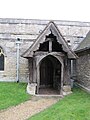
 Porch on the church - geograph.org.uk - 1561394.jpg 426 × 640; 90 KB
-
 St Michael, Begbroke, Oxon - Porch - geograph.org.uk - 1633231.jpg 424 × 640; 73 KB
-
 Cottage on the High Street - geograph.org.uk - 1615303.jpg 640 × 427; 71 KB
-

-

-
 Berrick StHelen Braces&Trusses.jpg 2,000 × 3,000; 2.74 MB
-
 Berrick StHelen porch.jpg 2,000 × 3,000; 2.88 MB
-
 Berrick StHelen southwest.jpg 2,910 × 1,940; 2.17 MB
-
 Berrick StHelen TieBeams&Trusses1.jpg 2,975 × 1,785; 2.89 MB
-
 Berrick StHelen WestEnd.jpg 2,000 × 3,000; 3.17 MB
-
 Berrick StHelen WestGallery.jpg 2,955 × 1,970; 3.15 MB
-
 The King's Arms Hotel - Bicester - geograph.org.uk - 1032131.jpg 640 × 480; 60 KB
-
 Lawrence's Farm, Bix - geograph.org.uk - 1067364.jpg 640 × 480; 108 KB
-
 The Barn at Bix Manor - geograph.org.uk - 87241.jpg 640 × 481; 53 KB
-
 Bix Common - geograph.org.uk - 626621.jpg 640 × 480; 159 KB
-
 Cottage in the trees - geograph.org.uk - 1364100.jpg 640 × 426; 122 KB
-
 Bridge support - geograph.org.uk - 1629140.jpg 640 × 427; 87 KB
-
 Glebe Farm (geograph 3444823).jpg 640 × 427; 227 KB
-
 Brightwell RedLion.JPG 2,700 × 1,620; 469 KB
-
 Cottage on the street - geograph.org.uk - 1671507.jpg 1,024 × 683; 137 KB
-
 Cottage with the pheasants - geograph.org.uk - 1671522.jpg 1,024 × 683; 161 KB
-
 Thatched cottage in Brightwell 1 - geograph.org.uk - 921108.jpg 640 × 480; 91 KB
-
 Thatched cottage in Brightwell 2 - geograph.org.uk - 921115.jpg 640 × 480; 104 KB
-
 Thatched cottage on Church Lane - geograph.org.uk - 1671342.jpg 1,024 × 683; 98 KB
-
 Brightwell-cum-Sotwell pub.jpg 640 × 480; 63 KB
-
 Burford, High Street facades - geograph.org.uk - 1297362.jpg 640 × 427; 396 KB
-
 Chalgrove TheGreen 1–2.jpg 1,280 × 720; 507 KB
-
 Childrey village pond - geograph.org.uk - 1237197.jpg 640 × 427; 104 KB
-
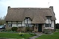
 Chinnor Oxon Thatched Cottages.JPG 2,739 × 1,704; 2.12 MB
-
 KnightonFarm barn.jpg 1,024 × 614; 315 KB
-
 ComptonBeauchamp StSwithun NW.jpg 1,024 × 512; 231 KB
-
 Coscote Manor - geograph.org.uk - 1288933.jpg 640 × 427; 45 KB
-
 Coscote Manor from "Quiet roads and sleepy villages" (1913) (14580254298).jpg 882 × 1,044; 214 KB
-
 Coscote Manor.jpg 640 × 480; 154 KB
-
 Cottage by the barn - geograph.org.uk - 1725808.jpg 1,024 × 683; 159 KB
-
 Cottages, Crowmarsh Gifford - geograph.org.uk - 72604.jpg 640 × 480; 89 KB
-
 Sitting on Mushrooms - geograph.org.uk - 1180622.jpg 640 × 426; 76 KB
-
 All Saints' church, Didcot - geograph.org.uk - 64064.jpg 640 × 480; 79 KB
-
 Didcot AllSaints ESE.jpg 1,280 × 715; 495 KB
-
 Didcot AllSaints SSE.jpg 1,280 × 720; 604 KB
-
 Cottage garden, East Hagbourne - geograph.org.uk - 1779350.jpg 3,008 × 2,000; 2.44 MB
-
 Looking in the porch - geograph.org.uk - 1691919.jpg 533 × 800; 97 KB
-
 Thatched house in East Hagbourne - geograph.org.uk - 1723703.jpg 640 × 480; 60 KB
-
 The cottages and the village life of rural England (1912) (14777415694).jpg 1,968 × 1,472; 507 KB
-
 Towards the second cross - geograph.org.uk - 1690090.jpg 533 × 800; 81 KB
-
 Upper Cross East Hagbourne.jpg 400 × 231; 37 KB
-
 Village cross East Hagbourne.JPG 2,304 × 3,072; 1.33 MB
-
 East Hagbourne - geograph.org.uk - 78669.jpg 640 × 481; 54 KB
-
 East Hagbourne Main Road - geograph.org.uk - 78671.jpg 640 × 481; 56 KB
-
 Champs Chapel Museum in East Hendred - geograph.org.uk - 1308806.jpg 640 × 427; 65 KB
-
 Converted Chapel in East Hendred - geograph.org.uk - 1308805.jpg 640 × 427; 84 KB
-
 Godfreys Farm - geograph.org.uk - 1639788.jpg 640 × 480; 104 KB
-
 High Street, East Hendred - geograph.org.uk - 1308808.jpg 640 × 427; 81 KB
-
 Jesus Chapel, East Hendred - geograph.org.uk - 1547779.jpg 640 × 440; 107 KB
-
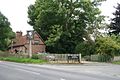
 Newbury Road on way to Ridgeway - geograph.org.uk - 1274890.jpg 640 × 480; 97 KB
-
 The Plough East Hendred Stevage.jpeg 2,359 × 1,564; 1.38 MB
-
 The Wheatsheaf in East Hendred - geograph.org.uk - 1308802.jpg 640 × 427; 73 KB
-
 Village shop, East Hendred - geograph.org.uk - 14444.jpg 640 × 480; 142 KB
-
 East Hendred (39170156374).jpg 897 × 720; 328 KB
-
 East Hendred (Newbury Road) - geograph.org.uk - 1440073.jpg 640 × 480; 126 KB
-
 East Hendred general store Stevage.jpeg 2,169 × 1,492; 1.36 MB
-
 East Hendred Village Pump - geograph.org.uk - 1308809.jpg 640 × 489; 74 KB
-

-
 East Hendred, Wisteria House - geograph.org.uk - 1760111.jpg 640 × 480; 81 KB
-

-
 Fire Mark over the window - geograph.org.uk - 2613569.jpg 1,024 × 775; 144 KB
-
 Coombe End Farm - geograph.org.uk - 1386432.jpg 640 × 426; 201 KB
-
 GreatBourton AllSaints and lychgate.jpg 1,280 × 719; 483 KB
-
 GreatBourton AllSaints lychgate south.jpg 1,024 × 1,280; 727 KB
-
 GreatBourton AllSaints lychgate west.jpg 1,280 × 1,214; 694 KB
-
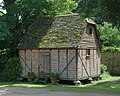
 GreatCoxwell Barn RoofCentre.jpg 1,280 × 852; 785 KB
-
 GreatCoxwell Barn RoofSection.jpg 1,280 × 852; 682 KB
-
 GreatCoxwell Barn WestPorch interior.jpg 1,280 × 847; 617 KB
-
 Gable end - geograph.org.uk - 722222.jpg 635 × 471; 202 KB
-
 Ornate barn - geograph.org.uk - 722225.jpg 639 × 479; 214 KB
-
 Local shops in Harwell - geograph.org.uk - 1315552.jpg 640 × 427; 68 KB
-
 Gravel Hill - geograph.org.uk - 1532581.jpg 640 × 480; 83 KB
-
 Henley-on-Thames HartSt 44–50.jpg 1,280 × 677; 466 KB
-
 Henley-on-Thames ReadingRd 273–281.jpg 1,280 × 1,215; 565 KB
-
 HenleyOnThames DukeSt47–49.jpg 2,850 × 1,900; 2.33 MB
-
 Henton cottage.JPG 2,240 × 1,680; 1.75 MB
-
 Henton ManorFarmCottage.JPG 2,100 × 1,400; 952 KB
-
 Sack Lift - geograph.org.uk - 1732421.jpg 853 × 1,280; 155 KB
-
 Joists in the roof - geograph.org.uk - 1578566.jpg 640 × 480; 66 KB
-
 Roof through the arch - geograph.org.uk - 1578553.jpg 640 × 480; 66 KB
-
 Looking south into Kingston Lisle - geograph.org.uk - 666974.jpg 640 × 395; 110 KB
-
 LetcombeBassett ThatchedHouse.JPG 2,790 × 1,860; 626 KB
-
 Lew Church - geograph.org.uk - 351115.jpg 640 × 448; 127 KB
-
 Project Timescape - geograph.org.uk - 1243207.jpg 640 × 427; 56 KB
-
 A Cottage in West Ginge - geograph.org.uk - 113742.jpg 640 × 481; 60 KB
-
 Old Granary - geograph.org.uk - 1670858.jpg 873 × 1,024; 319 KB
-
 Behind the gate - geograph.org.uk - 1590860.jpg 640 × 480; 93 KB
-
-
 The Dovecote.jpg 278 × 209; 9 KB
-
 Lyford StMary TowerFrame.jpg 840 × 1,280; 493 KB
-
 Old Manor Sunningwell Geograph-3632268-by-Des-Blenkinsopp.jpg 2,387 × 1,920; 1.05 MB
-
 Barn at Lilley Farm - geograph.org.uk - 856908.jpg 640 × 416; 97 KB
-
 MarshBaldon cottage.JPG 2,750 × 1,650; 1.43 MB
-
 MarshBaldon cottages.JPG 3,000 × 1,800; 1.81 MB
-
 MarshBaldon Gateways.JPG 3,000 × 2,000; 2.52 MB
-

-
 Beetle and wedge - geograph.org.uk - 958396.jpg 640 × 426; 89 KB
-
 Cottage by the Rec - geograph.org.uk - 959471.jpg 640 × 426; 52 KB
-
 Cottage by the Street - geograph.org.uk - 958360.jpg 640 × 426; 66 KB
-
 Cottage in the mirror - geograph.org.uk - 959466.jpg 640 × 426; 50 KB
-
 Ferry Cottage - geograph.org.uk - 1312935.jpg 640 × 426; 70 KB
-
 Looking up Ferry lane - geograph.org.uk - 1315575.jpg 640 × 426; 63 KB
-
 Netherton DrewettsCottage.JPG 2,940 × 1,960; 2.11 MB
-
 Roof in the chapel - geograph.org.uk - 1655235.jpg 480 × 640; 89 KB
-
 Village House - geograph.org.uk - 921631.jpg 640 × 480; 106 KB
-

-
 Northmoor RectoryFarm granary.JPG 2,350 × 1,880; 2.03 MB
-
 Northmoor StDenys NaveSouth.jpg 3,000 × 2,000; 2.96 MB
-
 Northmoor StDenys south 30612.jpg 3,000 × 2,000; 2.79 MB
-
 NorthMoreton MoretonCottage.jpg 1,024 × 683; 440 KB
-
 NorthMoreton VictoriaCottage.jpg 1,024 × 683; 453 KB
-
 Lych gate to the cemetery - geograph.org.uk - 1380878.jpg 450 × 600; 47 KB
-
 Greyfriars, Oxford.JPG 4,000 × 3,000; 2.8 MB
-

-
 Turf Tavern in Oxford, England.jpg 4,000 × 3,000; 2.34 MB
-
 35 Holywell Street, Oxford.JPG 3,000 × 4,000; 2.7 MB
-
 Pembroke Street - geograph.org.uk - 792561.jpg 640 × 509; 111 KB
-
 Piddington ChurchCottage.JPG 3,000 × 2,000; 2.22 MB
-
 Outbuilding, The Crown, Pishill - geograph.org.uk - 755085.jpg 480 × 640; 182 KB
-
 The B480, Pishill - geograph.org.uk - 755084.jpg 640 × 480; 138 KB
-
 Advanced dereliction at Grey's Green - geograph.org.uk - 556652.jpg 640 × 477; 137 KB
-
 ShiltonBarn drawings.tif 2,450 × 1,890; 3.52 MB
-
 Ferry Lane - geograph.org.uk - 1325090.jpg 640 × 426; 58 KB
-
 Plough cottage - geograph.org.uk - 1325049.jpg 640 × 426; 69 KB
-
 School Lane, Stadhampton - geograph.org.uk - 1734177.jpg 1,600 × 1,202; 345 KB
-
 The Cherry Tree in Steventon - geograph.org.uk - 1256439.jpg 640 × 427; 62 KB
-
 Steventon - geograph.org.uk - 14192.jpg 600 × 617; 70 KB
-
 Steventon Cottage Geograph-2613312-by-Bill-Nicholls.jpg 1,024 × 683; 159 KB
-
 Causeway Steventon Geograph-3071496-by-Des-Blenkinsopp.jpg 2,048 × 1,536; 890 KB
-
 Cruck Cottage, The Causeway - geograph.org.uk - 159923.jpg 640 × 480; 106 KB
-
 Scot's Farm - geograph.org.uk - 1005666.jpg 640 × 427; 172 KB
-
 Sunningwell 43–45 SE.jpg 1,280 × 881; 647 KB
-
 SuttonCourtenay HighSt 76.jpg 1,280 × 1,256; 842 KB
-
 Barn at Manor Farm, Sydenham - geograph.org.uk - 39197.jpg 640 × 480; 122 KB
-
 Sydenham 1&2.jpg 3,000 × 1,800; 2.48 MB
-
 Sydenham ForgeCottage&BarnEndCottage.jpg 3,000 × 1,500; 1.81 MB
-
 Sydenham RydersFarmBarn.jpg 3,000 × 2,000; 2.37 MB
-
 Sydenham TheForge.jpg 3,000 × 1,800; 1.66 MB
-
 Mangers - geograph.org.uk - 325191.jpg 640 × 480; 120 KB
-
 Bell Lane From Oxford Road - geograph.org.uk - 1449233.jpg 640 × 480; 191 KB
-
 Historic Building in Thame, Oxfordshire - geograph.org.uk - 7244.jpg 640 × 480; 362 KB
-
 Inside Jordans Courtyard - geograph.org.uk - 247576.jpg 480 × 640; 88 KB
-
 Jordans Courtyard Gateway, Thame - geograph.org.uk - 247572.jpg 482 × 640; 83 KB
-
 Thatched Cottage, High Street - geograph.org.uk - 832983.jpg 640 × 480; 95 KB
-
 The best one yet - geograph.org.uk - 2613631.jpg 1,024 × 756; 131 KB
-
 The Plough, West Hanney - geograph.org.uk - 770965.jpg 640 × 579; 113 KB
-
 The Plough, West Hanney.jpg 586 × 548; 109 KB
-
 Tithe Barn by St Mary the Virgin - geograph.org.uk - 353715.jpg 640 × 480; 105 KB
-
 Tudor Cottage, Henley-on-Thames.jpg 3,456 × 2,304; 2.79 MB
-
 Tudor House Steventon Geograph-2613566-by-Bill-Nicholls.jpg 426 × 320; 36 KB
-
 Barn by the corner - geograph.org.uk - 934815.jpg 640 × 426; 99 KB
-
 Cottage on the corner - geograph.org.uk - 934477.jpg 640 × 426; 91 KB
-
 Cottage on the corner - geograph.org.uk - 934479.jpg 426 × 640; 80 KB
-
-

-
 Waterperry Church - geograph.org.uk - 719593.jpg 640 × 425; 80 KB
-
 Waterperry StMaryV AisleS Roof.jpg 1,940 × 2,910; 1.53 MB
-
 Waterperry StMaryV AisleS RoofE.jpg 3,000 × 2,000; 2.51 MB
-
 Waterperry StMaryV NaveRoof.jpg 3,008 × 2,000; 2.46 MB
-
 Waterperry StMaryV NaveWest.jpg 2,000 × 3,000; 2.07 MB
-
 Waterperry StMaryV TowerCeiling.jpg 3,008 × 2,000; 2.68 MB
-
 St. Leonard church, West Challow - geograph.org.uk - 82293.jpg 640 × 480; 102 KB
-
 Green Thatch Cottage - geograph.org.uk - 78666.jpg 640 × 481; 65 KB
-
 Main Street in West Hagbourne - geograph.org.uk - 1288944.jpg 640 × 427; 86 KB
-

-
 Thatched Cottage in West Hagbourne - geograph.org.uk - 1288963.jpg 640 × 427; 92 KB
-
 West Hagbourne - geograph.org.uk - 1288950.jpg 640 × 427; 69 KB
-
 White Cottage, Didcot - geograph-4311294-by-Jaggery.jpg 800 × 551; 117 KB
-
 Street in Woolstone - geograph.org.uk - 26032.jpg 640 × 480; 169 KB
-
 Waterfall Cottage, Woolstone - geograph.org.uk - 26033.jpg 640 × 480; 163 KB


.jpg)


_(14580254298).jpg)


_(14777415694).jpg)


.jpg)
_-_geograph.org.uk_-_1440073.jpg)


