Category:Ticehurst
Jump to navigation
Jump to search
village and civil parish in East Sussex, UK  | |||||
| Upload media | |||||
| Instance of | |||||
|---|---|---|---|---|---|
| Location | Rother, East Sussex, South East England, England | ||||
| Area |
| ||||
| official website | |||||
 | |||||
English: Ticehurst is both a village and one of the villages which comprise a large civil parish in the Rother district of East Sussex, England. The parish lies in the upper reaches of both the River Teise before it enters Bewl Water and in the upper reaches of the River Rother flowing to the south-east. The parish includes the Parish wards of Ticehurst, Flimwell and Stonegate.
Subcategories
This category has the following 12 subcategories, out of 12 total.
B
- The Bell, Ticehurst (5 F)
- Bewl Water (128 F)
C
- Chequers, Ticehurst (4 F)
F
O
- Oasts in Ticehurst (86 F)
P
- Pashley Manor, Ticehurst (15 F)
S
T
- Ticehurst Methodist Chapel (7 F)
Media in category "Ticehurst"
The following 200 files are in this category, out of 1,246 total.
(previous page) (next page)-
 "Daffodils" at Pashley Manor - geograph.org.uk - 4948846.jpg 640 × 480; 427 KB
-
 "Demoiselle Crane", Pashley Manor - geograph.org.uk - 4948865.jpg 640 × 480; 331 KB
-
 "Dragonfly" at Pashley Manor - geograph.org.uk - 4948836.jpg 480 × 640; 316 KB
-
 "Family" at Pashley Manor - geograph.org.uk - 4948841.jpg 480 × 640; 355 KB
-
 "Jurassic Park" Red Route trail, Bedgebury Forest - geograph.org.uk - 5076845.jpg 4,000 × 3,000; 4.53 MB
-
 "Show of Hands" Red Route trail, Bedgebury Forest - geograph.org.uk - 5076844.jpg 3,000 × 4,000; 3.77 MB
-
 "Stag" and "Doe" at Pashley Manor - geograph.org.uk - 4948849.jpg 640 × 480; 338 KB
-
 "Tulips" at Pashley Manor - geograph.org.uk - 4948871.jpg 640 × 480; 406 KB
-
 'Country Furniture Barns', Flimwell - geograph.org.uk - 3636219.jpg 1,600 × 1,200; 275 KB
-

-
 A line of Poplars - geograph.org.uk - 2197550.jpg 640 × 430; 178 KB
-
 A line of trees along the fence - geograph.org.uk - 2957697.jpg 640 × 430; 101 KB
-
 A linear woodland - geograph.org.uk - 3752515.jpg 640 × 430; 68 KB
-
 A shelterbelt - geograph.org.uk - 2947238.jpg 640 × 430; 85 KB
-
 A small wood near Broomden - geograph.org.uk - 2941163.jpg 640 × 430; 89 KB
-
 A sunken lane - geograph.org.uk - 2934627.jpg 640 × 430; 131 KB
-
 A wet day at Bewl Water - geograph.org.uk - 5915546.jpg 3,544 × 2,659; 879 KB
-
 A21 - pedestrians crossing ahead - geograph.org.uk - 3094151.jpg 640 × 428; 112 KB
-
 A21 - queues likely - geograph.org.uk - 3094177.jpg 640 × 428; 111 KB
-
 A21 and The Royal Oak - geograph.org.uk - 4750332.jpg 640 × 426; 81 KB
-
 A21 approaching Cedar Farm - geograph.org.uk - 3094135.jpg 640 × 428; 86 KB
-
 A21 at Swiftsden - geograph.org.uk - 333953.jpg 640 × 480; 83 KB
-
 A21 near Cedar Farm - geograph.org.uk - 4755652.jpg 640 × 528; 91 KB
-
 A21 north towards London - geograph.org.uk - 333955.jpg 640 × 480; 93 KB
-
 A21 to Flimwell - geograph.org.uk - 2411460.jpg 3,072 × 2,304; 2.28 MB
-
 A21, Flimwell - geograph.org.uk - 4272186.jpg 640 × 472; 90 KB
-
 A21, northbound - geograph.org.uk - 6018674.jpg 1,024 × 747; 208 KB
-
 A21, northwards - geograph.org.uk - 2204270.jpg 640 × 430; 151 KB
-
 A21, southbound - geograph.org.uk - 4750334.jpg 640 × 426; 89 KB
-
 A21, southbound - geograph.org.uk - 4750336.jpg 640 × 426; 92 KB
-
 A21, southbound - geograph.org.uk - 4755383.jpg 640 × 426; 92 KB
-
 A21, southwards - geograph.org.uk - 2204277.jpg 640 × 430; 167 KB
-
 A268 approaches crossroads with A21 - geograph.org.uk - 2989853.jpg 3,558 × 2,631; 1.3 MB
-
 A268 Hawkhurst Road - geograph.org.uk - 5787909.jpg 1,024 × 684; 330 KB
-
 A268 junction with A21 - geograph.org.uk - 2597223.jpg 3,414 × 2,361; 1.15 MB
-
 A268 north of Seacox Heath - geograph.org.uk - 2989839.jpg 3,497 × 2,552; 1.75 MB
-
 A268, east of Flimwell - geograph.org.uk - 3769818.jpg 640 × 430; 80 KB
-
 A268, westbound - geograph.org.uk - 4272118.jpg 640 × 546; 78 KB
-
 Access lane to London Barn Farm - geograph.org.uk - 2222798.jpg 2,304 × 3,072; 3.06 MB
-
 Access road to Hazelhurst Farm - geograph.org.uk - 3664610.jpg 4,288 × 3,216; 3.97 MB
-
 Access road to Quedley Farm - geograph.org.uk - 1818260.jpg 3,072 × 2,304; 2.05 MB
-
 Acres Rise becomes Springfield - geograph.org.uk - 3664517.jpg 4,288 × 3,216; 6.24 MB
-
 Acres Rise, Ticehurst - geograph.org.uk - 4842665.jpg 3,264 × 2,448; 1.67 MB
-
 Acres Rise, Ticehurst - geograph.org.uk - 4842668.jpg 3,264 × 2,448; 1.63 MB
-
 Adapted Stile Nr. Newbridge Wood - geograph.org.uk - 3722153.jpg 800 × 600; 824 KB
-
 An orchard - geograph.org.uk - 2947243.jpg 640 × 430; 92 KB
-
 Apple orchard, Chesson's Farm - geograph.org.uk - 3667790.jpg 4,288 × 3,216; 5.3 MB
-
 Apple orchard, Chesson's Farm - geograph.org.uk - 3667795.jpg 4,288 × 3,216; 4.97 MB
-
 Approaching Little Whiligh - geograph.org.uk - 2928296.jpg 640 × 430; 90 KB
-
 Apricot orchard - geograph.org.uk - 4588672.jpg 1,024 × 768; 343 KB
-
 Apsley Court, Ticehurst - geograph.org.uk - 5561497.jpg 3,814 × 3,566; 4.02 MB
-
 Arrival at Ticehurst - geograph.org.uk - 2892164.jpg 3,872 × 2,592; 4.75 MB
-
 Autumn colours, Chingley Wood - geograph.org.uk - 2196654.jpg 640 × 430; 213 KB
-
 Autumn colours, Long Wood - geograph.org.uk - 2924530.jpg 640 × 430; 140 KB
-
 Autumn, Rosa Solis Wood - geograph.org.uk - 2204035.jpg 640 × 430; 127 KB
-
 Autumnal colours, Ketley Wood - geograph.org.uk - 2203819.jpg 640 × 430; 203 KB
-
 B2087 is Lower Platts - geograph.org.uk - 2597249.jpg 3,647 × 2,420; 1.19 MB
-
 B2087 Lower Platts - geograph.org.uk - 2356150.jpg 640 × 480; 84 KB
-
 B2087, Flimwell - geograph.org.uk - 5960379.jpg 1,024 × 681; 178 KB
-
 B2087, Flimwell - geograph.org.uk - 5964897.jpg 1,024 × 681; 156 KB
-
 B2087, Flimwell - geograph.org.uk - 6018676.jpg 1,024 × 681; 164 KB
-
 B2087, Union Street - geograph.org.uk - 2203947.jpg 640 × 430; 117 KB
-
 B2099 - geograph.org.uk - 2950056.jpg 640 × 430; 71 KB
-
 B2099 approaches junction with Burnt Lodge Lane - geograph.org.uk - 2990238.jpg 3,315 × 2,412; 1.66 MB
-
 B2099 east of Ticehurst - geograph.org.uk - 333967.jpg 640 × 480; 161 KB
-
 B2099 in autumn, near Pashley Manor - geograph.org.uk - 2635296.jpg 2,256 × 1,496; 913 KB
-
 B2099 junction of High Street and Church Street - geograph.org.uk - 2990214.jpg 3,648 × 2,736; 2.67 MB
-
 B2099 junction with Stonegate Road - geograph.org.uk - 2990278.jpg 3,320 × 2,308; 1.85 MB
-
 B2099 near Wallcrouch - geograph.org.uk - 2727103.jpg 2,272 × 1,704; 1.05 MB
-
 B2099 south of Alder Wood - geograph.org.uk - 2990260.jpg 3,527 × 2,659; 1.48 MB
-
 B2099 south of Little Boarzall - geograph.org.uk - 2597276.jpg 3,648 × 2,356; 1.5 MB
-
 B2099 to Hurst Green - geograph.org.uk - 3068405.jpg 640 × 427; 125 KB
-
 B2099 towards Ticehurst - geograph.org.uk - 3088085.jpg 640 × 480; 182 KB
-
 B2099 west of Ticehurst - geograph.org.uk - 2951930.jpg 640 × 430; 69 KB
-
 B2099, Ticehurst - geograph.org.uk - 4052938.jpg 640 × 430; 54 KB
-
 Bales in the Rother Valley - geograph.org.uk - 4189801.jpg 640 × 430; 56 KB
-
 Bales, Witherenden Farm - geograph.org.uk - 2939775.jpg 640 × 430; 69 KB
-
 Bardown Road - geograph.org.uk - 3807594.jpg 640 × 480; 146 KB
-
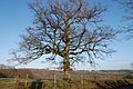 Bare tree - geograph.org.uk - 2830696.jpg 2,256 × 1,496; 917 KB
-
 Barn at Cottenden Farm - geograph.org.uk - 5112659.jpg 3,468 × 2,316; 1.4 MB
-
 Barn at Little Whiligh - geograph.org.uk - 2928316.jpg 640 × 430; 83 KB
-
 Barn by Broomden Oast - geograph.org.uk - 2947330.jpg 640 × 430; 88 KB
-
 Barn by the A21 - geograph.org.uk - 2204593.jpg 640 × 430; 154 KB
-
 Barn Cottage - geograph.org.uk - 2972394.jpg 640 × 430; 63 KB
-
 Barn, Cottenden Farm - geograph.org.uk - 2969821.jpg 640 × 430; 49 KB
-
 Barn, New House Farm - geograph.org.uk - 2969833.jpg 640 × 379; 48 KB
-
 Barn, Quedley Farm - geograph.org.uk - 2203999.jpg 640 × 430; 119 KB
-
 Barn, Wallcrouch Farm - geograph.org.uk - 2951964.jpg 640 × 430; 79 KB
-
 Barn, Wedd's Farm - geograph.org.uk - 2961105.jpg 640 × 430; 75 KB
-
 Barns at Ballards Wood - geograph.org.uk - 4481571.jpg 3,516 × 2,344; 3.31 MB
-
 Barns by Burnt Lodge Lane - geograph.org.uk - 4435374.jpg 2,000 × 954; 744 KB
-
 Bedgebury Bluebells - geograph.org.uk - 797012.jpg 640 × 480; 97 KB
-
 Beechwood - geograph.org.uk - 333264.jpg 480 × 640; 153 KB
-
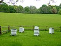 Beehives at Pashley Manor - geograph.org.uk - 4948839.jpg 640 × 480; 287 KB
-
 Bend in Battenhurst Rd. - geograph.org.uk - 1105757.jpg 640 × 430; 77 KB
-
 Bend in the A21 - geograph.org.uk - 2217202.jpg 640 × 430; 169 KB
-

-
 Berner's Hill, with cyclist - geograph.org.uk - 5789612.jpg 1,024 × 684; 298 KB
-
 Berners Hill, Flimwell - geograph.org.uk - 4842888.jpg 3,264 × 2,448; 2.25 MB
-
 Berners Hill, Flimwell - geograph.org.uk - 4842903.jpg 3,264 × 2,448; 2.01 MB
-
 Bewl Bridge Close, Flimwell - geograph.org.uk - 4842911.jpg 3,264 × 2,448; 1.89 MB
-
 Bewl Bridge Lane - geograph.org.uk - 1815144.jpg 3,072 × 2,304; 2.77 MB
-
 Bewl Reservoir by Newbarn Farm - geograph.org.uk - 5731087.jpg 5,184 × 3,456; 4.05 MB
-
 Bewl Water - geograph.org.uk - 3642399.jpg 3,696 × 2,448; 2.18 MB
-
 Bewl Water - geograph.org.uk - 3794141.jpg 8,371 × 3,414; 7.84 MB
-
 Bewl Water - geograph.org.uk - 4343141.jpg 640 × 476; 48 KB
-
 Bewl Water - geograph.org.uk - 4343149.jpg 640 × 480; 46 KB
-
 Bewl Water - geograph.org.uk - 4343152.jpg 640 × 479; 49 KB
-
 Bewl Water - geograph.org.uk - 4343187.jpg 640 × 480; 55 KB
-
 Bewl Water - geograph.org.uk - 5561510.jpg 4,896 × 3,672; 6.15 MB
-
 Bewl Water - geograph.org.uk - 5915544.jpg 3,716 × 2,787; 1.03 MB
-
 Bewl Water - Ketley Pond - geograph.org.uk - 5787939.jpg 1,024 × 684; 211 KB
-
 Bewl Water dam - geograph.org.uk - 3599191.jpg 2,560 × 1,920; 1.8 MB
-
 Bewl Water Dam - geograph.org.uk - 3642388.jpg 3,696 × 2,448; 2.22 MB
-
 Bewl Water Dam - geograph.org.uk - 4172731.jpg 640 × 427; 62 KB
-
 Bewl Water Dam - geograph.org.uk - 4435275.jpg 3,648 × 2,736; 1.98 MB
-
 Bewl Water dam - geograph.org.uk - 4435343.jpg 3,570 × 2,380; 1.26 MB
-
 Bewl Water Nature Reserve - geograph.org.uk - 5915541.jpg 3,224 × 2,418; 2.31 MB
-
 Bewl Water near New Barn Farm - geograph.org.uk - 5922695.jpg 4,000 × 3,000; 4.23 MB
-
 Bewl Water Panorama - geograph.org.uk - 3642653.jpg 12,455 × 2,198; 4.86 MB
-
 Bewl Water Reservoir - geograph.org.uk - 3667850.jpg 4,288 × 3,216; 5.6 MB
-
 Bewl Water Reservoir - geograph.org.uk - 3668092.jpg 4,288 × 3,216; 6.22 MB
-
 Bewl Water Reservoir - geograph.org.uk - 3670046.jpg 4,288 × 3,216; 5.25 MB
-
 Bewl Water Reservoir - geograph.org.uk - 3670054.jpg 4,288 × 3,216; 5.45 MB
-
 Bewl Water Reservoir - geograph.org.uk - 4488984.jpg 2,706 × 2,706; 1.79 MB
-
 Bewl Water Reservoir and Combewell Wood - geograph.org.uk - 3670087.jpg 4,288 × 3,216; 5.59 MB
-
 Bewl Water Reservoir and Greenwoods Wood - geograph.org.uk - 3672804.jpg 4,288 × 3,216; 6.09 MB
-
 Bewl Water Reservoir near New Barns Farm - geograph.org.uk - 4481524.jpg 4,000 × 3,000; 4.55 MB
-
 Beyond the Dam - geograph.org.uk - 3642391.jpg 3,696 × 2,448; 2.25 MB
-
 Birchett's Green Farm - geograph.org.uk - 2934633.jpg 640 × 430; 75 KB
-
 Birchett's Green Lane - geograph.org.uk - 2937584.jpg 640 × 430; 133 KB
-
 Birchett's Green Lane - geograph.org.uk - 2937598.jpg 640 × 430; 117 KB
-
 Birchett's Green Lane - geograph.org.uk - 2937612.jpg 640 × 430; 94 KB
-
 Birchett's Green Lane - geograph.org.uk - 2937614.jpg 640 × 430; 116 KB
-
 Birchett's Green Lane - geograph.org.uk - 2937623.jpg 640 × 430; 115 KB
-
 Birchett's Green Lane - geograph.org.uk - 2937634.jpg 640 × 430; 73 KB
-
 Birchett's Green Lane - geograph.org.uk - 2941160.jpg 640 × 430; 54 KB
-
 Birchett's Green Lane - geograph.org.uk - 5915531.jpg 4,000 × 3,000; 4.75 MB
-
 Birchett's Green Lane - geograph.org.uk - 5915538.jpg 3,249 × 2,437; 1.96 MB
-
 Birchett's Green Lane - geograph.org.uk - 5915539.jpg 3,812 × 2,859; 2.45 MB
-
 Birchett's Green Rd - geograph.org.uk - 2934614.jpg 640 × 430; 56 KB
-
 Birchett's Green Rd - geograph.org.uk - 2934615.jpg 640 × 430; 65 KB
-
 Birchett's Green Rd - geograph.org.uk - 2934619.jpg 640 × 430; 74 KB
-
 Birchett's Green Rd - geograph.org.uk - 2934623.jpg 640 × 430; 97 KB
-
 Birchett's Green Rd - geograph.org.uk - 2934626.jpg 640 × 430; 106 KB
-
 Birchett's Green Rd - geograph.org.uk - 2950010.jpg 640 × 430; 86 KB
-
 Birchett's Green Road - geograph.org.uk - 2356143.jpg 640 × 480; 155 KB
-
 Birchetts Green Lane - geograph.org.uk - 3667432.jpg 4,288 × 3,216; 7.24 MB
-
 Blenheim Way, Flimwell - geograph.org.uk - 4842942.jpg 3,264 × 2,448; 1.63 MB
-
 Bluebells in Woodland - geograph.org.uk - 190410.jpg 427 × 640; 145 KB
-
 Boarder's Bridge - geograph.org.uk - 2944898.jpg 640 × 430; 109 KB
-
 Boarders Lane - geograph.org.uk - 2941240.jpg 640 × 430; 94 KB
-
 Boarders Lane - geograph.org.uk - 2941242.jpg 640 × 430; 120 KB
-
 Boarders Lane - geograph.org.uk - 2944899.jpg 640 × 430; 115 KB
-
 Boarders Lane - geograph.org.uk - 2944904.jpg 640 × 430; 106 KB
-
 Boarders Lane - geograph.org.uk - 2944905.jpg 640 × 430; 94 KB
-
 Bobby's Wood sign - geograph.org.uk - 4292775.jpg 1,024 × 683; 185 KB
-
 Borders Farm - geograph.org.uk - 2944901.jpg 640 × 430; 96 KB
-
 Bracken beneath conifers, Ketley Wood - geograph.org.uk - 2203884.jpg 640 × 430; 195 KB
-
 Bracken, Ketley Wood - geograph.org.uk - 2203835.jpg 640 × 430; 205 KB
-
 Bramdean Cottage - geograph.org.uk - 2988366.jpg 640 × 430; 67 KB
-
 Brick Kiln Cottage - geograph.org.uk - 2218175.jpg 640 × 338; 55 KB
-
 Brick Kiln Cottage, Ticehurst - geograph.org.uk - 2218178.jpg 640 × 430; 98 KB
-
 Bridge to the island, Pashley Manor - geograph.org.uk - 4948859.jpg 640 × 480; 398 KB
-

-
 Bridle gate near London Barn Farm - geograph.org.uk - 2222806.jpg 3,072 × 2,304; 2.64 MB
-
 Bridleway to Fleet Wood - geograph.org.uk - 2222807.jpg 2,304 × 3,072; 3.23 MB
-
 Bridleway to London Barn Farm - geograph.org.uk - 3070428.jpg 640 × 480; 90 KB
-
 Bridleway to Witherenden Farm - geograph.org.uk - 2939768.jpg 640 × 430; 59 KB
-
 Bridleway towards A21 - geograph.org.uk - 5076937.jpg 4,000 × 3,000; 3.66 MB
-
 Broad Oak - geograph.org.uk - 2969836.jpg 640 × 430; 61 KB
-
 Broom Hill, Flimwell - geograph.org.uk - 4842908.jpg 3,264 × 2,448; 1.7 MB
-
 Broomden - geograph.org.uk - 2947321.jpg 640 × 430; 123 KB
-
 Broomden - geograph.org.uk - 2949974.jpg 640 × 430; 113 KB
-
 Broomden Farm - geograph.org.uk - 2949976.jpg 640 × 430; 75 KB
-
 Broomden Oast in the distance - geograph.org.uk - 2941145.jpg 640 × 430; 49 KB
-
 Broomden Wood - geograph.org.uk - 2947271.jpg 640 × 430; 130 KB
-
 Broomden Wood - geograph.org.uk - 2947279.jpg 640 × 430; 136 KB
-
 Broomden Wood - geograph.org.uk - 2947288.jpg 640 × 430; 123 KB
-
 Broomden Wood - geograph.org.uk - 2947293.jpg 640 × 430; 127 KB
-
 Burnt Lodge - geograph.org.uk - 2941210.jpg 640 × 430; 110 KB
-
 Burnt Lodge Lane - geograph.org.uk - 2941200.jpg 640 × 430; 85 KB
-
 Burnt Lodge Lane - geograph.org.uk - 2941206.jpg 640 × 430; 85 KB
-
 Burnt Lodge Lane - geograph.org.uk - 2941209.jpg 640 × 430; 129 KB
-
 Burnt Lodge Lane - geograph.org.uk - 2941219.jpg 640 × 430; 81 KB
-
 Burnt Lodge Lane - geograph.org.uk - 2949984.jpg 640 × 430; 92 KB
-
 Burnt Lodge Lane - geograph.org.uk - 2950024.jpg 640 × 430; 71 KB
-
 Burnt Lodge Lane - geograph.org.uk - 2950033.jpg 640 × 430; 114 KB
-
 Burnt Lodge Lane - geograph.org.uk - 2950042.jpg 640 × 430; 99 KB
-
 Bus stop, Ticehurst - geograph.org.uk - 3636204.jpg 1,600 × 1,122; 279 KB
-
 By the Hastings Line - geograph.org.uk - 3614580.jpg 640 × 430; 73 KB
-
 Car park at Stonegate Station - geograph.org.uk - 4725125.jpg 640 × 426; 85 KB
-
 Car park, Stonegate Station - geograph.org.uk - 3614286.jpg 640 × 430; 86 KB
-
 Car park, Stonegate station - geograph.org.uk - 5722410.jpg 640 × 480; 139 KB
-
 Cars for sale - geograph.org.uk - 6031839.jpg 1,024 × 681; 149 KB
-
 Cars parked on Rosemary Lane - geograph.org.uk - 2198343.jpg 640 × 430; 39 KB
-
 Cherry Orchard - geograph.org.uk - 4588666.jpg 1,024 × 768; 308 KB
-
 Cherry orchard - geograph.org.uk - 4588670.jpg 1,024 × 768; 367 KB
-
 Chesson's Farm Barn - geograph.org.uk - 3667737.jpg 4,288 × 3,216; 4 MB
-
 Chingley Wood - geograph.org.uk - 2196607.jpg 640 × 430; 111 KB


_Reservoir_Route_in_Starve_Wood_-_geograph.org.uk_-_3672786.jpg)


