Category:Thurleigh
Jump to navigation
Jump to search
village in Bedfordshire, UK  | |||||
| Upload media | |||||
| Instance of | |||||
|---|---|---|---|---|---|
| Location | Bedford, Bedfordshire, East of England, England | ||||
 | |||||
English: Thurleigh is a village and civil parish in north Bedfordshire, England, about 6 miles (10 km) north of Bedford. It is home to the Bedford Autodrome which also houses Thurleigh Museum.
Subcategories
This category has the following 3 subcategories, out of 3 total.
Media in category "Thurleigh"
The following 103 files are in this category, out of 103 total.
-
 A view from St Peters churchyard (geograph 1832176).jpg 1,024 × 768; 168 KB
-
 Air raid shelter - geograph.org.uk - 1806909.jpg 3,648 × 2,736; 2.22 MB
-
 Backnoe End Equestrian Centre - geograph.org.uk - 3133222.jpg 640 × 480; 50 KB
-
 Backnoe End Equestrian Centre - geograph.org.uk - 3133225.jpg 640 × 480; 93 KB
-

-

-
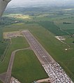 Bedford Aerodrome, aerial 2015 - geograph.org.uk - 4527584.jpg 566 × 640; 67 KB
-
 Bedford Autodrome perimeter 3 - geograph.org.uk - 1420786.jpg 640 × 480; 226 KB
-
 Bedfordshire house, Thurleigh (1) - geograph.org.uk - 1837555.jpg 1,024 × 768; 167 KB
-
 Bedfordshire house, Thurleigh (2) - geograph.org.uk - 1837559.jpg 1,024 × 768; 185 KB
-
 Bedfordshire house, Thurleigh (3) - geograph.org.uk - 1837562.jpg 1,024 × 768; 153 KB
-
 Bedfordshire house, Thurleigh (4) - geograph.org.uk - 1837572.jpg 1,024 × 768; 159 KB
-
 Beside Tilwick Wood - geograph.org.uk - 34970.jpg 640 × 480; 142 KB
-
 Bridleway - geograph.org.uk - 215087.jpg 640 × 480; 126 KB
-
 Bridleway on the Bedfordia farmland - geograph.org.uk - 227424.jpg 640 × 480; 107 KB
-
 Brook Farm, Ravensden - geograph.org.uk - 34945.jpg 640 × 480; 142 KB
-
 Byway towards Cross End - geograph.org.uk - 3133241.jpg 640 × 480; 81 KB
-
 Church End, Thurleigh - geograph.org.uk - 1420823.jpg 640 × 480; 203 KB
-
 Clear bridleway across arable land - geograph.org.uk - 1420799.jpg 640 × 480; 200 KB
-
 College Farm - geograph.org.uk - 3133238.jpg 640 × 480; 59 KB
-
 Communications Mast - geograph.org.uk - 3133228.jpg 480 × 640; 94 KB
-
 Cottage at Scald End - geograph.org.uk - 1832137.jpg 1,024 × 768; 130 KB
-
 Cross End Lane - geograph.org.uk - 3133247.jpg 640 × 480; 135 KB
-
 Cross End, Cross End - geograph.org.uk - 2291353.jpg 640 × 480; 104 KB
-
 Drive to Blackburn Hall - geograph.org.uk - 406060.jpg 640 × 480; 72 KB
-
 Ex-military infrastructure 1 - geograph.org.uk - 1420805.jpg 640 × 480; 180 KB
-
 Ex-military infrastructure 2 - geograph.org.uk - 1420812.jpg 480 × 640; 198 KB
-
 Farm implements beside the Keysoe road - geograph.org.uk - 1806929.jpg 3,648 × 2,736; 2.21 MB
-
 Farmland near Thurleigh - geograph.org.uk - 3133192.jpg 640 × 480; 74 KB
-
 Farmland near Thurleigh - geograph.org.uk - 3133193.jpg 640 × 480; 67 KB
-
 Farmland off Keysoe Road - geograph.org.uk - 3133215.jpg 640 × 480; 95 KB
-
 Farmland, College Farm - geograph.org.uk - 3133239.jpg 640 × 480; 103 KB
-
 Farmland, Manor Farm - geograph.org.uk - 3133200.jpg 640 × 480; 113 KB
-
 Festival of Britain logo, Thurleigh village sign - geograph.org.uk - 2522987.jpg 1,958 × 2,000; 2.73 MB
-
 Field entrance off Cross End Lane - geograph.org.uk - 3133244.jpg 640 × 480; 81 KB
-
 Fields near Thurleigh Windmill - geograph.org.uk - 1832147.jpg 1,024 × 768; 113 KB
-
 Footpath across a field - geograph.org.uk - 215093.jpg 640 × 469; 123 KB
-
 High Street, Thurleigh - geograph.org.uk - 1420827.jpg 640 × 480; 261 KB
-
 Keysoe Road - geograph.org.uk - 3133217.jpg 640 × 480; 64 KB
-
 Keysoe Road - geograph.org.uk - 3133235.jpg 640 × 480; 79 KB
-
 Lane near Manor Farm - geograph.org.uk - 3133201.jpg 640 × 480; 136 KB
-
 Large thatched house (geograph 1832157).jpg 1,024 × 768; 138 KB
-
 Milton Road towards Thurleigh - geograph.org.uk - 3133182.jpg 640 × 480; 65 KB
-
 Milton Road towards Thurleigh - geograph.org.uk - 3133190.jpg 640 × 480; 73 KB
-
 Milton Road towards Thurleigh - geograph.org.uk - 3133198.jpg 640 × 480; 74 KB
-
 Nameless brook at Thurleigh - geograph.org.uk - 1832186.jpg 1,024 × 768; 263 KB
-
 No entry - geograph.org.uk - 1806855.jpg 3,648 × 2,736; 2.3 MB
-
 Old Milton Road - geograph.org.uk - 3133188.jpg 640 × 480; 64 KB
-
 RAE Bedford - geograph.org.uk - 613298.jpg 640 × 443; 111 KB
-
 Robins Folly, Cross End - geograph.org.uk - 2291340.jpg 640 × 480; 103 KB
-
 Scald End Farm - geograph.org.uk - 1832140.jpg 1,024 × 768; 139 KB
-
 Thatched cottage, Thurleigh - geograph.org.uk - 3133207.jpg 640 × 480; 83 KB
-
 Thatched house at Scald End - geograph.org.uk - 1832145.jpg 1,024 × 768; 172 KB
-
 The Jackal at Thurleigh (geograph 1832164).jpg 1,024 × 768; 123 KB
-
 The Jackal at Thurleigh (geograph 1832180).jpg 1,024 × 768; 123 KB
-
 The Jackal, Church End (geograph 3133203).jpg 640 × 468; 76 KB
-
 The old village pump at Thurleigh - geograph.org.uk - 1837840.jpg 1,024 × 768; 197 KB
-
 The road from Thurleigh - geograph.org.uk - 1806817.jpg 3,648 × 2,736; 2.15 MB
-
 Thurleigh Airfield - geograph.org.uk - 1420815.jpg 640 × 480; 213 KB
-
 Thurleigh Baptist Chapel (1888) (geograph 2520723).jpg 3,008 × 2,000; 3.88 MB
-
 Thurleigh Baptist Chapel (1888) (geograph 2521465).jpg 2,000 × 2,573; 3.18 MB
-
 Thurleigh Baptist Chapel AD 1888 - geograph.org.uk - 1104329.jpg 425 × 640; 62 KB
-
 Thurleigh Village Hall - geograph.org.uk - 1837577.jpg 1,024 × 768; 195 KB
-
 Thurleigh village sign - geograph.org.uk - 2522980.jpg 3,008 × 2,000; 6.17 MB
-
 Thurleigh windmill (geograph 1806879).jpg 2,736 × 3,648; 2.18 MB
-
 Thurleigh windmill.jpg 480 × 640; 94 KB
-
 Thurleigh, St Peter - geograph.org.uk - 5472837.jpg 4,608 × 3,456; 5.39 MB
-
 Trees beside Milton Road - geograph.org.uk - 3133181.jpg 640 × 480; 75 KB
-
 Warning sign on the airfield perimeter - geograph.org.uk - 1805041.jpg 3,648 × 2,736; 2.1 MB
-
 Water Tower - geograph.org.uk - 34964.jpg 480 × 640; 85 KB
-
 Wayside Cottage - geograph.org.uk - 4755299.jpg 640 × 480; 58 KB
-
 Wheat field west of Thurleigh - geograph.org.uk - 1420820.jpg 640 × 480; 198 KB
-
 Whitwickgreen Farm - geograph.org.uk - 1420801.jpg 640 × 480; 208 KB
-
 Bedford Autodrome perimeter 1 - geograph.org.uk - 1420767.jpg 640 × 480; 244 KB
-
 Bedford Autodrome perimeter 2 - geograph.org.uk - 1420776.jpg 640 × 480; 235 KB
-
 Bedford Autodrome perimeter 4 - geograph.org.uk - 1420790.jpg 640 × 480; 221 KB
-
 Bedfordshire view - geograph.org.uk - 215096.jpg 640 × 480; 80 KB
-
 Byway to Cross End - geograph.org.uk - 473827.jpg 640 × 480; 122 KB
-
 Cereal land near Backnoe End - geograph.org.uk - 1420796.jpg 640 × 480; 206 KB
-
 Church End, Thurleigh - geograph.org.uk - 1420832.jpg 640 × 480; 232 KB
-
 Combine harvester - geograph.org.uk - 215090.jpg 640 × 480; 88 KB
-
 Countryside - geograph.org.uk - 215113.jpg 640 × 480; 106 KB
-
 Cross End - geograph.org.uk - 34975.jpg 640 × 480; 137 KB
-
 Entrance to Outfields farm - geograph.org.uk - 86987.jpg 640 × 480; 103 KB
-

-
 Farmland - geograph.org.uk - 215111.jpg 640 × 480; 113 KB
-

-
 Great and Little Woods - geograph.org.uk - 34946.jpg 640 × 480; 117 KB
-
 Harvested fields - geograph.org.uk - 215099.jpg 640 × 480; 113 KB
-
 Keysoe Road - geograph.org.uk - 385427.jpg 480 × 640; 117 KB
-
 Long View, Red Gate Farm - geograph.org.uk - 34937.jpg 640 × 480; 131 KB
-
 Manor Farm, Thurleigh - geograph.org.uk - 473824.jpg 640 × 480; 108 KB
-
 Mowsbury Hill - geograph.org.uk - 89240.jpg 640 × 480; 88 KB
-
 Outfields farm - geograph.org.uk - 87005.jpg 640 × 480; 94 KB
-
 Park End Farm House - geograph.org.uk - 34973.jpg 640 × 480; 132 KB
-
 Phone mast near Cleat Hill - geograph.org.uk - 89235.jpg 640 × 347; 45 KB
-
 Red Gate Farm - geograph.org.uk - 34940.jpg 640 × 480; 128 KB
-
 Remains of the old Brook Farm - geograph.org.uk - 34943.jpg 640 × 480; 128 KB
-
 Roads in Outfields farm - geograph.org.uk - 86999.jpg 640 × 480; 96 KB
-
 The Jackal - geograph.org.uk - 227425.jpg 640 × 480; 89 KB
-
 Thurleigh Village Hall - geograph.org.uk - 34931.jpg 640 × 480; 139 KB
-
 Tilwick Wood - geograph.org.uk - 34966.jpg 640 × 480; 132 KB
-
 View from Graze Hill - geograph.org.uk - 86980.jpg 640 × 480; 115 KB
.jpg)


_aerodrome,_disused,_aerial_-_geograph.org.uk_-_3515887.jpg)
_aerodrome,_disused,_aerial_-_geograph.org.uk_-_3515893.jpg)


_-_geograph.org.uk_-_1837555.jpg)
_-_geograph.org.uk_-_1837559.jpg)
_-_geograph.org.uk_-_1837562.jpg)
_-_geograph.org.uk_-_1837572.jpg)


.jpg)


.jpg)
.jpg)
.jpg)


_(geograph_2520723).jpg)
_(geograph_2521465).jpg)


.jpg)


