Category:Thornhill, Stirling
Jump to navigation
Jump to search
English: Thornhill is a village in the Scottish council area of Stirling. It lies 14 miles from Stirling itself, south of Callander, east of Aberfoyle and west of Doune.
Simple English: Thornhill is a village in the Scottish council area of Stirling. It lies 14 miles from Stirling itself, south of Callander, east of Aberfoyle and west of Doune.
village in Stirling, Scotland, UK  | |||||
| Upload media | |||||
| Instance of | |||||
|---|---|---|---|---|---|
| Location |
| ||||
| Population |
| ||||
 | |||||
Media in category "Thornhill, Stirling"
The following 97 files are in this category, out of 97 total.
-
 1902 - panoramio.jpg 3,296 × 2,472; 1.86 MB
-
 Ancient cairn, Craighead - geograph.org.uk - 191776.jpg 640 × 478; 132 KB
-
 At the back of the cottage - panoramio.jpg 3,488 × 2,616; 2.21 MB
-
 Baa Baa Black Sheep - geograph.org.uk - 740007.jpg 640 × 480; 33 KB
-
 Cherry Tree In Evening Sun - panoramio.jpg 1,429 × 948; 338 KB
-
 Cherry Tree in Winter - panoramio.jpg 2,000 × 3,008; 2.9 MB
-
 Cutting heather on Flanders Moss - geograph.org.uk - 99118.jpg 640 × 480; 132 KB
-
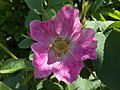 Dog rose - geograph.org.uk - 192743.jpg 640 × 478; 121 KB
-
 Doune to Thornhill Road - panoramio.jpg 2,000 × 3,008; 1.59 MB
-
 Drainage ditch on Flanders Moss - geograph.org.uk - 1154877.jpg 640 × 478; 144 KB
-
 Drainage Ditch, Flanders Moss - geograph.org.uk - 101220.jpg 640 × 480; 139 KB
-
 Entering Thornhill from the West - geograph.org.uk - 1544645.jpg 640 × 480; 74 KB
-
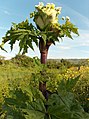 Giant hogweed - geograph.org.uk - 192725.jpg 478 × 640; 151 KB
-
 Hedges Walk Thornhill - panoramio.jpg 1,424 × 2,144; 596 KB
-
 High Moss Pow, mid-reaches, Flanders Moss - geograph.org.uk - 101230.jpg 640 × 480; 107 KB
-
 Lochan on Flanders Moss - geograph.org.uk - 99117.jpg 640 × 480; 129 KB
-
 Lodge Blairhoyle, Thornhill.jpg 478 × 640; 113 KB
-
 Main Street Thornhill - panoramio - Neil Aitkenhead.jpg 1,155 × 772; 337 KB
-
 Main Street Thornhill - panoramio.jpg 3,008 × 2,000; 2.57 MB
-
 Moss-side of Boquhapple - geograph.org.uk - 192715.jpg 640 × 478; 151 KB
-
 Norrieston Cottage back - panoramio.jpg 3,488 × 2,616; 2.13 MB
-
 Norrieston Cottage Front - panoramio.jpg 3,488 × 2,616; 2.1 MB
-
 Norrieston Farm Sign - panoramio.jpg 3,488 × 2,616; 1.86 MB
-
 Oaks On The South Common - panoramio.jpg 1,495 × 759; 521 KB
-
 Periwinkle - geograph.org.uk - 192740.jpg 478 × 640; 108 KB
-
 Rose and honey bee - geograph.org.uk - 192741.jpg 478 × 640; 119 KB
-
 Sepia Sunrise - panoramio.jpg 1,501 × 997; 573 KB
-
 Sheep grazing just west of Thornhill - geograph.org.uk - 774430.jpg 640 × 428; 49 KB
-
 Sixty One - panoramio.jpg 898 × 922; 554 KB
-
 Snow Tree - panoramio.jpg 997 × 1,501; 705 KB
-

-
 Summer Morning - Oaks And Meadow - panoramio.jpg 2,883 × 1,009; 3.31 MB
-
 Sunshine ^ Stormy Skies - panoramio.jpg 1,264 × 918; 253 KB
-
 Sweet cicely seed pods - geograph.org.uk - 192733.jpg 640 × 478; 128 KB
-
 The B822 - geograph.org.uk - 192744.jpg 478 × 640; 167 KB
-
 The Little Dog Laughed - panoramio.jpg 2,420 × 1,343; 1.33 MB
-
 There's A Cuckoo In There Somewhere - panoramio.jpg 1,493 × 992; 498 KB
-
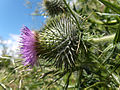 Thistle - geograph.org.uk - 192732.jpg 640 × 478; 149 KB
-
 Tipis, Thornhill - geograph.org.uk - 336830.jpg 480 × 640; 106 KB
-
 Ancient cairn, Craighead - geograph.org.uk - 370351.jpg 640 × 480; 117 KB
-
 Ashentree Farm - geograph.org.uk - 370352.jpg 640 × 480; 132 KB
-
 Barley, Forth valley - geograph.org.uk - 191768.jpg 640 × 478; 168 KB
-
 Barn, Coldoch - geograph.org.uk - 191775.jpg 640 × 478; 123 KB
-
 Ben Ledi from afar - geograph.org.uk - 201025.jpg 640 × 480; 110 KB
-
 Boghall Farm - geograph.org.uk - 191757.jpg 640 × 478; 133 KB
-
 Borland farm - geograph.org.uk - 201022.jpg 640 × 480; 67 KB
-
 Bridge of Goodie - geograph.org.uk - 191772.jpg 640 × 478; 220 KB
-
 Bridge of Goodie - geograph.org.uk - 552140.jpg 640 × 480; 103 KB
-
 Carse of McOrriston - geograph.org.uk - 191755.jpg 640 × 478; 114 KB
-
 Cloud at Burnbank - geograph.org.uk - 185317.jpg 640 × 478; 60 KB
-
 Cottages, Thornhill - geograph.org.uk - 191749.jpg 640 × 478; 130 KB
-
 Declining fertility - geograph.org.uk - 210556.jpg 640 × 480; 89 KB
-
 Farm track to Union Farm - geograph.org.uk - 201021.jpg 640 × 480; 85 KB
-
 Farmland and forest at Blair Drummond - geograph.org.uk - 183822.jpg 640 × 478; 87 KB
-
 Farmland east of Thornhill - geograph.org.uk - 192718.jpg 640 × 478; 90 KB
-
 Farmland Near Poldar Moss - geograph.org.uk - 739993.jpg 640 × 480; 42 KB
-
 Farmland south of Thornhill - geograph.org.uk - 192739.jpg 640 × 478; 158 KB
-
 Farmland, Ballinton - geograph.org.uk - 191756.jpg 640 × 478; 118 KB
-
 Farmland, Burnbank - geograph.org.uk - 183835.jpg 640 × 478; 124 KB
-
 Farmland, Causewayend - geograph.org.uk - 191777.jpg 640 × 478; 104 KB
-
 Farmland, Coldoch - geograph.org.uk - 185320.jpg 640 × 478; 113 KB
-
 Farmland, east of Thornhill - geograph.org.uk - 191752.jpg 640 × 478; 98 KB
-
 Farmland, McOrriston - geograph.org.uk - 192734.jpg 640 × 478; 140 KB
-
 Farmland, north of Thornhill - geograph.org.uk - 191750.jpg 640 × 478; 160 KB
-
 Farmland, southeast of Thornhill - geograph.org.uk - 191753.jpg 640 × 478; 132 KB
-
 Farmland, Upper Spittalton - geograph.org.uk - 191759.jpg 640 × 478; 114 KB
-
 Farmland, Wester Spittalton - geograph.org.uk - 192720.jpg 640 × 478; 105 KB
-
 Goodie Water - geograph.org.uk - 370353.jpg 640 × 480; 114 KB
-
 Goodie Water - geograph.org.uk - 552139.jpg 640 × 480; 106 KB
-
 Goodie Water - geograph.org.uk - 552141.jpg 640 × 480; 112 KB
-
 Grey Blue Grey - geograph.org.uk - 740035.jpg 640 × 480; 25 KB
-
 Hay-meadow, Coldoch - geograph.org.uk - 192729.jpg 478 × 640; 202 KB
-
 High Moss Pow - geograph.org.uk - 101205.jpg 640 × 480; 148 KB
-
 Kippen Road, Thornhill - geograph.org.uk - 739961.jpg 480 × 640; 38 KB
-
 Lennieston Muir - geograph.org.uk - 210560.jpg 640 × 480; 105 KB
-
 Looking West from Whirrieston - geograph.org.uk - 533339.jpg 640 × 476; 90 KB
-
 Main Street, Thornhill - geograph.org.uk - 192737.jpg 640 × 478; 114 KB
-
 Myme Farm - geograph.org.uk - 191762.jpg 640 × 478; 134 KB
-
 Nether Carse - geograph.org.uk - 191770.jpg 640 × 478; 102 KB
-
 Netherton Bridge - geograph.org.uk - 191760.jpg 478 × 640; 151 KB
-
 Norrieston Church, Thornhill - geograph.org.uk - 125719.jpg 640 × 480; 103 KB
-
 Norrieston Church, Thornhill - geograph.org.uk - 192736.jpg 478 × 640; 128 KB
-
 Pasture, Burnbank - geograph.org.uk - 185314.jpg 640 × 478; 92 KB
-
 River Forth - geograph.org.uk - 191766.jpg 640 × 478; 163 KB
-
 River Forth - geograph.org.uk - 191771.jpg 640 × 478; 134 KB
-
 River Forth - geograph.org.uk - 192728.jpg 640 × 478; 133 KB
-
 Round bales, Whirreston - geograph.org.uk - 210551.jpg 640 × 480; 78 KB
-
 Scarecrow near Bridge of Goodie - geograph.org.uk - 552138.jpg 640 × 480; 102 KB
-
 Sitka plantation - geograph.org.uk - 210564.jpg 480 × 640; 100 KB
-
 South Coldoch - geograph.org.uk - 184266.jpg 640 × 478; 101 KB
-
 South East from Whirrieston - geograph.org.uk - 534629.jpg 640 × 479; 57 KB
-
 South from Whirrieston - geograph.org.uk - 533340.jpg 640 × 480; 69 KB
-
 The Knowles - geograph.org.uk - 370343.jpg 640 × 480; 153 KB
-
 The Knowles - geograph.org.uk - 370344.jpg 640 × 480; 132 KB
-
 Torrie - geograph.org.uk - 210573.jpg 640 × 480; 90 KB
-
 Upper Spittalton - geograph.org.uk - 193703.jpg 640 × 478; 91 KB
-
 Wood and farmland, Poldar Moss - geograph.org.uk - 191761.jpg 640 × 478; 157 KB


