Category:Theobalduskapel (Turnhout)
Jump to navigation
Jump to search
|
This is a category about onroerend erfgoed number 85506
|
| Object location | | View all coordinates using: OpenStreetMap |
|---|
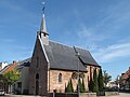
chapel in Turnhout, Belgium  | |||||
| Upload media | |||||
| Instance of | |||||
|---|---|---|---|---|---|
| Location | Turnhout, Arrondissement of Turnhout, Province of Antwerp, Flemish Region, Belgium | ||||
| Diocese | |||||
 | |||||
Media in category "Theobalduskapel (Turnhout)"
The following 6 files are in this category, out of 6 total.
-
 85506 turnhout Sint-Theobalduskapel.jpg 3,000 × 2,250; 4.7 MB
-
 Theobalduskapel 01.jpg 5,472 × 3,648; 5.64 MB
-
 Theobalduskapel 02.jpg 3,648 × 5,472; 6.06 MB
-
 Theobalduskapel 03.jpg 3,648 × 5,472; 6.18 MB
-
 Theobalduskapel.JPG 600 × 749; 469 KB
-
 Turnhout, kerk7 foto1 2010-10-03 12.50.JPG 3,126 × 2,345; 4.17 MB


