Category:The War with Mexico (books)
Jump to navigation
Jump to search
English: This category is for books, page images and cover images from "The War with Mexico" by Justin H. Smith.
Book of American History | |||||
| Upload media | |||||
| Instance of | |||||
|---|---|---|---|---|---|
| Genre | |||||
| Country of origin | |||||
| Author |
| ||||
| Publisher |
| ||||
| Language of work or name | |||||
| Publication date |
| ||||
| |||||
Subcategories
This category has only the following subcategory.
Media in category "The War with Mexico (books)"
The following 61 files are in this category, out of 61 total.
-
 Disposition of forces along the Sacramento.jpg 367 × 405; 65 KB
-
 HHBHM V2 D057 Vera Cruz to Perote.jpg 1,932 × 1,355; 294 KB
-
 The War with Mexico, Vol 1.djvu 1,160 × 1,500, 607 pages; 156.85 MB
-
 The War with Mexico, Vol 2.djvu 2,600 × 4,264, 642 pages; 20.01 MB
-
 WWM V1 D002 Library of Basil O'Connor.jpg 981 × 1,385; 396 KB
-
 WWM V1 D008 The Annexation of Texas by the same author.jpg 1,114 × 1,571; 158 KB
-
 WWM V1 D009 Title page.jpg 2,024 × 3,058; 152 KB
-
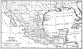 WWM V1 D028 Map of Mexico and the surrounding area.jpg 2,662 × 1,600; 759 KB
-
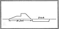
 WWM V1 D030 Profile of the route between Mexico and Vera Cruz.jpg 1,530 × 702; 63 KB
-
 WWM V1 D187 Matamoros and Fort Brown sketch map.jpg 1,572 × 1,550; 375 KB
-
 WWM V1 D190 Fort Brown outside Matamoros.jpg 1,559 × 1,042; 273 KB
-
 WWM V1 D194 Left side map of the battle of Palo Alto.jpg 1,683 × 2,637; 744 KB
-
 WWM V1 D195 Right side map of the battle of Palo Alto.jpg 1,734 × 2,651; 450 KB
-
 WWM V1 D196 Left side map of the battle of Palo Alto.jpg 1,688 × 2,654; 698 KB
-
 WWM V1 D197 Map of the battle of Palo Alto.jpg 1,968 × 1,483; 448 KB
-
 WWM V1 D204 Battle of Resaca de la Palma.jpg 1,551 × 1,371; 215 KB
-
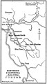
 WWM V1 D244 Map of area between Monterey and Matamoros.jpg 1,579 × 1,295; 121 KB
-
 WWM V1 D266 Battle of Monterey, general plan.jpg 1,554 × 999; 246 KB
-
 WWM V1 D274 Battle of Monterrey, detailed plan.jpg 2,529 × 1,588; 660 KB
-
 WWM V1 D305 Altamira and Tampico near the Gulf of Mexico.jpg 795 × 1,094; 104 KB
-
 WWM V1 D305 Wool's march.jpg 1,604 × 2,358; 153 KB
-
 WWM V1 D310 Map of area surrounding Tampico.jpg 795 × 1,097; 105 KB
-
 WWM V1 D321 General Kearny's march.jpg 1,595 × 2,630; 296 KB
-
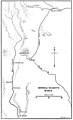
 WWM V1 D339 El Paso to Rosales.jpg 631 × 2,321; 92 KB
-
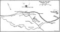
 WWM V1 D341 Battle of Sacramento.jpg 1,580 × 1,733; 416 KB
-
 WWM V1 D350 California coast.jpg 1,551 × 1,413; 215 KB
-
 WWM V1 D351 Northern California.jpg 804 × 1,415; 131 KB
-
 WWM V1 D375 Pico's and Kearny's positions near San Pascual.jpg 815 × 820; 104 KB
-
 WWM V1 D378 Battle near Los Angeles en Mexico.jpg 1,558 × 1,193; 199 KB
-
 WWM V1 D394 Map of area between Matamoros and Tampico.jpg 818 × 1,827; 111 KB
-
 WWM V1 D415 Mexico to Agua Nueva.jpg 622 × 1,680; 106 KB
-
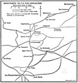 WWM V1 D416 Monterey to La Encarnacion.jpg 1,569 × 1,669; 248 KB
-
 WWM V1 D421 Battle of Buena Vista.jpg 1,587 × 1,881; 649 KB
-
 WWM V2 D007 Title page.jpg 2,468 × 3,769; 162 KB
-
 WWM V2 D018 Map of Mexico.jpg 3,290 × 1,976; 1.08 MB
-
 WWM V2 D039 San Juan de Ulua.jpg 2,000 × 1,741; 399 KB
-
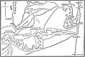
 WWM V2 D042 Siege of Vera Cruz general plan.jpg 3,269 × 1,764; 364 KB
-
 WWM V2 D046 Siege of Vera Cruz American batteries.jpg 1,958 × 1,417; 383 KB
-
 WWM V2 D058 Contour lines near Cerro Gordo.jpg 1,041 × 629; 167 KB
-
 WWM V2 D061 Battle of Cerro Gordo general plan.jpg 3,267 × 1,958; 1.07 MB
-
 WWM V2 D069 Battle of Cerro Gordo central part of the field.jpg 1,919 × 1,338; 507 KB
-
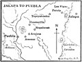 WWM V2 D079 Jalapa to Puebla.jpg 1,010 × 768; 101 KB
-
 WWM V2 D080 Vera Cruz to Mexico.jpg 820 × 3,286; 157 KB
-
 WWM V2 D098 Valley of Mexico.jpg 1,962 × 1,450; 319 KB
-
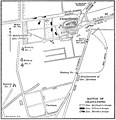
 WWM V2 D118 Battles of Aug 20, 1847 general plan.jpg 3,051 × 1,965; 699 KB
-
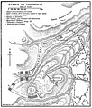 WWM V2 D125 Battle of Contreras.jpg 1,971 × 2,309; 890 KB
-
 WWM V2 D129 Battle of Churubusco.jpg 1,954 × 1,358; 288 KB
-
 WWM V2 D130 Rio de Churubusco bridgehead.jpg 1,042 × 1,004; 173 KB
-
 WWM V2 D131 Bridgehead, profile of east curtain.jpg 1,034 × 521; 28 KB
-
 WWM V2 D132 Road to Coyoacan west of the convent and church.jpg 1,003 × 693; 90 KB
-
 WWM V2 D159 Battles of Mexico city.jpg 1,972 × 3,037; 571 KB
-
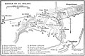 WWM V2 D161 Battle of El Molino.jpg 1,936 × 1,278; 316 KB
-
 WWM V2 D168 Battle of Chapultepec.jpg 1,957 × 2,027; 396 KB
-
 WWM V2 D169 Blindage at Chapultepec.jpg 519 × 511; 30 KB
-
 WWM V2 D177 The Citadel in 1840.jpg 574 × 997; 54 KB
-
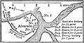 WWM V2 D216 Alvarado Mexico.jpg 1,028 × 524; 114 KB
-
 WWM V2 D223 A part of the Tabasco river.jpg 1,022 × 2,274; 375 KB
-
 WWM V2 D224 Guaymas.jpg 1,037 × 518; 82 KB
-
 WWM V2 D225 Lower California.jpg 522 × 770; 56 KB
-
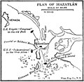 WWM V2 D225 Plan of Mazatlan.jpg 1,040 × 1,021; 163 KB
-
 WWM V2 D259 Territory acquired from Mexico.jpg 1,959 × 1,575; 603 KB


