Category:The Serpent Trail
Jump to navigation
Jump to search

English: Media related to the Serpent Trail, a 64-mile (103 km) long walking trail in Surrey and West Susex, England. It runs from Haslemere and Petersfield following a serpentine route.
| Upload media | |||||
| Instance of |
| ||||
|---|---|---|---|---|---|
| Location | Hampshire, South East England, England | ||||
| Length |
| ||||
| Terminus | |||||
 | |||||
Media in category "The Serpent Trail"
The following 46 files are in this category, out of 46 total.
-

-

-

-
 A Footpath Corner, Graffham Common - geograph.org.uk - 337943.jpg 640 × 428; 184 KB
-
 Bridleway signpost on Terwick Common - geograph.org.uk - 1292451.jpg 640 × 360; 77 KB
-
 Cattle grazing on the Serpent Trail - geograph.org.uk - 1071937.jpg 640 × 360; 99 KB
-
 Crosstracks on the Serpent Trail - geograph.org.uk - 1071932.jpg 640 × 360; 101 KB
-
 Dry feet on two trails - geograph.org.uk - 962801.jpg 360 × 640; 99 KB
-

-
-
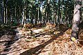
 Fairytale walk through the woods - geograph.org.uk - 1071948.jpg 640 × 360; 132 KB
-
 Field gate in Valewood Park - geograph.org.uk - 1456166.jpg 640 × 360; 98 KB
-
 Field in Valewood Park - geograph.org.uk - 1456175.jpg 640 × 360; 79 KB
-
 Finger post on Serpent Trail.JPG 1,920 × 1,280; 1.1 MB
-
 Footpath at Northpark Copse - geograph.org.uk - 1615051.jpg 640 × 360; 105 KB
-

-
 Footpath reaches byway near Liphook - geograph.org.uk - 1153621.jpg 640 × 360; 92 KB
-
 Footpath through Northpark Copse - geograph.org.uk - 1615055.jpg 640 × 360; 93 KB
-
 Footpath to Lodge Farm - geograph.org.uk - 1730061.jpg 1,600 × 1,200; 422 KB
-
 Gates on the Serpent Trail - geograph.org.uk - 1566715.jpg 640 × 360; 59 KB
-
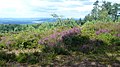
 Heather on Stedham Common - geograph.org.uk - 1071974.jpg 640 × 360; 85 KB
-

-
 Improvised hurdle by the New Lipchis Way - geograph.org.uk - 1009641.jpg 640 × 429; 134 KB
-
 Notice at Chapel Common - geograph.org.uk - 1053929.jpg 640 × 480; 125 KB
-
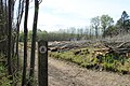 Serpent Trail at Flexham Park.JPG 1,920 × 1,280; 1.47 MB
-

-

-
 Serpent Trail path on Hesworth Common - geograph.org.uk - 1453502.jpg 640 × 480; 143 KB
-

-
 Serpent Trail, Bexleyhill Common - geograph.org.uk - 1341988.jpg 640 × 482; 194 KB
-
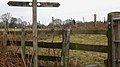
 Signpost and seat on Older Hill - geograph.org.uk - 1200863.jpg 640 × 360; 85 KB
-

-
 Signpost on Stanley Common - geograph.org.uk - 1127492.jpg 640 × 360; 98 KB
-
 Stedham Common Serpent Trail.JPG 1,280 × 960; 540 KB
-

-
 The Serpent Trail at Bexleyhill - geograph.org.uk - 1815618.jpg 800 × 600; 182 KB
-
 The Serpent Trail at Scotland farm - geograph.org.uk - 1614904.jpg 640 × 360; 62 KB
-
 The Serpent Trail near Haslemere - geograph.org.uk - 1456246.jpg 640 × 360; 42 KB
-

-

-
 Two long distance paths share a signpost - geograph.org.uk - 962793.jpg 640 × 360; 115 KB
-
 Bridleway junction on Black Down - geograph.org.uk - 1414483.jpg 640 × 360; 104 KB
-
 Bridleway junction on Black Down - geograph.org.uk - 1414487.jpg 640 × 360; 86 KB
-
 Bridleway junction on Black Down - geograph.org.uk - 1414507.jpg 640 × 360; 80 KB
-

-
 Footpath in Nyewood - geograph.org.uk - 1424563.jpg 360 × 640; 84 KB


