Category:The Juneau Gold Belt, Alaska USGS Bulletin 287, 1906
Jump to navigation
Jump to search
Media in category "The Juneau Gold Belt, Alaska USGS Bulletin 287, 1906"
The following 20 files are in this category, out of 20 total.
-
 Alaska Juneau Gold Mine Mill Gold Creek.PNG 825 × 473; 291 KB
-
 Berners Bay map.PNG 417 × 606; 41 KB
-
 Douglas geologic map.PNG 1,244 × 600; 1.75 MB
-
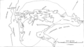
 Douglas Island gold mines.PNG 1,186 × 598; 277 KB
-
 Funter Bay map.PNG 581 × 597; 50 KB
-
 Glass Peninsula geologic map.PNG 598 × 616; 639 KB
-
 Gold Creek geologic map.PNG 1,206 × 584; 1.38 MB
-
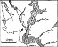
 Gold Creek map.PNG 1,078 × 611; 214 KB
-
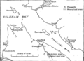 Holkham Bay.PNG 697 × 507; 37 KB
-
 Juneau geologic map.PNG 1,259 × 592; 1.75 MB
-
 Juneau Gold Belt.PNG 429 × 586; 49 KB
-
 Kootznahoo Inlet map.PNG 972 × 549; 52 KB
-
 Kowee Creek map.PNG 453 × 606; 38 KB
-
 Lemon Creek geologic map.PNG 1,257 × 597; 1.74 MB
-
 Mendenhall glacier map.PNG 712 × 573; 60 KB
-
 Port Snettisham.PNG 724 × 520; 30 KB
-
 Sheep Creek map.PNG 580 × 581; 80 KB
-
 Treadwell Mines Douglas Island.PNG 1,244 × 262; 397 KB
-
 Treadwell Mines geologic map.PNG 1,149 × 614; 1.35 MB
-
 Windham Bay.PNG 424 × 588; 35 KB


