Category:The Gate of the Pacific (1867) by PIM, Bedford Clapperton Trevelyan
Jump to navigation
Jump to search
English: The Gate of the Pacific. by PIM, Bedford Clapperton Trevelyan (1867).
| This category includes images from a book scanned for the British Library Mechanical Curator collection.
The full set of images from the book is available on Flickr. |
1863 edition of book by Bedford Clapperton Trevelyan Pim | |||||
| Upload media | |||||
| Instance of |
| ||||
|---|---|---|---|---|---|
| Author | |||||
| Place of publication |
| ||||
| Language of work or name | |||||
| Distribution format |
| ||||
| Full work available at URL | |||||
| Collection | |||||
| Publication date |
| ||||
| |||||
Media in category "The Gate of the Pacific (1867) by PIM, Bedford Clapperton Trevelyan"
The following 18 files are in this category, out of 18 total.
-
 PIMM 1867 The Gate of the Pacific.jpg 440 × 693; 150 KB
-
 Preparing for the iron road.jpg 1,327 × 2,249; 2.28 MB
-

-
 San Juan del Sur (1859).jpg 2,095 × 1,319; 1.81 MB
-
 Map of Greytown Harbour (1860).jpg 2,201 × 1,311; 1.14 MB
-
 Grey Town, the Gorgon villa (1860).jpg 2,059 × 1,382; 1.79 MB
-
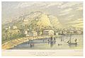
 Port of Realejo (1859).jpg 2,091 × 1,393; 1.75 MB
-
 Railroad Bridge over the Ghagres, half way across the isthmus.jpg 2,053 × 1,392; 1.76 MB
-
 Panama City, Eastern Suburb, Railway terminus on the right.jpg 2,105 × 1,441; 1.92 MB
-
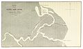 Map of the River San Juan Delta.jpg 2,203 × 1,311; 1.69 MB
-
 River San Juan, Plantation just below the Machuca Rapids.jpg 2,041 × 1,426; 1.97 MB
-
 Gorgon Bay.jpg 2,041 × 1,360; 1.58 MB
-
 Map of Port Realejo.jpg 2,291 × 1,335; 1.5 MB
-
 Map of Port Nacascolo.jpg 775 × 903; 331 KB
-
 Map of the Gorgon Bay.jpg 2,193 × 1,305; 1.03 MB
-
 Railway construction details.jpg 2,294 × 1,426; 1.98 MB
-
 Map of Great Barrier Harbour (Port Fritzroy).jpg 1,287 × 2,169; 1.37 MB
-
 Map of Central America, the new transit route.jpg 3,493 × 2,023; 2.9 MB


.jpg)
.jpg)
.jpg)
.jpg)


.jpg)