Category:The Dynasty
Jump to navigation
Jump to search
| Object location | | View all coordinates using: OpenStreetMap |
|---|
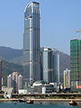
English: The Dynasty was formerly called "Vision City Phase 2". See Category:Vision City for Phase 1.
中文:御凱
 | |||||
| Upload media | |||||
| Instance of | |||||
|---|---|---|---|---|---|
| Location | Hong Kong, PRC | ||||
 | |||||
Media in category "The Dynasty"
The following 30 files are in this category, out of 30 total.
-
 2021年10月-海之戀.jpg 4,000 × 2,250; 3.82 MB
-

-
 HK Nina Tower 200803(cropped).jpg 902 × 1,600; 371 KB
-
 HK Nina Tower 200803.jpg 1,200 × 1,600; 1.75 MB
-
 HK The Dynasty.jpg 1,200 × 1,599; 1.54 MB
-
 HK TheDynasty Dec 2008.JPG 960 × 1,280; 233 KB
-
 HK Tsing Yi Bridge North.jpg 1,600 × 1,200; 1.33 MB
-
 HK Tsing Yi Promenade 青衣海濱公園 07.JPG 1,600 × 1,200; 1.14 MB
-
 HK Tsing Yi Promenade 青衣海濱公園 08.JPG 1,600 × 1,200; 1.16 MB
-
 HK Tsing Yi Promenade 青衣海濱公園 09.JPG 1,600 × 1,200; 1.14 MB
-
 HK Tsing Yi Promenade 青衣海濱公園 Banister Chinachem Nina Tower.JPG 1,600 × 1,200; 1.19 MB
-
 HK Tsing Yi Promenade.jpg 1,600 × 1,200; 1.46 MB
-
 HK Tsuen Wan View 200803.jpg 1,600 × 1,200; 1.43 MB
-
 HK TW 荃灣西站 Tsuen Wan West Station MTR exit signs October 2021 SS2 16.jpg 4,128 × 3,096; 2.93 MB
-

-

-
 HK Vision City Phase 2.jpg 1,165 × 1,554; 1.47 MB
-
 Nina Tower 200711.jpg 1,536 × 2,048; 777 KB
-
 Nina Tower Night.jpg 900 × 1,200; 359 KB
-
 The Dynasty 2014.jpg 1,605 × 2,140; 2.85 MB
-
 The Dynasty back side.jpg 3,935 × 5,929; 14.22 MB
-
 The Dynasty Liftlobby in Citywalk Phase 2 201106.jpg 2,245 × 1,666; 2.19 MB
-
 The Dynasty.jpg 1,200 × 1,600; 660 KB
-
 The Pavilia Bay (Hong Kong).jpg 4,949 × 2,784; 4.06 MB
-
 Tsuen Wan Skyline 2010.jpg 3,052 × 1,997; 3.86 MB
-
 Tugboat (Hongkong Salvage & Towage).JPG 3,200 × 2,400; 2.2 MB
-
 Vision City Phase 2 200810.jpg 1,200 × 1,600; 582 KB
-
 Vision City Phase 2 Site.jpg 1,024 × 768; 336 KB
-
 Vision City Phase 2.jpg 1,200 × 1,600; 494 KB
-
 Yeung Uk Road 201408.jpg 2,112 × 1,408; 2.66 MB


.jpg)


.jpg)

.JPG)


