Category:Thames Path in Oxfordshire
Jump to navigation
Jump to search

Subcategories
This category has the following 8 subcategories, out of 8 total.
A
- Abingdon Bridge (49 F)
B
- Bloomers Hole Footbridge (4 F)
G
- Gatehampton Railway Bridge (42 F)
- Godstow Bridge (12 F)
H
- Thames Path in Hartslock Woods (11 F)
S
- Shillingford Bridge (42 F)
- Sonning Bridge (74 F)
- Swinford Toll Bridge (30 F)
Media in category "Thames Path in Oxfordshire"
The following 76 files are in this category, out of 76 total.
-
 2016 at Gatehampton Bridge - towpath arch.JPG 1,366 × 910; 576 KB
-
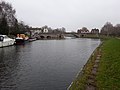
 Thames Path at Abingdon bridge - geograph.org.uk - 58879.jpg 640 × 474; 80 KB
-

-
 Abingdon Bridge 01.jpg 4,128 × 3,096; 4.2 MB
-
 Abingdon Bridge 07.jpg 4,128 × 3,096; 6.72 MB
-
 Abingdon in the distance - geograph.org.uk - 1432480.jpg 640 × 426; 71 KB
-
 Along a path - geograph.org.uk - 1433828.jpg 640 × 426; 70 KB
-
 Bend in the path - geograph.org.uk - 1061454.jpg 426 × 640; 81 KB
-
 The Thames Path at Medley - geograph.org.uk - 1758536.jpg 989 × 1,500; 310 KB
-

-
 Bridge ahead - geograph.org.uk - 1449764.jpg 426 × 640; 126 KB
-
 Bridges by the Thames - geograph.org.uk - 871837.jpg 640 × 462; 119 KB
-
 Charlock flowers - geograph.org.uk - 945078.jpg 480 × 640; 61 KB
-
 Fiddler's Island - geograph.org.uk - 872832.jpg 640 × 480; 80 KB
-
 FiddlersIsland01.JPG 2,048 × 1,536; 1.4 MB
-
 Footbridge over Hinksey Stream - geograph.org.uk - 871863.jpg 640 × 480; 126 KB
-
 Footbridge over Hinksey Stream, Oxford - geograph.org.uk - 524300.jpg 640 × 533; 128 KB
-
 Gate in the path - geograph.org.uk - 1464154.jpg 640 × 427; 88 KB
-
 Godstow Abbey, Oxfordshire 49.jpg 4,128 × 3,096; 6.38 MB
-
 Path through the arch - geograph.org.uk - 1451884.jpg 640 × 427; 90 KB
-
 HST on bridge over the Thames and Thames Path - geograph.org.uk - 4855089.jpg 1,024 × 683; 291 KB
-
 Muddy path - geograph.org.uk - 1176235.jpg 400 × 600; 73 KB
-
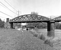
 Rail bridge over the River Thames, carrying the Cherwell Valley line 08.jpg 4,128 × 3,096; 6.73 MB
-
 Rail bridge over the River Thames, carrying the Cherwell Valley line 10.jpg 4,128 × 3,096; 7.11 MB
-
 Rail bridge over the River Thames, carrying the Cherwell Valley line 11.jpg 4,128 × 3,096; 5.92 MB
-
 River Thames and Port Meadow from Godstow Lock.jpg 4,032 × 3,024; 2.16 MB
-
 Sandford Lock 01.jpg 4,128 × 3,096; 4.72 MB
-
 Signpost and canal bridge at St Johns Lock - geograph.org.uk - 2373880.jpg 3,216 × 2,136; 3.51 MB
-
 Thames Path Footbridge - geograph.org.uk - 1365851.jpg 640 × 480; 132 KB
-
 Thames Path - geograph.org.uk - 3926117.jpg 640 × 430; 93 KB
-
 Thames Path - geograph.org.uk - 3928216.jpg 640 × 430; 83 KB
-
 Thames Path - geograph.org.uk - 3934624.jpg 640 × 430; 91 KB
-
 Thames Path - geograph.org.uk - 3934636.jpg 640 × 430; 90 KB
-
 Thames Path - geograph.org.uk - 3935194.jpg 640 × 430; 96 KB
-
 Thames Path - geograph.org.uk - 3944342.jpg 640 × 430; 91 KB
-
 Thames Path - geograph.org.uk - 3944347.jpg 640 × 430; 77 KB
-
 Thames Path - geograph.org.uk - 5515382.jpg 640 × 426; 113 KB
-
 Thames Path - geograph.org.uk - 5515460.jpg 640 × 426; 113 KB
-
 Thames Path - geograph.org.uk - 5515545.jpg 640 × 426; 123 KB
-
 Thames Path - geograph.org.uk - 5948403.jpg 1,024 × 681; 258 KB
-
 Thames Path - geograph.org.uk - 5948407.jpg 1,024 × 681; 197 KB
-
 Thames Path - geograph.org.uk - 5948410.jpg 1,024 × 681; 182 KB
-
 Thames Path - geograph.org.uk - 5948428.jpg 1,024 × 681; 219 KB
-
 Thames Path - geograph.org.uk - 5948432.jpg 1,024 × 681; 240 KB
-
 Thames Path - geograph.org.uk - 5957641.jpg 1,024 × 681; 252 KB
-
 Thames Path - geograph.org.uk - 5957644.jpg 1,024 × 681; 212 KB
-
 Thames Path - geograph.org.uk - 5957651.jpg 1,024 × 681; 248 KB
-
 Thames Path - geograph.org.uk - 5957667.jpg 1,024 × 681; 249 KB
-
 Thames Path - geograph.org.uk - 5957676.jpg 1,024 × 681; 281 KB
-
 Thames Path - geograph.org.uk - 5957682.jpg 1,024 × 681; 222 KB
-
 Thames Path - geograph.org.uk - 5957698.jpg 1,024 × 681; 234 KB
-
 Thames Path - geograph.org.uk - 780733.jpg 640 × 427; 115 KB
-
 Thames Path approaches Fiddler's Island - geograph.org.uk - 3999867.jpg 1,500 × 1,922; 881 KB
-
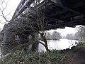
 Thames Path at Godstow Bridge - geograph.org.uk - 3389289.jpg 640 × 427; 229 KB
-
 Thames Path fingerpost near Kennington, Oxfordshire.jpg 4,128 × 3,096; 5.47 MB
-
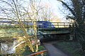
 Thames Path footbridge SE of Godstow Lock - geograph.org.uk - 3255719.jpg 1,024 × 683; 281 KB
-
 Thames Path going towards Folly Bridge - geograph.org.uk - 4875276.jpg 683 × 1,024; 227 KB
-
 Thames Path in Oxford - geograph.org.uk - 4529828.jpg 1,024 × 827; 297 KB
-
 Thames Path in the Floods - geograph.org.uk - 3903745.jpg 1,024 × 768; 152 KB
-
 Thames path north of Sandford Lock - geograph.org.uk - 871809.jpg 480 × 640; 133 KB
-
 Thames Path over Bulstake Stream - geograph.org.uk - 3926129.jpg 640 × 430; 104 KB
-
 Thames Path signpost on East Street - geograph.org.uk - 3321647.jpg 1,000 × 1,500; 218 KB
-
 Thames Path south of Iffley lock - geograph.org.uk - 3948226.jpg 640 × 430; 102 KB
-
 Thames path to Whitchurch - geograph.org.uk - 1566125.jpg 640 × 480; 101 KB
-
 Thames Path, Fiddler's Island - geograph.org.uk - 5957726.jpg 1,024 × 681; 262 KB
-
 Thames Path, south of Radley, Oxfordshire.jpg 4,128 × 3,096; 8.87 MB
-
 The Old Boat House, River Thames, Radley, Oxfordshire.jpg 2,994 × 1,796; 1.63 MB
-
 The Thames Path at Culham - geograph.org.uk - 1336779.jpg 640 × 427; 97 KB
-
 The Thames Path at Kennington - geograph.org.uk - 1622435.jpg 640 × 427; 86 KB
-
 The Thames Path by Culham Cut - geograph.org.uk - 1336785.jpg 640 × 417; 87 KB
-
 The Thames Path by Culham Lock - geograph.org.uk - 1336783.jpg 640 × 427; 97 KB
-
 The Thames Path in Abingdon - geograph.org.uk - 1405762.jpg 640 × 427; 72 KB
-
 The Thames Path near Culham - geograph.org.uk - 945056.jpg 480 × 640; 73 KB
-
 Type FW3-24 pillbox, Moreton, Northmore, Oxfordshire.jpg 2,469 × 1,852; 1.57 MB
-
 Walkers on the path - geograph.org.uk - 1220848.jpg 640 × 426; 82 KB
-
 Thames Path by Port Meadow - geograph.org.uk - 111743.jpg 480 × 640; 98 KB


