Category:Teynham
Jump to navigation
Jump to search
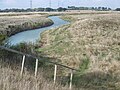
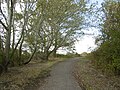
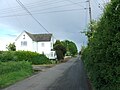
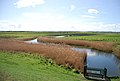
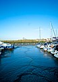
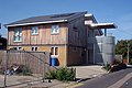
English: Teynham is a large village, and civil parish in Kent, England, in the district of Swale. The parish spans the A2 some three miles west of Faversham, and extends north to include the hamlet of Conyer, on an inlet of the Swale, a channel that separates the mainland of Kent from the Isle of Sheppey. Barrow Green is also part of the village.
village and civil parish in Kent, England, UK  | |||||
| Upload media | |||||
| Instance of | |||||
|---|---|---|---|---|---|
| Location | Swale, Kent, South East England, England | ||||
 | |||||
Subcategories
This category has the following 7 subcategories, out of 7 total.
C
- Conyer (14 F)
F
- Fowley Island, Kent (5 F)
- Fox, Teynham (2 F)
- Frognal, Kent (6 F)
M
- St Mary's church, Teynham (16 F)
O
T
- Teynham railway station (6 F)
Media in category "Teynham"
The following 200 files are in this category, out of 441 total.
(previous page) (next page)-
 A gated community, Conyer - geograph.org.uk - 3033762.jpg 640 × 430; 71 KB
-
 Amber Close, Teynham - geograph.org.uk - 3698757.jpg 3,488 × 2,616; 2.19 MB
-
 Baker Close, Teynham - geograph.org.uk - 3698780.jpg 3,488 × 2,616; 2.17 MB
-
-
 Barge at Conyer - geograph.org.uk - 3029789.jpg 640 × 430; 81 KB
-
 Barge, Conyer Creek - geograph.org.uk - 3029746.jpg 640 × 430; 91 KB
-
 Belle Friday Close, Teynham - geograph.org.uk - 3698708.jpg 3,488 × 2,616; 2.24 MB
-
 Boat Hoist, Swale Marina - geograph.org.uk - 3031904.jpg 640 × 430; 56 KB
-
 Boat in the mud - geograph.org.uk - 3034849.jpg 640 × 430; 53 KB
-
 Boat lift at Conyer - geograph.org.uk - 6249780.jpg 4,848 × 3,232; 828 KB
-
 Boat Lift, Swale Marina, Conyer - geograph.org.uk - 3708561.jpg 3,488 × 2,616; 1.96 MB
-
 Boat moored near Fowley Island - geograph.org.uk - 3034856.jpg 640 × 430; 46 KB
-
 Boat moored, South Deep - geograph.org.uk - 3034850.jpg 640 × 430; 47 KB
-
 Boat on the Swale - geograph.org.uk - 4490158.jpg 2,272 × 1,704; 929 KB
-
 Boats in the mud, Conyer Creek - geograph.org.uk - 3029743.jpg 640 × 430; 81 KB
-
 Borrow dyke, Teynham Level - geograph.org.uk - 5429926.jpg 640 × 480; 116 KB
-
 Bradfield Avenue, Teynham - geograph.org.uk - 3698942.jpg 3,488 × 2,616; 2.21 MB
-
 Bradfield Avenue, Teynham - geograph.org.uk - 3698958.jpg 3,488 × 2,616; 2.16 MB
-
 Brunswick Arms, Conyer - geograph.org.uk - 3708564.jpg 3,488 × 2,616; 1.48 MB
-
 Building on land adjacent to 67, London Road - geograph.org.uk - 3699270.jpg 1,175 × 881; 220 KB
-

-
 Caravan going fishing^ - geograph.org.uk - 4404964.jpg 1,024 × 370; 69 KB
-
 Caravan Yacht Hybrid, the Swale - geograph.org.uk - 4489939.jpg 2,272 × 1,704; 889 KB
-
 Channel and earth bank - geograph.org.uk - 994593.jpg 640 × 481; 110 KB
-
 Cherry Gardens, Teynham - geograph.org.uk - 3698680.jpg 3,488 × 2,616; 2.28 MB
-
 Cherry Gardens, Teynham - geograph.org.uk - 4489831.jpg 2,272 × 1,704; 701 KB
-
 Cherry Tree Close, Teynham - geograph.org.uk - 3698767.jpg 3,488 × 2,616; 1.76 MB
-
 Claxfield House, London Road - geograph.org.uk - 6004148.jpg 3,264 × 2,448; 3.73 MB
-
 Co-op food store, Kent (27709014811).jpg 2,048 × 1,536; 1.46 MB
-
 Coastal embankment W of Luddenham Gut - view E - geograph.org.uk - 6337467.jpg 5,184 × 2,920; 5.88 MB
-

-
 Convenience store, Teynham - geograph.org.uk - 2003621.jpg 3,072 × 2,304; 2.29 MB
-
 Converted oast house by Teynham station - geograph.org.uk - 5429008.jpg 640 × 480; 138 KB
-
 Conyer - geograph.org.uk - 3033753.jpg 640 × 430; 65 KB
-
 Conyer Creek - geograph.org.uk - 3028250.jpg 640 × 430; 68 KB
-
 Conyer Creek - geograph.org.uk - 3029730.jpg 640 × 401; 59 KB
-
 Conyer Creek - geograph.org.uk - 3029740.jpg 640 × 430; 83 KB
-
 Conyer Creek - geograph.org.uk - 3029744.jpg 640 × 430; 82 KB
-
 Conyer Creek - geograph.org.uk - 3029780.jpg 640 × 430; 64 KB
-
 Conyer Creek - geograph.org.uk - 5154340.jpg 4,608 × 3,456; 3.36 MB
-
 Conyer Creek - geograph.org.uk - 5161045.jpg 4,608 × 3,147; 2.85 MB
-
 Conyer Creek - geograph.org.uk - 5429619.jpg 640 × 480; 131 KB
-
 Conyer Creek - geograph.org.uk - 5429649.jpg 640 × 428; 120 KB
-
 Conyer Creek - geograph.org.uk - 6249763.jpg 5,184 × 3,456; 1.44 MB
-
 Conyer Creek - geograph.org.uk - 6249765.jpg 5,184 × 3,456; 1.6 MB
-
 Conyer Creek entering The Swale - geograph.org.uk - 3024240.jpg 640 × 430; 52 KB
-

-
 Conyer Creek Mud - geograph.org.uk - 4296333.jpg 683 × 1,024; 250 KB
-
 Conyer Dock 1968 - geograph.org.uk - 1622151.jpg 640 × 439; 51 KB
-
 Conyer Marina - geograph.org.uk - 6248941.jpg 5,184 × 3,456; 1.26 MB
-
 Conyer Marina - geograph.org.uk - 6248942.jpg 5,184 × 3,456; 1.54 MB
-
 Conyer Marina - geograph.org.uk - 6248943.jpg 5,184 × 3,456; 1.27 MB
-
 Conyer Rd - geograph.org.uk - 3031924.jpg 640 × 430; 112 KB
-
 Conyer Rd - geograph.org.uk - 3033765.jpg 640 × 430; 104 KB
-
 Conyer Road, Conyer - geograph.org.uk - 3708572.jpg 3,488 × 2,616; 1.62 MB
-
 Conyer Road, near Conyer - geograph.org.uk - 4483433.jpg 2,272 × 1,704; 909 KB
-
 Conyer Road, Teynham - geograph.org.uk - 3698907.jpg 3,488 × 2,616; 2.28 MB
-
 Conyer Road, Teynham - geograph.org.uk - 5039968.jpg 2,304 × 1,728; 823 KB
-
 Conyer Village Sign - geograph.org.uk - 3708568.jpg 2,811 × 2,367; 554 KB
-
 Conyer village sign - geograph.org.uk - 6249877.jpg 3,266 × 4,899; 719 KB
-

-
 Crispins Fish Bar, Teynham - geograph.org.uk - 272360.jpg 640 × 480; 86 KB
-
 Crossing point - geograph.org.uk - 3040402.jpg 640 × 352; 42 KB
-
 Deerton Farmhouse - geograph.org.uk - 1221522.jpg 640 × 480; 83 KB
-
 Deerton Farmhouse - geograph.org.uk - 5154215.jpg 4,608 × 3,456; 3.55 MB
-
 Deerton Natural Burial Ground - geograph.org.uk - 1221527.jpg 640 × 480; 114 KB
-
 Deerton Natural Burial Ground - geograph.org.uk - 3773576.jpg 640 × 480; 63 KB
-
 Deerton Street near Teynham, Kent - geograph.org.uk - 3718567.jpg 640 × 360; 47 KB
-
 Deerton Street, near Teynham - geograph.org.uk - 3773586.jpg 640 × 480; 99 KB
-
 Deerton Street, near Teynham - geograph.org.uk - 3773593.jpg 640 × 480; 97 KB
-
 Deerton Street, near Teynham - geograph.org.uk - 3773615.jpg 469 × 640; 132 KB
-
 Deerton Street, near Teynham - geograph.org.uk - 4483441.jpg 2,272 × 1,704; 956 KB
-
 Deerton Street, near Teynham - geograph.org.uk - 4483444.jpg 2,272 × 1,704; 785 KB
-
 Deerton Street, near Teynham - geograph.org.uk - 4483447.jpg 2,272 × 1,704; 837 KB
-
 Deerton Street, near Teynham - geograph.org.uk - 4483448.jpg 2,272 × 1,704; 790 KB
-
 Deerton Street, near Teynham - geograph.org.uk - 4483449.jpg 2,272 × 1,704; 836 KB
-
 Deerton Street, near Teynham - geograph.org.uk - 4483450.jpg 2,272 × 1,704; 770 KB
-
 Deerton Street, near Teynham - geograph.org.uk - 4483451.jpg 2,272 × 1,704; 775 KB
-
 Disused rifle range, Teynham Levels - geograph.org.uk - 3034885.jpg 640 × 430; 55 KB
-
 Donald Moor Avenue, Teynham - geograph.org.uk - 3698707.jpg 3,488 × 2,616; 2.25 MB
-
 Drainage channel at Luddenham Marshes - geograph.org.uk - 6248936.jpg 5,184 × 3,456; 1.62 MB
-
 Drainage ditch at Teynham Levels - geograph.org.uk - 6249858.jpg 5,184 × 3,456; 1.8 MB
-
 Drainage ditch at the head of Conyer Creek - geograph.org.uk - 5154451.jpg 4,608 × 3,456; 3.56 MB
-
 Drainage ditch near Conyer - geograph.org.uk - 3029732.jpg 640 × 430; 69 KB
-
 Drainage ditch near Conyer - geograph.org.uk - 3031885.jpg 640 × 430; 73 KB
-
 Drainage Ditch near Conyer - geograph.org.uk - 3708610.jpg 3,488 × 2,616; 2.14 MB
-
 Drainage Ditch, Teynham Levels - geograph.org.uk - 3034861.jpg 640 × 430; 63 KB
-
 Drainage ditches, Teynham Level - geograph.org.uk - 4489950.jpg 2,272 × 1,704; 849 KB
-
 Drainage pump at Teynham Level - geograph.org.uk - 6249864.jpg 5,184 × 3,456; 2.06 MB
-
 Eastwood Cottages, Conyer Road - geograph.org.uk - 6249874.jpg 5,184 × 3,456; 1.14 MB
-
 Electricity pylon at Conyer - geograph.org.uk - 6249782.jpg 3,456 × 5,184; 1.66 MB
-
 Embayment on The Swale - geograph.org.uk - 3038079.jpg 640 × 430; 67 KB
-

-
 Farmland by the railway - geograph.org.uk - 3163484.jpg 640 × 430; 39 KB
-
 Farmland near Lower Newlands - geograph.org.uk - 3163481.jpg 640 × 430; 33 KB
-
 Farmland on the edge of Conyer - geograph.org.uk - 3033763.jpg 640 × 430; 61 KB
-
 Flooded track under railway bridge - geograph.org.uk - 1073568.jpg 481 × 640; 68 KB
-
 Footpath across Osiers Farm, Teynham - geograph.org.uk - 4483431.jpg 2,272 × 1,704; 785 KB
-
 Footpath alongside Conyer Creek - geograph.org.uk - 5154365.jpg 4,608 × 3,456; 3.36 MB
-
 Footpath leading towards Orchard View, Teynham - geograph.org.uk - 4489838.jpg 2,272 × 1,704; 933 KB
-
 Footpath to Conyer - geograph.org.uk - 3360801.jpg 4,000 × 3,000; 4.18 MB
-
 Footpath to St Mary's Church, Teynham - geograph.org.uk - 4713298.jpg 4,608 × 3,456; 3.93 MB
-
 Footpath to Teynham Church - geograph.org.uk - 4713291.jpg 4,608 × 3,456; 3.47 MB
-
 Former goods shed, Teynham station - geograph.org.uk - 5428973.jpg 640 × 428; 144 KB
-
 Fowley Island - geograph.org.uk - 3034862.jpg 640 × 430; 52 KB
-
 Fowley Island - geograph.org.uk - 3034878.jpg 640 × 430; 54 KB
-
 Fowley Island - geograph.org.uk - 4489965.jpg 2,272 × 1,704; 569 KB
-
 Fowley Island - geograph.org.uk - 5428632.jpg 640 × 480; 95 KB
-
 Fowley Island across South Deep - geograph.org.uk - 3034871.jpg 640 × 430; 52 KB
-
 Fowley Island, The Swale - geograph.org.uk - 3034844.jpg 640 × 430; 63 KB
-
 French's Row, Teynham - geograph.org.uk - 3698919.jpg 3,488 × 2,616; 2.3 MB
-
 Frognal Gardens, Teynham - geograph.org.uk - 3698660.jpg 3,488 × 2,616; 2.26 MB
-
 Frognal Gardens, Teynham - geograph.org.uk - 3698667.jpg 3,488 × 2,616; 2.25 MB
-
 Frognal Gardens, Teynham - geograph.org.uk - 5428537.jpg 640 × 428; 87 KB
-
 Frognal Lane, Teynham - geograph.org.uk - 4483421.jpg 2,272 × 1,704; 866 KB
-
 Frognall Lane, Lower Rd junction - geograph.org.uk - 3163520.jpg 640 × 430; 48 KB
-
 Garages on Lower Road, Teynham - geograph.org.uk - 5039977.jpg 2,304 × 1,728; 826 KB
-
 Gateway, Teynham Level - geograph.org.uk - 5428658.jpg 640 × 480; 113 KB
-

-
 Ham Farm Cottage - geograph.org.uk - 994582.jpg 640 × 481; 120 KB
-
 Harrys Road, Teynham - geograph.org.uk - 3698793.jpg 3,488 × 2,616; 2.22 MB
-
 Harrys Road, Teynham - geograph.org.uk - 4483419.jpg 2,272 × 1,704; 755 KB
-
 High water at Conyer Creek - geograph.org.uk - 2564848.jpg 4,000 × 3,000; 2.25 MB
-
 Honeyball Walk, Teynham - geograph.org.uk - 3698770.jpg 3,488 × 2,616; 2.23 MB
-
 Honeyball Walk, Teynham - geograph.org.uk - 3698776.jpg 3,488 × 2,616; 2.24 MB
-
 Houseboat, Conyer Creek - geograph.org.uk - 3029794.jpg 640 × 430; 77 KB
-
 Houses along Conyer Creek - geograph.org.uk - 3029784.jpg 640 × 430; 59 KB
-
 Houses on Conyer Rd - geograph.org.uk - 3033750.jpg 640 × 430; 82 KB
-
 Houses, Lower Rd - geograph.org.uk - 3163506.jpg 640 × 282; 29 KB
-
 Houses, Lower Rd - geograph.org.uk - 3163513.jpg 640 × 284; 34 KB
-
 In Conyer - geograph.org.uk - 3033758.jpg 640 × 430; 81 KB
-
 In St Mary's Churchyard, Teynham - geograph.org.uk - 5154181.jpg 4,608 × 3,456; 3.44 MB
-
 In St Mary's Churchyard, Teynham - geograph.org.uk - 5154189.jpg 4,608 × 3,456; 3.4 MB
-
 Kissing gate, Saxon Shore Way - geograph.org.uk - 3031878.jpg 640 × 430; 86 KB
-
 Lacel House, London Road - geograph.org.uk - 4103884.jpg 1,175 × 881; 189 KB
-
 Larkrise, Conyer - geograph.org.uk - 4489892.jpg 2,272 × 1,704; 746 KB
-
 Level crossing at Teynham station - geograph.org.uk - 3718594.jpg 640 × 360; 62 KB
-
 Level Crossing by Teynham Station - geograph.org.uk - 3698873.jpg 3,488 × 2,616; 2.16 MB
-
 Level Crossing on Lower Road, Teynham - geograph.org.uk - 1073554.jpg 640 × 481; 101 KB
-
 Level Crossing, Lower Frognal Farm, near Teynham - geograph.org.uk - 4483422.jpg 2,272 × 1,704; 852 KB
-
 London Road - geograph.org.uk - 6249880.jpg 5,184 × 3,456; 1.04 MB
-
 London Road, Teynham - geograph.org.uk - 3698975.jpg 3,488 × 2,616; 2.28 MB
-
 Looking across Conyer Creek - geograph.org.uk - 5159001.jpg 4,608 × 3,456; 3.32 MB
-
 Looking across the salt marsh to Conyer Creek - geograph.org.uk - 5154378.jpg 4,608 × 3,456; 3.37 MB
-
 Looking east-southeast along Lower Road - geograph.org.uk - 5356586.jpg 3,264 × 2,448; 3.75 MB
-
 Looking north-northeast along Station Road - geograph.org.uk - 4103899.jpg 1,142 × 856; 192 KB
-
 Low tide at Conyer - geograph.org.uk - 6249758.jpg 5,184 × 3,456; 1.79 MB
-
 Low tide in Conyer Creek - geograph.org.uk - 272404.jpg 640 × 480; 98 KB
-
 Lower Norton Lane, near Teynham - geograph.org.uk - 4483456.jpg 2,272 × 1,704; 1.1 MB
-

-
 Lower Road, Bapchild - geograph.org.uk - 5039985.jpg 2,304 × 1,728; 827 KB
-
 Lower Road, near Teynham - geograph.org.uk - 4483426.jpg 2,272 × 1,704; 682 KB
-
 Lower Road, near Teynham - geograph.org.uk - 4483455.jpg 2,272 × 1,704; 972 KB
-
 Lower Road, Teynham - geograph.org.uk - 3698835.jpg 3,488 × 2,616; 2.28 MB
-
 Lower Road, Teynham - geograph.org.uk - 4483420.jpg 2,272 × 1,704; 763 KB
-
 Lower Road, Teynham - geograph.org.uk - 4483424.jpg 2,272 × 1,704; 802 KB
-
 Lower Road, Teynham - geograph.org.uk - 5039951.jpg 2,170 × 1,532; 1.11 MB
-
 Luddenham Gut - geograph.org.uk - 3040412.jpg 640 × 430; 65 KB
-
 Luddenham Gut - geograph.org.uk - 4490171.jpg 2,272 × 1,704; 773 KB
-
 Luddenham Gut - landward side - geograph.org.uk - 3012820.jpg 640 × 427; 82 KB
-
 Luddenham gut stream under Pylon - geograph.org.uk - 994572.jpg 481 × 640; 75 KB
-
 Lychgate to St. Mary's church, Teynham - geograph.org.uk - 3773792.jpg 640 × 480; 121 KB
-
 Marina at Conyer off Swale Estuary - geograph.org.uk - 6337466.jpg 5,184 × 2,920; 4.98 MB
-
 Marine caravan - geograph.org.uk - 5429682.jpg 640 × 480; 105 KB
-
 Marsh Lane, near Teynham - geograph.org.uk - 4483435.jpg 2,272 × 1,704; 904 KB
-
 Marsh Lane, near Teynham - geograph.org.uk - 4483436.jpg 2,272 × 1,704; 703 KB
-
 Mouth of Conyer Creek - geograph.org.uk - 5429664.jpg 640 × 480; 114 KB
-
 Mud Swale Marine Services Conyer Creek - geograph.org.uk - 4296313.jpg 732 × 1,024; 254 KB
-

-
 Navigating Conyer Creek - geograph.org.uk - 5429661.jpg 640 × 480; 123 KB
-
 New Development at Conyer Road Conyer Creek - geograph.org.uk - 4296372.jpg 1,024 × 683; 225 KB
-
 New Development at Conyer Road Conyer Creek - geograph.org.uk - 4296377.jpg 1,024 × 683; 300 KB
-
 New Development at Conyer Road Conyer Creek - geograph.org.uk - 4296382.jpg 1,024 × 683; 314 KB
-
 New Dwellings on Frognal Lane - geograph.org.uk - 1450555.jpg 640 × 427; 84 KB
-
 New Gardens Road, Teynham - geograph.org.uk - 3698699.jpg 3,488 × 2,616; 2.17 MB
-
 New housing, Conyer Road - geograph.org.uk - 6249754.jpg 5,184 × 3,456; 1.29 MB
-
 Nutberry Close, Teynham - geograph.org.uk - 3698954.jpg 3,488 × 2,616; 1.37 MB
-
 Old brickworks wharf - geograph.org.uk - 5429668.jpg 640 × 480; 117 KB
-
 Old building base, Conyer Brickworks - geograph.org.uk - 5428625.jpg 640 × 480; 163 KB
-
 Old house at Teynham Street, Kent - geograph.org.uk - 1438991.jpg 640 × 480; 68 KB
-
 Old orchard at Teynham - geograph.org.uk - 3360811.jpg 4,000 × 3,000; 4.17 MB
-
 Orchard by the Saxon Shore Way - geograph.org.uk - 3033787.jpg 640 × 430; 67 KB
-
 Orchard by the Saxon Shore Way - geograph.org.uk - 3033790.jpg 640 × 430; 63 KB
-
 Orchard near Conyer - geograph.org.uk - 3033781.jpg 640 × 430; 94 KB
-
 Orchard View, Teynham - geograph.org.uk - 3698786.jpg 3,488 × 2,616; 2.2 MB
-
 Orchard View, Teynham - geograph.org.uk - 4489843.jpg 2,272 × 1,704; 776 KB
-
 Orchard View, Teynham - geograph.org.uk - 4489845.jpg 2,272 × 1,704; 724 KB
-
 Orchards to the east of Deerton Street - geograph.org.uk - 3773565.jpg 640 × 472; 108 KB
-
 Orchards, near Teynham - geograph.org.uk - 4483438.jpg 2,272 × 1,704; 785 KB
-
 Orchards, near Teynham - geograph.org.uk - 4483442.jpg 2,272 × 1,704; 821 KB
-
 Osier Road near Teynham - geograph.org.uk - 4713301.jpg 4,608 × 3,456; 3.38 MB
-
 Osier Road near Teynham, Kent - geograph.org.uk - 3718572.jpg 640 × 360; 72 KB
-
 Osier Road, Teynham - geograph.org.uk - 4483430.jpg 2,272 × 1,704; 853 KB
-

-
 Paddocks by Lower Road - geograph.org.uk - 5428547.jpg 640 × 428; 91 KB
-
 Path through old brickworks area, Conyer - geograph.org.uk - 5429644.jpg 640 × 480; 163 KB
-
 Pedestrian Level Crossing, Teynham - geograph.org.uk - 4489853.jpg 2,272 × 1,704; 906 KB
-
 Polytunnelled Strawberry Field - geograph.org.uk - 1450561.jpg 640 × 427; 108 KB
-
 Pylon near Conyer Creek - geograph.org.uk - 3031893.jpg 640 × 430; 53 KB
-
 Pylon near Conyer Creek - geograph.org.uk - 3031895.jpg 430 × 640; 48 KB


.jpg)


