Category:Teufelsbrunnen (D 213)
Jump to navigation
Jump to search
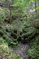
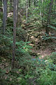
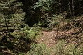
Deutsch: Die Ponordoline Teufelsbrunnen (HFA-Katasternummer: D 213) befindet sich im oberfränkischen Landkreis Bayreuth, etwa 1850 Meter nordwestlich des Hufeisen-Waldhauses im Veldensteiner Forst im Bundesland Bayern in Deutschland. In die etwa 20 Meter tiefe und steilwandige Doline fließt ein kleines Rinnsal, das dem Teufelsbrunnen entspringt. Sie ist als Naturdenkmal, Geotop 472R076: Ponordoline ESE von Weidensees sowie als Höhle mit der Katasternummer D 213 verzeichnet. Im Dolinenkataster Nordbayern ist sie als Nummer 6234/D096 registriert
Geotop in Landkreis Bayreuth in Bavaria, Germany _01.jpg) | |||||
| Upload media | |||||
| Instance of | |||||
|---|---|---|---|---|---|
| Location | Veldensteiner Forst, Bayreuth, Upper Franconia, Bavaria, Germany | ||||
| Heritage designation | |||||
| Width |
| ||||
| Length |
| ||||
| Area |
| ||||
| Elevation above sea level |
| ||||
| official website | |||||
 | |||||
This category shows the natural monument in Veldensteiner Forst in Bavaria with the ID 41/37 and the name Teufelsbrunnen D 213.
|
 |
 |
Media in category "Teufelsbrunnen (D 213)"
The following 13 files are in this category, out of 13 total.
-
 Teufelsbrunnen (D 213) 01.jpg 5,472 × 3,648; 17.4 MB
-
 Teufelsbrunnen (D 213) 02.jpg 5,472 × 3,648; 17.56 MB
-
 Teufelsbrunnen (D 213) 03.jpg 3,648 × 5,472; 17.17 MB
-
 Teufelsbrunnen (D 213) 04.jpg 3,648 × 5,472; 18.36 MB
-
 Teufelsbrunnen (D 213) 05.jpg 5,472 × 3,648; 16.02 MB
-
 Teufelsbrunnen (D 213) 06.jpg 3,648 × 5,472; 18.27 MB
-
 Teufelsbrunnen (D 213) 07.jpg 3,648 × 5,472; 18.63 MB
-
 Teufelsbrunnen (D 213) 08.jpg 5,472 × 3,648; 17.91 MB
-
 Teufelsbrunnen (D 213) 09.jpg 12,197 × 4,777; 54.82 MB
-
 Teufelsbrunnen (D 213) 10.jpg 5,472 × 3,648; 19.17 MB
-
 Teufelsbrunnen (D 213) 11.jpg 5,472 × 3,648; 18.06 MB
-
 Teufelsbrunnen (D 213) 12.jpg 3,648 × 5,472; 19.19 MB
-
 Teufelsbrunnen (D 213) 13.jpg 5,472 × 3,648; 18.64 MB
_02.jpg)
_03.jpg)
_04.jpg)
_05.jpg)
_06.jpg)
_07.jpg)
_08.jpg)
_10.jpg)
_11.jpg)
_12.jpg)
_13.jpg)
_09.jpg)
Categories:
- Natural monuments in Landkreis Bayreuth
- Caves of Karstgebiet D
- Caves of Landkreis Bayreuth
- Geography of Landkreis Bayreuth
- Geotopes in Landkreis Bayreuth
- Sinkholes in Bavaria
- Landschaftsschutzgebiet Fränkische Schweiz - Veldensteiner Forst im Regierungsbezirk Oberfranken
- Geotopes in Naturpark Fränkische Schweiz-Veldensteiner Forst
- Caves in Naturpark Fränkische Schweiz-Veldensteiner Forst
- Ponors in Bavaria