Category:Temple de Colombier
Jump to navigation
Jump to search
| Object location | | View all coordinates using: OpenStreetMap |
|---|
 | |||||
| Upload media | |||||
| Instance of | |||||
|---|---|---|---|---|---|
| Part of | |||||
| Location | |||||
| Street address |
| ||||
| Architectural style | |||||
| Heritage designation | |||||
 | |||||
|
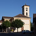
This is a category about a cultural property of national significance in Switzerland with KGS number 3991
|
Media in category "Temple de Colombier"
The following 8 files are in this category, out of 8 total.
-
 B-Colombier-NE-Temple.jpg 1,200 × 1,800; 2.13 MB
-
 Colombier-Temple.jpg 1,200 × 1,200; 1.22 MB
-
 Temple de Colombier - chaire.jpg 2,000 × 1,329; 241 KB
-
 Temple de Colombier - droite.jpg 2,000 × 1,329; 286 KB
-
 Temple de Colombier - entrée principale.jpg 2,000 × 3,011; 826 KB
-
 Temple de Colombier - gauche.jpg 2,000 × 1,329; 288 KB
-
 Temple de Colombier - panoramique.jpg 5,376 × 2,688; 1.38 MB
-
 Temple de Colombier.jpg 5,472 × 3,648; 5.84 MB


