Category:Temple, Glasgow
Jump to navigation
Jump to search
district of Glasgow, in the north of the city, bounded by Anniesland to the south, Knightswood to the west and Kelvindale to the east  | |||||
| Upload media | |||||
| Instance of | |||||
|---|---|---|---|---|---|
| Location | Glasgow City, Scotland | ||||
 | |||||
Subcategories
This category has the following 4 subcategories, out of 4 total.
D
T
- Temple Anniesland Parish Church (23 F)
- Temple Bridge, Glasgow (4 F)
Media in category "Temple, Glasgow"
The following 14 files are in this category, out of 14 total.
-
 Bearsden Road with railway bridge (geograph 6323093).jpg 1,024 × 768; 208 KB
-
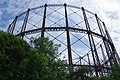
 Gasholder, Temple Gasworks (geograph 5460120).jpg 1,600 × 1,200; 415 KB
-
 Gasometers at Kelvindale (geograph 6215270).jpg 1,024 × 768; 226 KB
-
 Glasgow wards 2017 no14 Drumchapel.png 2,000 × 2,040; 504 KB
-
 Lock 27 on the Forth and Clyde Canal - geograph.org.uk - 382665.jpg 640 × 480; 72 KB
-
 Lock 27, Forth and Clyde Canal (geograph 4935918).jpg 1,024 × 768; 200 KB
-
 Lock on the Forth and Clyde Canal (geograph 6215272).jpg 1,024 × 768; 290 KB
-
 Lower Clyde Valley (geograph 6695008).jpg 800 × 541; 106 KB
-
 NethertonCommunityCentre.JPG 2,816 × 2,112; 1.33 MB
-
 Next Generation Club, Temple - geograph.org.uk - 519934.jpg 640 × 480; 86 KB
-
 Railway bridge over the A739 Bearsden Road (geograph 5689295).jpg 1,024 × 683; 144 KB
-
 Sunset at the Old Gasworks - geograph.org.uk - 49200.jpg 640 × 480; 99 KB
-
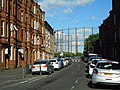
 Temple Gas Works (geograph 6198742).jpg 1,280 × 851; 468 KB
-
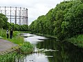 The Forth and Clyde Canal (geograph 6215256).jpg 1,024 × 768; 266 KB
.jpg)
.jpg)
.jpg)


.jpg)
.jpg)
.jpg)


.jpg)

.jpg)
.jpg)