Category:Temple, Cornwall
Jump to navigation
Jump to search
settlement in Blisland, Cornwall, United Kingdom  | |||||
| Upload media | |||||
| Instance of |
| ||||
|---|---|---|---|---|---|
| Location | Blisland, Cornwall, South West England, England | ||||
 | |||||
English: Temple is a hamlet in the parish of Blisland on Bodmin Moor, Cornwall. In 1934, the parish of Temple was incorporated into Blisland parish.
Subcategories
This category has the following 2 subcategories, out of 2 total.
T
- Temple War Memorial (1 F)
Media in category "Temple, Cornwall"
The following 36 files are in this category, out of 36 total.
-
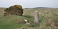 Boundary stone - geograph.org.uk - 418833.jpg 640 × 328; 61 KB
-
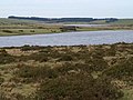
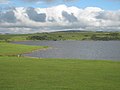
 Colliford Lake - geograph.org.uk - 16973.jpg 640 × 480; 25 KB
-
 Colliford Lake and Meadows Downs - geograph.org.uk - 708198.jpg 640 × 480; 86 KB
-
 Colliford Lake NW end on Bodmin Moor - geograph.org.uk - 130232.jpg 640 × 480; 42 KB
-
 Dozmary Pool - geograph.org.uk - 840.jpg 640 × 436; 35 KB
-
 Keeping the Sheep in - geograph.org.uk - 646453.jpg 640 × 480; 57 KB
-
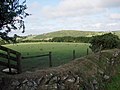 Sheep field - geograph.org.uk - 223887.jpg 640 × 480; 55 KB
-
 Submerged Hedge - geograph.org.uk - 646462.jpg 640 × 480; 121 KB
-
 Temple bridge - geograph.org.uk - 1543939.jpg 640 × 427; 73 KB
-
 Temple Old Bridge - geograph.org.uk - 748861.jpg 640 × 480; 102 KB
-
 The Colliford Tavern - geograph.org.uk - 748885.jpg 640 × 352; 58 KB
-
 A corner of Colliford Lake - geograph.org.uk - 1450187.jpg 640 × 480; 53 KB
-
 A30 across Bodmin Moor - geograph.org.uk - 748868.jpg 640 × 480; 79 KB
-
 A30 looking east - geograph.org.uk - 750156.jpg 640 × 480; 86 KB
-
 Beef cattle on the moor - geograph.org.uk - 750131.jpg 640 × 359; 81 KB
-
 Colliford Lake - geograph.org.uk - 708214.jpg 640 × 480; 85 KB
-
 Colliford Lake on Bodmin Moor - geograph.org.uk - 773114.jpg 640 × 426; 90 KB
-
 Conifer shelterbelt - geograph.org.uk - 750160.jpg 640 × 480; 83 KB
-
 Gillhouse Downs - geograph.org.uk - 708240.jpg 640 × 480; 84 KB
-
 Glynn Valley Works, Cardinham Moor - geograph.org.uk - 620230.jpg 640 × 427; 92 KB
-
 Glynn Valley Works, Cardinham Moor - geograph.org.uk - 620245.jpg 640 × 427; 64 KB
-
 Glynn Valley Works, Cardinham Moor - geograph.org.uk - 620264.jpg 640 × 427; 69 KB
-
 Hawk's Tor trig - geograph.org.uk - 565333.jpg 640 × 480; 115 KB
-
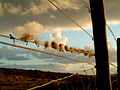
 Killer tamed - geograph.org.uk - 169860.jpg 640 × 426; 54 KB
-

-
 Pool and pony, Cardinham Moor - geograph.org.uk - 621508.jpg 640 × 405; 62 KB
-
 Redhill Downs - geograph.org.uk - 223877.jpg 640 × 480; 61 KB
-
 Road beside Jamaica Inn - geograph.org.uk - 462630.jpg 640 × 480; 58 KB
-
 Road beside Jamaica Inn - geograph.org.uk - 462633.jpg 640 × 480; 45 KB
-
 Rough ground - geograph.org.uk - 223871.jpg 640 × 480; 57 KB
-
 St Bellarmin's Tor, Cardinham Moor - geograph.org.uk - 621511.jpg 640 × 363; 56 KB
-

-
 The road to Warleggan from the A30 - geograph.org.uk - 169840.jpg 640 × 426; 56 KB
-
 Track to Higher Dewey - geograph.org.uk - 223895.jpg 640 × 480; 55 KB
-
 Unfenced road with earth barriers - geograph.org.uk - 418827.jpg 640 × 288; 47 KB
-
 Warleggan Down - geograph.org.uk - 223910.jpg 640 × 480; 70 KB


