Category:Telephone booths in the East Riding of Yorkshire
Jump to navigation
Jump to search
Ceremonial counties of England: Bedfordshire · Berkshire · Buckinghamshire · Cambridgeshire · Cheshire · Cornwall · Cumbria · Derbyshire · Devon · Dorset · Durham · East Riding of Yorkshire · East Sussex · Essex · Gloucestershire · Greater London · Greater Manchester · Hampshire · Herefordshire · Hertfordshire · Kent · Lancashire · Leicestershire · Lincolnshire · Merseyside · North Yorkshire · Northamptonshire · Northumberland · Nottinghamshire · Oxfordshire · Rutland · Shropshire · Somerset · South Yorkshire · Staffordshire · Suffolk · Surrey · Tyne and Wear · Warwickshire · West Sussex · West Yorkshire · Wiltshire · Worcestershire
City-counties: Bristol ·
Former historic counties:
Other former counties:
City-counties: Bristol ·
Former historic counties:
Other former counties:
Subcategories
This category has the following 5 subcategories, out of 5 total.
B
- Telephone booths in Bridlington (11 F)
K
- KCOM Group telephone boxes (118 F)
Media in category "Telephone booths in the East Riding of Yorkshire"
The following 194 files are in this category, out of 194 total.
-
 "The Coach and Horses" at Dunswell (geograph 4506539).jpg 4,435 × 3,558; 3.77 MB
-
 'Crown and Anchor' Pub at Kilnsea - geograph.org.uk - 874745.jpg 640 × 426; 105 KB
-
 1 Prestongate, Hessle - geograph.org.uk - 696177.jpg 640 × 510; 91 KB
-
 A164 entering Beverley (geograph 3802130).jpg 2,744 × 1,850; 3.5 MB
-
 A164-Wilfholme Road junction near Beswick - geograph.org.uk - 972105.jpg 640 × 439; 174 KB
-
 A614 Through Haisthorpe.jpg 640 × 480; 42 KB
-
 Archway Sewerby Hall.jpg 480 × 640; 84 KB
-
 Archway to the Courtyard - geograph.org.uk - 656435.jpg 640 × 473; 97 KB
-
 Arram Village.JPG 2,272 × 1,704; 1.04 MB
-
 At the Humber Bridge Viewing Area - geograph.org.uk - 1516191.jpg 640 × 345; 215 KB
-
 Beeford Store and Post Office - geograph.org.uk - 1222542.jpg 640 × 427; 312 KB
-
 Bench and phone box, Kirk Ella (geograph 6889570).jpg 768 × 1,024; 1.37 MB
-
 Black Swan - Cross Hill - geograph.org.uk - 41141.jpg 640 × 480; 90 KB
-
 Black Swan Inn, Asselby (geograph 2324508).jpg 1,600 × 1,200; 240 KB
-
 Blacktoft - panoramio.jpg 3,264 × 2,448; 3.97 MB
-
 Bolton, East Riding of Yorkshire.jpg 640 × 478; 127 KB
-
 Bridlington Railway Station Exterior - geograph.org.uk - 1212027.jpg 640 × 480; 62 KB
-
 Bridlington Station (geograph 5429933).jpg 640 × 426; 66 KB
-
 Brind Lane (geograph 3937439).jpg 1,024 × 768; 121 KB
-
 Broomfleet - geograph.org.uk - 235987.jpg 640 × 426; 130 KB
-

-
 Bus stop and shelter on Kingston Road (B1232) (geograph 6116493).jpg 5,184 × 3,888; 4.47 MB
-
 Chapel Garth, Arram - geograph.org.uk - 834263.jpg 640 × 480; 181 KB
-
 Cherry Burton Post Office - geograph.org.uk - 590220.jpg 640 × 480; 124 KB
-
 Cherry Burton-on-Sea - geograph.org.uk - 1402619.jpg 640 × 482; 121 KB
-
 Church Gate Hedon.jpg 640 × 480; 59 KB
-
 Church Lane, Nunburnholme - geograph.org.uk - 1429389.jpg 640 × 480; 61 KB
-
 Church Road-New Walk, North Ferriby (geograph 4312210).jpg 543 × 640; 200 KB
-

-
 Coach and Horses Dunswell.jpg 640 × 389; 188 KB
-
 Cottingham IMG 0057 - panoramio.jpg 1,067 × 1,600; 1,005 KB
-
 Cross on the village green, Brandesburton - geograph.org.uk - 1748513.jpg 2,112 × 2,816; 2.61 MB
-
 Crown and Anchor, Kilnsea - geograph.org.uk - 21846.jpg 640 × 480; 100 KB
-
 Defibrillator in K6 telephone box on Main Street, Withernwick (geograph 6362853).jpg 2,303 × 4,044; 2.6 MB
-
 Driffield Telephone Exchange - geograph.org.uk - 1419628.jpg 640 × 480; 78 KB
-
 Dyer Lane, Beverley - panoramio.jpg 1,200 × 780; 537 KB
-
 Elizabeth II postbox and phonebox, Fordon (geograph 5178744).jpg 2,125 × 1,988; 900 KB
-

-
 Elizabeth II postbox and telephone box on Main Street, Welwick (geograph 6376416).jpg 4,408 × 3,355; 3.68 MB
-
 Elizabeth II postbox and telephone box, North Ferriby Post Office (geograph 5658811).jpg 2,848 × 2,136; 1.46 MB
-
 Entering Wawne on Sutton Road (geograph 4474213).jpg 4,588 × 3,428; 4.89 MB
-
 Entrance to Low Fordon Farm (geograph 5178747).jpg 640 × 480; 97 KB
-
 First Lane - geograph.org.uk - 1774462.jpg 640 × 480; 82 KB
-
 Fleetbeck Lane, Goodmanham - geograph.org.uk - 1563853.jpg 640 × 480; 92 KB
-
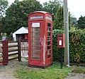
 Flinton phone box.jpg 453 × 640; 136 KB
-
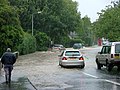
 Flooding - June 2007.JPG 2,816 × 2,120; 813 KB
-
 Footpath through Low Fordon Farm.jpg 640 × 480; 79 KB
-

-
 Former Post Office, Warter (geograph 7054690).jpg 640 × 394; 62 KB
-
 Fridaythorpe village (geograph 5984605).jpg 1,024 × 768; 185 KB
-
 Full Sutton View 1.jpg 640 × 337; 65 KB
-
 Full Sutton.jpg 640 × 478; 114 KB
-
 Hallgate at West Green - geograph.org.uk - 755905.jpg 640 × 480; 76 KB
-

-
 Hard times^ - geograph.org.uk - 1333993.jpg 640 × 401; 57 KB
-
 Harlthorpe Telephone Box - geograph.org.uk - 1299088.jpg 640 × 480; 82 KB
-
 Henry's Amusements, Ulrome - geograph.org.uk - 925169.jpg 640 × 427; 140 KB
-
 Hessle, Prestongate, Hessle Square - panoramio.jpg 1,200 × 614; 334 KB
-
 Hessle, the Indian Hawk(e) - geograph.org.uk - 1293479.jpg 640 × 480; 62 KB
-
 High Catton 1.jpg 640 × 478; 141 KB
-
 Hollym Road Withernsea (geograph 2406998).jpg 640 × 480; 44 KB
-
 Hollym Road, Withernsea (geograph 2096114).jpg 800 × 600; 214 KB
-
 Holmpton Post Office - geograph.org.uk - 281736.jpg 640 × 470; 123 KB
-
 Houses on Main Street, Wetwang (geograph 6457255).jpg 800 × 600; 114 KB
-
 Humber Bridge Viewing Area, Hessle - geograph.org.uk - 978125.jpg 640 × 480; 71 KB
-
 Hutton Cranswick, Village Green - panoramio.jpg 815 × 1,200; 579 KB
-
 Jeans Walk - geograph.org.uk - 287520.jpg 640 × 482; 156 KB
-
 Jenny Brough Lane, Hessle - geograph.org.uk - 466467.jpg 480 × 640; 123 KB
-
 Jenny Brough Lane, Hessle - geograph.org.uk - 912792.jpg 640 × 383; 104 KB
-
 K6 telephone box on Beverley Road, Dunswell (geograph 6104306).jpg 800 × 612; 120 KB
-
 K6 telephone box on Kingston Road (geograph 6116487).jpg 800 × 600; 121 KB
-
 K6 telephone box on Main Street, Welwick (geograph 6378163).jpg 480 × 640; 84 KB
-
 K6 telephone box on Main Street, Wetwang (geograph 6457257).jpg 625 × 800; 108 KB
-
 K6 telephone box on Main Street, Withernwick (geograph 6362852).jpg 800 × 558; 163 KB
-
 K6 telephone box on West Ella Road, Kirk Ella (geograph 6117484).jpg 800 × 579; 166 KB
-
 Keyingham village cross.jpg 640 × 454; 94 KB
-
 Kingston Road, Willerby (geograph 3315464).jpg 800 × 600; 200 KB
-
 Kingston Road, Willerby - geograph.org.uk - 416838.jpg 640 × 416; 285 KB
-

-

-
 Lincoln Arms public house on Lincoln Way, Beverley (geograph 4400588).jpg 1,600 × 1,062; 707 KB
-
 Lissett - geograph.org.uk - 73190.jpg 640 × 480; 112 KB
-
 Lloyds TSB, Beverley - geograph.org.uk - 1567460.jpg 640 × 462; 74 KB
-
 Lowthorpe.jpg 640 × 480; 78 KB
-
 Main Road Bilton.jpg 640 × 480; 74 KB
-
 Main Street (B1445), Welwick (geograph 6376419).jpg 640 × 403; 51 KB
-
 Main Street (east of church) - geograph.org.uk - 452637.jpg 640 × 422; 106 KB
-
 Main street ,Asselby. (geograph 2448157).jpg 480 × 640; 65 KB
-
 Main Street Kilnwick.jpg 640 × 407; 178 KB
-
 Main Street Sigglesthorne.jpg 640 × 426; 215 KB
-
 Main Street, Kilnwick (geograph 5253557).jpg 640 × 480; 61 KB
-
 Main Street, Laxton - geograph.org.uk - 1333576.jpg 640 × 480; 70 KB
-
 Main Street, Skidby - geograph.org.uk - 682058.jpg 640 × 480; 78 KB
-
 Main Street, Watton (geograph 5253594).jpg 640 × 480; 60 KB
-
 Main Street, Watton (geograph 6494189).jpg 5,456 × 3,632; 2.26 MB
-
 Main Street, Watton - geograph.org.uk - 1043435.jpg 640 × 427; 293 KB
-
 Market Cross, Brandesburton - geograph.org.uk - 1352018.jpg 640 × 480; 67 KB
-
 Market Place Farm. - geograph.org.uk - 1025617.jpg 640 × 480; 76 KB
-
 Market Place, Bridlington - geograph.org.uk - 1709643.jpg 800 × 600; 118 KB
-
 Market Place, Bridlington Old Town - geograph.org.uk - 942142.jpg 640 × 480; 82 KB
-
 Market Place, South Cave - geograph.org.uk - 1477241.jpg 640 × 480; 83 KB
-
 Marsh Lane, Ryehill - geograph.org.uk - 1107061.jpg 640 × 426; 181 KB
-
 Meltonby Lane (geograph 3763565).jpg 640 × 427; 100 KB
-
 Meltonby Lane - The Square, Yapham (geograph 5746060).jpg 640 × 409; 139 KB
-
 Millington Village - geograph.org.uk - 16887.jpg 640 × 480; 93 KB
-
 New housing in Wawne, East Yorks. - geograph.org.uk - 803826.jpg 640 × 427; 169 KB
-
 North Church Side, Easington - geograph.org.uk - 981799.jpg 640 × 403; 87 KB
-
 North Ferriby Post Office - geograph.org.uk - 891652.jpg 640 × 490; 218 KB
-
 North Ferriby's communications hub (geograph 5326062).jpg 800 × 600; 95 KB
-
 North Road (B1242), Withernsea (geograph 6375109).jpg 800 × 600; 88 KB
-
 Northside Road Hollym.jpg 523 × 640; 184 KB
-
 Northside Road in Hollym - geograph.org.uk - 1042887.jpg 640 × 480; 153 KB
-
 Old High Street at Swinefleet - geograph.org.uk - 397900.jpg 640 × 480; 68 KB
-
 Paull Primary School - geograph.org.uk - 756965.jpg 640 × 480; 167 KB
-
 Phone box - panoramio.jpg 3,430 × 2,373; 1.64 MB
-
 Phone box at the border (geograph 4205309).jpg 1,024 × 768; 253 KB
-
 Phone box, Skidby - panoramio.jpg 1,200 × 800; 464 KB
-
 Post Office on Church Road, North Ferriby (geograph 5254271).jpg 1,200 × 799; 356 KB
-
 Potter Hill, Beverley - geograph.org.uk - 470560.jpg 473 × 640; 128 KB
-
 Railway Street, Hornsea - geograph.org.uk - 334326.jpg 640 × 419; 100 KB
-
 Redundant telephone kiosk, Main Street, Withernwick (geograph 5598799).jpg 768 × 1,024; 277 KB
-
 Reedness - geograph.org.uk - 508769.jpg 640 × 426; 112 KB
-
 Road junction, Everingham - geograph.org.uk - 1369523.jpg 640 × 392; 189 KB
-
 Road through Yapham near Pocklington (geograph 5609123).jpg 5,184 × 2,920; 6.02 MB
-
 Sanluca restaurant at Hessle Haven - geograph.org.uk - 260174.jpg 640 × 426; 228 KB
-
 Saturday Market, Beverley, Yorkshire (geograph 4557652).jpg 2,535 × 2,237; 2.03 MB
-
 Scholefield Avenue Woodmansey (geograph 6349394).jpg 800 × 600; 122 KB
-
 Seaton Road, Bewholme - geograph.org.uk - 888704.jpg 640 × 543; 192 KB
-
 Shops on Lincoln Way, Beverley (geograph 4400540).jpg 1,600 × 1,062; 493 KB
-
 Sigglesthorne, Main St - panoramio.jpg 1,200 × 721; 491 KB
-
 Signpost to Dancing Lane - geograph.org.uk - 652111.jpg 640 × 485; 138 KB
-
 Skeffling main road - geograph.org.uk - 40946.jpg 640 × 480; 128 KB
-
 Skidby Mill Restaurant - geograph.org.uk - 392063.jpg 640 × 480; 98 KB
-
 Skidby phonebox at sunrise - panoramio.jpg 940 × 639; 70 KB
-
 Skidby Phonebox IMG 6188 - panoramio.jpg 1,200 × 826; 356 KB
-
 Skidby, Main St - panoramio.jpg 1,046 × 611; 150 KB
-
 South Cave looking north. - geograph.org.uk - 1640542.jpg 640 × 480; 61 KB
-

-
 Springfield Way, Anlaby (geograph 5196012).jpg 1,600 × 1,065; 618 KB
-
 St Nicholas Church Institute.jpg 640 × 384; 63 KB
-
 St. Nicholas' Church Institute - geograph.org.uk - 331395.jpg 640 × 417; 130 KB
-
 Station Road, Middleton on the Wolds - geograph.org.uk - 1175860.jpg 640 × 409; 200 KB
-
 Straight lines - geograph.org.uk - 1221126.jpg 640 × 427; 47 KB
-
 Swanland Road Roundabout, Hessle - geograph.org.uk - 1343418.jpg 640 × 360; 51 KB
-
 Telephone box on Main Street, Kilnwick (geograph 5253559).jpg 640 × 480; 74 KB
-

-
 Telephone Box, on the green at Fimber - geograph.org.uk - 685477.jpg 640 × 480; 78 KB
-
 Telephone Exchange Tibthorpe.jpg 640 × 480; 81 KB
-
 Telephone Exchange, Langtoft - geograph.org.uk - 1567689.jpg 640 × 480; 104 KB
-
 The Bay Horse, Cherry Burton - geograph.org.uk - 679603.jpg 640 × 480; 84 KB
-
 The bridge over the beck, Lockington - geograph.org.uk - 799260.jpg 640 × 427; 198 KB
-
 The Charter Club on Pasture Road - geograph.org.uk - 1287176.jpg 640 × 480; 65 KB
-
 The Coach and Horses, China Red, Dunswell (geograph 6104305).jpg 4,761 × 3,297; 3.32 MB
-
 The Crown and Anchor at Kilnsea - geograph.org.uk - 1515290.jpg 640 × 480; 63 KB
-
 The Crown and Anchor, Kilnsea - geograph.org.uk - 1255370.jpg 640 × 428; 57 KB
-
 The Crown and Anchor, Kilnsea - geograph.org.uk - 304973.jpg 640 × 477; 85 KB
-
 The Duke of Cumberland, North Ferriby - geograph.org.uk - 891210.jpg 640 × 428; 197 KB
-
 The exit from Danes Dyke - geograph.org.uk - 47039.jpg 640 × 480; 71 KB
-
 The Meridian Centre on Pier Road, Withernsea (geograph 3606996).jpg 1,024 × 768; 152 KB
-
 The Original Keys, Driffield - geograph.org.uk - 592763.jpg 640 × 480; 75 KB
-
 The Push Inn, Beverley - geograph.org.uk - 1411722.jpg 640 × 480; 74 KB
-
 The Push Inn, Beverley - geograph.org.uk - 800641.jpg 640 × 449; 174 KB
-
 The Push, Saturday Market, Beverley - geograph.org.uk - 811175.jpg 640 × 480; 94 KB
-
 The road into Welwick - geograph.org.uk - 180085.jpg 640 × 467; 99 KB
-

-
 The Village Green, Brandesburton - geograph.org.uk - 591041.jpg 640 × 480; 76 KB
-
 The village pub in Asselby (geograph 3921824).jpg 2,592 × 1,944; 1.6 MB
-
 Thixendale Junction - geograph.org.uk - 746447.jpg 640 × 421; 109 KB
-
 Thorngumbald - geograph.org.uk - 217633.jpg 640 × 480; 111 KB
-
 Tibthorpe.jpg 640 × 480; 134 KB
-
 TK31 detail Tunstall HU12.jpg 3,433 × 5,259; 1.56 MB
-
 TK31 Tunstall Caravan Park, East Yorks HU12.jpg 3,121 × 4,901; 1.88 MB
-
 TK31 Tunstall side view HU12.jpg 2,939 × 5,032; 1.97 MB
-
 Two East Yorkshire icons - geograph.org.uk - 1774904.jpg 480 × 640; 171 KB
-
 Victoria Road (A164), Beverley (geograph 6361410).jpg 640 × 480; 89 KB
-
 War Memorial, Welwick (geograph 6378159).jpg 800 × 600; 198 KB
-
 Wawne - geograph.org.uk - 1201368.jpg 640 × 416; 74 KB
-
 Weel near Beverley - geograph.org.uk - 51691.jpg 640 × 480; 129 KB
-
 Weel.jpg 640 × 465; 101 KB
-
 West End, Walkington - geograph.org.uk - 1772893.jpg 640 × 475; 124 KB
-
 West Green - geograph.org.uk - 391915.jpg 640 × 480; 147 KB
-
 West Green IMG 2584 - panoramio.jpg 1,145 × 1,600; 1.18 MB
-
 Whelans Irish pub (geograph 3435913).jpg 3,970 × 2,194; 1.36 MB
-
 Whelans of Asselby (geograph 4505918).jpg 800 × 533; 83 KB
-
 Whelans of Asselby.jpg 3,967 × 3,003; 2.91 MB
-
 White telephone box on Beverley Road (A1174) (geograph 4351230).jpg 640 × 480; 61 KB
-
 Willerby Methodist Church.jpg 640 × 466; 178 KB
-
 Willerby Square - geograph.org.uk - 103949.jpg 640 × 480; 89 KB
-
 Winestead - geograph.org.uk - 51917.jpg 640 × 480; 140 KB
-
 Winestead cottages - geograph.org.uk - 1739275.jpg 640 × 418; 197 KB
-
 Wood Drive, North Ferriby (geograph 5658034).jpg 640 × 480; 49 KB
-
 Yapham (geograph 5717931).jpg 1,600 × 1,200; 579 KB
-
 Yapham Village - geograph.org.uk - 1049573.jpg 640 × 480; 106 KB
-
 Yorkshire Wolds Way Marker.jpg 567 × 640; 146 KB
.jpg)


.jpg)


.jpg)

.jpg)


.jpg)
.jpg)

.jpg)
_(geograph_6116493).jpg)


.jpg)
.jpg)


.jpg)


.jpg)
.jpg)
.jpg)
.jpg)
.jpg)
.jpg)


.jpg)
.jpg)
.jpg)


_-_geograph.org.uk_-_1293479.jpg)

.jpg)
.jpg)

.jpg)


.jpg)
.jpg)
.jpg)
.jpg)
.jpg)
.jpg)

.jpg)

.jpg)
,_Beverley_(geograph_6361411).jpg)
.jpg)


,_Welwick_(geograph_6376419).jpg)
_-_geograph.org.uk_-_452637.jpg)
.jpg)


.jpg)


.jpg)
.jpg)


.jpg)
.jpg)


.jpg)
,_Withernsea_(geograph_6375109).jpg)


.jpg)

.jpg)


.jpg)


.jpg)

.jpg)
.jpg)

.jpg)


.jpg)


.jpg)
.jpg)


.jpg)


.jpg)


.jpg)


,_Beverley_(geograph_6361410).jpg)
.jpg)


.jpg)
.jpg)

_(geograph_4351230).jpg)


.jpg)
.jpg)

