Category:Teddington
Jump to navigation
Jump to search
English: Teddington is a residential district in the London Borough of Richmond upon Thames. It is covered by London region postal code TW11
largely suburban town centred in the London Borough of Richmond upon Thames  | |||||
| Upload media | |||||
| Instance of | |||||
|---|---|---|---|---|---|
| Location | London Borough of Richmond upon Thames, Greater London, London, England | ||||
| Located in or next to body of water | |||||
| Area |
| ||||
| Different from | |||||
 | |||||
Subcategories
This category has the following 17 subcategories, out of 17 total.
B
- Bridgeman Road, Teddington (7 F)
H
M
N
T
- Teddington Cemetery (424 F)
- Teddington lifeboat station (10 F)
- Teddington railway station (43 F)
- Teddington War Memorial (2 F)
W
Media in category "Teddington"
The following 109 files are in this category, out of 109 total.
-
 "Sailing at Teddington" (3741809863).jpg 800 × 800; 69 KB
-
 A Landing on the Thames near Teddington Lock - panoramio.jpg 4,572 × 3,026; 8.82 MB
-
 A Landscape of Teddington Lock and the Thames - panoramio.jpg 4,592 × 3,056; 10.84 MB
-
 A weir on the Thames Teddington London.jpg 2,272 × 1,704; 484 KB
-
 An Estate Agent's dream^ The Thames at Teddington. - panoramio.jpg 4,416 × 3,312; 4.42 MB
-
 Ancient weapon discovered in a tumulus at Teddington.png 672 × 1,863; 714 KB
-
 Anlaby Road, Teddington - geograph.org.uk - 4048641.jpg 2,304 × 1,728; 807 KB
-
 Austin Teddington.jpg 1,600 × 1,200; 565 KB
-
 Avenue Road, Teddington - geograph.org.uk - 3729146.jpg 1,600 × 1,200; 450 KB
-
 Brad Wiggins.jpg 4,896 × 3,672; 6.42 MB
-
 Broom Park - geograph.org.uk - 5415290.jpg 800 × 600; 146 KB
-
 Broom Road recreation ground, Teddington - geograph.org.uk - 3786967.jpg 2,304 × 1,728; 673 KB
-
 Bus on the Manor Road crossroads, Teddington - geograph.org.uk - 5808921.jpg 2,048 × 1,536; 1.5 MB
-
 Bus on the Manor Road crossroads, Teddington - geograph.org.uk - 5808925.jpg 2,048 × 1,536; 1.52 MB
-
 By the Thames at Lower Ham Road - geograph.org.uk - 376558.jpg 640 × 374; 57 KB
-
 Canbury Gardens Kingston Upon Thames - geograph.org.uk - 358309.jpg 640 × 480; 137 KB
-
 Cattle trough in Park rd, Teddington.JPG 3,099 × 2,042; 714 KB
-
 Clarence Road, Teddington - geograph.org.uk - 3729125.jpg 1,600 × 1,200; 589 KB
-
 Clarence Road, Teddington - geograph.org.uk - 3729136.jpg 1,600 × 1,200; 590 KB
-
 Coleshill Road, Teddington - geograph.org.uk - 5693301.jpg 1,024 × 576; 138 KB
-
 Crossroads on Manor Road, Teddington - geograph.org.uk - 5812516.jpg 2,048 × 1,536; 1.91 MB
-
 Dragon Boat Racing Canbury Gardens - geograph.org.uk - 372053.jpg 640 × 480; 111 KB
-
 Elm Tree Road, Teddington. - geograph.org.uk - 362795.jpg 640 × 370; 57 KB
-
 Ferry Road, Teddington - geograph.org.uk - 2536798.jpg 4,000 × 3,000; 4.15 MB
-
 Flats on Manor Road, Teddington - geograph.org.uk - 5808935.jpg 2,048 × 1,536; 1.57 MB
-
 Flats, Teddington - geograph.org.uk - 4955877.jpg 640 × 349; 49 KB
-
 Footbridge over the railway - geograph.org.uk - 3594645.jpg 1,600 × 1,200; 582 KB
-
 Full English Breakfast in Teddington.JPG 4,896 × 3,672; 7.02 MB
-
 Garden on Manor Road, Teddington - geograph.org.uk - 5812078.jpg 2,048 × 1,536; 2.4 MB
-
 Green Screening - geograph.org.uk - 49807.jpg 640 × 480; 176 KB
-
 Hamble Court - geograph.org.uk - 5420907.jpg 768 × 1,024; 289 KB
-
 Kings Road, Teddington - geograph.org.uk - 4048645.jpg 2,304 × 1,728; 825 KB
-
 Kingston Road in Teddington - geograph.org.uk - 4596164.jpg 1,500 × 956; 226 KB
-
 Kingston Road in Teddington - geograph.org.uk - 4596165.jpg 1,500 × 975; 204 KB
-
 Laurel Road, Teddington - geograph.org.uk - 4048383.jpg 2,304 × 1,728; 799 KB
-
 Lime Kilns, Millers Dale.jpg 1,800 × 1,350; 718 KB
-
 London Buses route 281 Teddington.jpg 1,600 × 1,200; 393 KB
-
 London Buses route 285 Teddington (2).jpg 1,600 × 1,200; 596 KB
-
 London Buses route 285 Teddington.jpg 1,600 × 1,200; 565 KB
-
 London Buses route 481 Teddington (1).jpg 1,600 × 1,200; 584 KB
-
 London Buses route 481 Teddington.jpg 796 × 597; 164 KB
-
 London Buses route 691 Teddington.jpg 1,600 × 1,200; 583 KB
-
 London Buses route R68 Teddington (1).jpg 1,600 × 1,200; 602 KB
-
 London Buses route R68 Teddington.jpg 1,600 × 1,200; 630 KB
-
 London Fire Brigade in front of Park Lane Stables, Teddington.jpg 2,048 × 1,536; 1.18 MB
-
 Manor Road in Twickenham - geograph.org.uk - 4596161.jpg 1,500 × 994; 179 KB
-
 Manor Road Recreation Ground, Teddington - geograph.org.uk - 1021532.jpg 640 × 426; 102 KB
-
 Meripilus giganteus - geograph.org.uk - 49898.jpg 640 × 480; 253 KB
-
 Modern houses on Blandford Road, Teddington - geograph.org.uk - 2272615.jpg 1,600 × 1,200; 628 KB
-
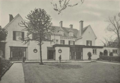 Munster Lodge, Teddington.png 1,043 × 725; 1.13 MB
-
 New Southern Belle (3671473221).jpg 1,253 × 828; 195 KB
-
 Normansfield Park - geograph.org.uk - 49808.jpg 640 × 480; 166 KB
-
 North Lane, Teddington - geograph.org.uk - 3717952.jpg 2,560 × 1,920; 1.03 MB
-
 Old Milepost by the A6, Lees Bottom (geograph 5623835).jpg 1,271 × 2,879; 398 KB
-
 Old sign to Bushy Park on Avenue Road - geograph.org.uk - 3729159.jpg 1,600 × 1,200; 532 KB
-
 Park Lane, Teddington - geograph.org.uk - 3718472.jpg 2,560 × 1,920; 1.06 MB
-
 Park Road, junction with Broad Street, Teddington - geograph.org.uk - 2125974.jpg 4,320 × 3,240; 3.77 MB
-
 Park Way, Teddington - geograph.org.uk - 3717990.jpg 2,560 × 1,920; 2.01 MB
-
 Path between Waldegrave Road and Arlington Road - geograph.org.uk - 3594654.jpg 1,600 × 1,200; 560 KB
-
 Pram Race, Church Road Teddington 1986 - geograph.org.uk - 345440.jpg 640 × 629; 110 KB
-
 Railway Road, Teddington - geograph.org.uk - 2934223.jpg 640 × 480; 118 KB
-
 River Thames near Canbury Gardens - geograph.org.uk - 8665.jpg 640 × 480; 105 KB
-
 Riverside park at Teddington - geograph.org.uk - 2494284.jpg 640 × 480; 105 KB
-
 Rose ringed Parakeet in bitter Almond.jpg 3,648 × 2,736; 1.13 MB
-
 Sacred Heart, Kingston Road - geograph.org.uk - 5330395.jpg 900 × 675; 677 KB
-
 Sacred Heart, Kingston Road - geograph.org.uk - 5330397.jpg 900 × 670; 701 KB
-

-
 Sergeant Brian Needel (6275757933).jpg 597 × 800; 65 KB
-
 Shacklegate Lane railway bridge - geograph.org.uk - 2934251.jpg 640 × 480; 148 KB
-
 Si Solo - geograph.org.uk - 2971074.jpg 4,288 × 3,216; 3.62 MB
-
 Spivack and Moonstone - geograph.org.uk - 2270788.jpg 3,588 × 2,552; 1.06 MB
-
 Spring sunshine, Waldegrave Park - geograph.org.uk - 3393393.jpg 732 × 1,024; 230 KB
-
 St Winifreds Road - geograph.org.uk - 2163606.jpg 640 × 480; 83 KB
-
 Stanley Road - geograph.org.uk - 4045932.jpg 640 × 427; 75 KB
-
 Stanley Road - geograph.org.uk - 4123929.jpg 640 × 428; 87 KB
-

-
 Tamesis.PNG 373 × 280; 89 KB
-
 Teddington - Field Lane - geograph.org.uk - 5092300.jpg 4,608 × 3,456; 6 MB
-
 Teddington - House on Bloom Road - geograph.org.uk - 5092305.jpg 4,608 × 3,456; 6.22 MB
-
 Teddington - Jubilee water fountain & the pub that used to be the Clarence1.JPG 2,618 × 3,533; 749 KB
-
 Teddington - Jubilee water fountain.JPG 2,736 × 3,648; 1.91 MB
-
 Teddington - Large Victorian House in Gloucester Road - geograph.org.uk - 5092285.jpg 4,608 × 3,456; 6.04 MB
-
 Teddington Lock - panoramio (1).jpg 4,311 × 2,815; 7.59 MB
-
 Teddington Lock on the Thames - panoramio.jpg 4,126 × 2,725; 6.83 MB
-
 Teddington, Grove Gardens, Diana statue (1).jpg 2,666 × 4,000; 3.05 MB
-
 Teddington, Grove Gardens, Diana statue (2).jpg 2,001 × 3,000; 1.76 MB
-
 Teddington, Grove Gardens.jpg 3,000 × 2,000; 1.31 MB
-
 Teddington, Jubilee water fountain inscription.JPG 2,736 × 3,648; 2.45 MB
-
 Teddington, Poppies.jpg 2,666 × 4,000; 2 MB
-
 Teddington, Udney Hall Gardens.jpg 3,000 × 1,844; 2.18 MB
-
 Teddington, Udney Park Playing Fields.jpg 4,750 × 1,624; 1.52 MB
-
 Teddington, UK - panoramio - Ed Parsons (1).jpg 1,280 × 856; 173 KB
-
 Teddington, UK - panoramio - Ed Parsons (2).jpg 1,280 × 856; 214 KB
-
 Teddington, UK - panoramio - Ed Parsons (3).jpg 1,280 × 856; 160 KB
-
 Teddington, UK - panoramio - Ed Parsons.jpg 1,280 × 856; 253 KB
-
 Teddington, UK - panoramio.jpg 1,280 × 856; 249 KB
-
-
 The Thames nr. Teddington Lock. - panoramio.jpg 4,416 × 2,150; 3.39 MB
-
 The Travelodge on Station Road, Teddington - geograph.org.uk - 4048367.jpg 2,304 × 1,728; 673 KB
-
 The Weir at Teddington Lock - panoramio.jpg 4,592 × 3,056; 2.01 MB
-
 Tram at Teddington, c. 1905 (4545470618).jpg 1,000 × 664; 218 KB
-
 Tram in Teddington (3741809063).jpg 797 × 800; 95 KB
-
 Triumph Herald 1200 in Teddington (1).jpg 1,600 × 1,200; 588 KB
-
 Triumph Herald 1200 in Teddington.jpg 1,600 × 1,200; 568 KB
-
 Twickenham Road, Strawberry Hill - geograph.org.uk - 2653694.jpg 640 × 480; 80 KB
-
 Two+riders+in+front+of+the+stables+and+two+children+on+the+pavement.jpg 1,916 × 1,277; 314 KB
-
 Waldegrave Park, Teddington - geograph.org.uk - 2019770.jpg 3,872 × 2,499; 4.18 MB
-
 Wick Road, Teddington - geograph.org.uk - 3729182.jpg 1,600 × 1,200; 578 KB
-
 York rd, Teddington.jpg 3,648 × 2,736; 2.09 MB
.jpg)


.jpg)

.jpg)


.jpg)


.jpg)


.jpg)


.jpg)


.jpg)

.jpg)
.jpg)


.jpg)
.jpg)
.jpg)


.jpg)
.jpg)
.jpg)


