Category:Tauberland
Jump to navigation
Jump to search
area in Germany   | |||||
| Upload media | |||||
| Instance of | |||||
|---|---|---|---|---|---|
| Location | |||||
 | |||||
Deutsch: Das Tauberland ist ein Naturraum der Neckar- und Tauber-Gäuplatten (Haupteinheit 12) im Südwestdeutschen Schichtstufenland. Es führt die Nr. 129 in der Systematik des Handbuchs der naturräumlichen Gliederung Deutschlands. Das Tauberland gliedert sich naturräumlich wie folgt:
- 129 Tauberland
- 129.0 Umpfer-Wachbach-Riedel
- 129.01 Königheimer Tal
- 129.1 Südliche Tauberplatten
- 129.2 Freudenbacher Platte
- 129.3 Taubergrund
- 129.30 Mittleres Taubertal
- 129.31 Vorbachtal
- 129.32 Wittigbachtal
- 129.4 Tauberberg
- 129.40 Unterbalbach-Röttinger Riedel
- 129.41 Messelhäuser Hochfläche
- 129.42 Großrinderfelder Fläche
- 129.43 Werbach-Böttigheimer Tal
- 129.0 Umpfer-Wachbach-Riedel
Subcategories
This category has the following 14 subcategories, out of 14 total.
F
- Freudenbacher Platte (1 F)
G
- Großrinderfelder Fläche (1 F)
K
- Königheimer Tal (2 F)
M
- Messelhäuser Hochfläche (4 F)
- Mittleres Taubertal (1 F)
S
- Südliche Tauberplatten (1 F)
T
- Tauberberg (1 F)
- Taubergrund (12 F)
- Taubertal bei Bieberehren (1 F)
U
- Umpfer-Wachbach-Riedel (2 F)
V
- Vorbachtal (2 F)
W
- Werbach-Böttigheimer Tal (1 F)
Media in category "Tauberland"
The following 7 files are in this category, out of 7 total.
-
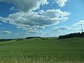
 AIMG 3596 Richtung Taubertal (Felder, Panorama).jpg 5,184 × 1,822; 1.44 MB
-
 AIMG 3596 Richtung Taubertal.jpg 5,184 × 3,888; 3.89 MB
-
 Bairdientone 040410.jpg 2,500 × 1,875; 4.38 MB
-
 Reliefkarte Tauber.jpg 2,364 × 1,978; 2.82 MB
-
 Sorbus dubronensis 200513.jpg 2,500 × 2,023; 3.24 MB
-
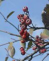 Sorbus dubronensis 220913.jpg 1,872 × 2,320; 2.26 MB
-
 Tauberkarte.jpg 650 × 520; 30 KB


.jpg)