Category:Tarrant Gunville
Jump to navigation
Jump to search
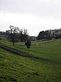
English: Tarrant Gunville is a village in north Dorset, England, situated at the head of the Tarrant Valley on Cranborne Chase five miles north east of Blandford Forum. The village has a population of 236 .
village and civil parish in Dorset, United Kingdom  | |||||
| Upload media | |||||
| Instance of | |||||
|---|---|---|---|---|---|
| Location | Dorset, South West England, England | ||||
 | |||||
Subcategories
This category has the following 4 subcategories, out of 4 total.
Media in category "Tarrant Gunville"
The following 200 files are in this category, out of 226 total.
(previous page) (next page)-
 AA sign at Tarrant Gunville - geograph.org.uk - 223210.jpg 640 × 480; 56 KB
-
 Ashmore Bottom - geograph.org.uk - 1347234.jpg 640 × 480; 94 KB
-
 Ashmore Bottom - geograph.org.uk - 1347270.jpg 640 × 480; 115 KB
-
 Ashmore Bottom - geograph.org.uk - 317348.jpg 480 × 640; 63 KB
-
 Ashmore Plantation - geograph.org.uk - 1347243.jpg 640 × 480; 114 KB
-
 Ashmore Plantation - geograph.org.uk - 321691.jpg 640 × 480; 143 KB
-
 Autumn Colour, Tarrant Gunville - geograph.org.uk - 1027417.jpg 640 × 480; 126 KB
-
 Autumn comes to Eastbury - geograph.org.uk - 1027703.jpg 640 × 480; 151 KB
-
 Barn with postbox, Stubhampton - geograph.org.uk - 1829345.jpg 640 × 480; 143 KB
-
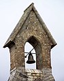 Bell cote, Trarrant Gunville - geograph.org.uk - 1027659.jpg 504 × 640; 71 KB
-

-
 Bridleway junction at the corner of Great Peaky Coppice - geograph.org.uk - 6396660.jpg 3,776 × 2,520; 3.05 MB
-
 Chettle, brassicas - geograph.org.uk - 4758233.jpg 1,024 × 768; 178 KB
-
 Chettle, stile - geograph.org.uk - 4758234.jpg 1,024 × 768; 247 KB
-
 Church path at Tarrant Gunville - geograph.org.uk - 223200.jpg 640 × 480; 120 KB
-
 Dead mouse, St Mary's Churchyard - geograph.org.uk - 1829299.jpg 640 × 480; 246 KB
-

-
 Domestic Geese, Stubhampton - geograph.org.uk - 1347152.jpg 479 × 640; 128 KB
-
 Ewes and lambs near Stubhampton - geograph.org.uk - 1347163.jpg 480 × 640; 119 KB
-
 Farmland near Caesar's Camp - geograph.org.uk - 269257.jpg 640 × 480; 65 KB
-
 Farmland south of Caesar's Camp - geograph.org.uk - 269255.jpg 640 × 480; 57 KB
-
 Finger post, Tarrant Gunville - geograph.org.uk - 1027617.jpg 480 × 640; 144 KB
-
 Footpath, Trarrant Gunville - geograph.org.uk - 1027688.jpg 640 × 480; 154 KB
-
 Forge Cottage, Tarrant Gunville - geograph.org.uk - 1027536.jpg 640 × 484; 51 KB
-
 Former school, Tarrant Gunville - geograph.org.uk - 1027657.jpg 640 × 480; 69 KB
-
 Garages, Tarrant Gunville - geograph.org.uk - 1027668.jpg 640 × 449; 86 KB
-
 Gates of White Kennels - geograph.org.uk - 299856.jpg 640 × 480; 138 KB
-
 Granary in the grounds of Eastbury House - geograph.org.uk - 981647.jpg 640 × 445; 409 KB
-
 Gunville Down - geograph.org.uk - 4801329.jpg 1,024 × 768; 181 KB
-

-
 Horse jump, Ashmore Bottom - geograph.org.uk - 1347226.jpg 640 × 481; 129 KB
-
 Iwerne Stepleton, track - geograph.org.uk - 4801315.jpg 768 × 1,024; 329 KB
-
 Kissing gate, Tarrant Gunville - geograph.org.uk - 1027696.jpg 640 × 480; 148 KB
-
 Little Tarrant - geograph.org.uk - 1027635.jpg 640 × 480; 102 KB
-
 Llamas, near Tarrant Gunville - geograph.org.uk - 1042761.jpg 640 × 480; 82 KB
-
 Log Stacks by Lime Pit Coppice - geograph.org.uk - 6392121.jpg 5,184 × 3,456; 7.56 MB
-
 Looking along the Southern Edge of Hanging Coppice - geograph.org.uk - 6392127.jpg 5,184 × 3,456; 7.15 MB
-
-
 Old granary at Eastbury - geograph.org.uk - 2407624.jpg 1,024 × 768; 138 KB
-

-
 Pheasant feeding strip - geograph.org.uk - 301687.jpg 480 × 640; 66 KB
-

-
 Postbox, Stubhampton - geograph.org.uk - 1829361.jpg 480 × 640; 163 KB
-
 Railings in Little Wood - geograph.org.uk - 1028301.jpg 640 × 480; 152 KB
-

-
 Riverside Cottage - geograph.org.uk - 301672.jpg 640 × 480; 75 KB
-
 School Lane, Tarrant Gunville - geograph.org.uk - 1027642.jpg 640 × 480; 122 KB
-
 Sheep at Eastbury - geograph.org.uk - 1027862.jpg 640 × 480; 109 KB
-
 Sheep grazing by the Tarrant - geograph.org.uk - 299833.jpg 640 × 480; 72 KB
-
 Sheep Grazing on Main Down - geograph.org.uk - 299814.jpg 640 × 480; 103 KB
-
 Sheep, Eastbury Estate - geograph.org.uk - 1022966.jpg 640 × 480; 103 KB
-
 Sign detail, Tarrant Gunville - geograph.org.uk - 1829259.jpg 640 × 480; 110 KB
-
 Solomon's Quarter - geograph.org.uk - 1027885.jpg 640 × 460; 97 KB
-
 Solomon's Quarter - geograph.org.uk - 1027888.jpg 640 × 450; 88 KB
-
 Stile, Jubilee Trail - geograph.org.uk - 1027988.jpg 640 × 480; 144 KB
-
 Stubhampton, flooded road - geograph.org.uk - 4800387.jpg 1,024 × 768; 155 KB
-
 Tarrant Gunville - geograph.org.uk - 1042773.jpg 640 × 480; 42 KB
-
 Tarrant Gunville Reservoir - geograph.org.uk - 301195.jpg 640 × 480; 117 KB
-
 Tarrant Gunville Reservoir - geograph.org.uk - 4800390.jpg 1,024 × 768; 142 KB
-
 Tarrant Gunville, beehives - geograph.org.uk - 4801208.jpg 1,024 × 768; 186 KB
-
 Tarrant Gunville, bridleway - geograph.org.uk - 4800411.jpg 1,024 × 768; 131 KB
-
 Tarrant Gunville, bridleway crossroads - geograph.org.uk - 4800467.jpg 1,024 × 768; 244 KB
-
 Tarrant Gunville, country road - geograph.org.uk - 4800339.jpg 1,024 × 768; 190 KB
-
 Tarrant Gunville, country road - geograph.org.uk - 4800397.jpg 1,024 × 768; 144 KB
-
 Tarrant Gunville, Drove Barn - geograph.org.uk - 4800350.jpg 1,024 × 768; 241 KB
-
 Tarrant Gunville, farm entrance road - geograph.org.uk - 4800360.jpg 1,024 × 768; 148 KB
-
 Tarrant Gunville, farm road - geograph.org.uk - 4758236.jpg 1,024 × 768; 209 KB
-
 Tarrant Gunville, farm track - geograph.org.uk - 4801294.jpg 1,024 × 768; 216 KB
-
 Tarrant Gunville, farmyard - geograph.org.uk - 4800355.jpg 1,024 × 771; 143 KB
-
 Tarrant Gunville, finger post - geograph.org.uk - 1142626.jpg 640 × 480; 98 KB
-
 Tarrant Gunville, finger-post detail - geograph.org.uk - 1989721.jpg 640 × 480; 101 KB
-
 Tarrant Gunville, footpath - geograph.org.uk - 4758235.jpg 1,024 × 768; 205 KB
-
 Tarrant Gunville, footpath - geograph.org.uk - 4758239.jpg 1,024 × 768; 273 KB
-
 Tarrant Gunville, footpath - geograph.org.uk - 4758240.jpg 1,024 × 768; 233 KB
-
 Tarrant Gunville, footpath - geograph.org.uk - 4801273.jpg 1,024 × 768; 188 KB
-
 Tarrant Gunville, forestry track - geograph.org.uk - 4800443.jpg 1,024 × 768; 276 KB
-
 Tarrant Gunville, gate - geograph.org.uk - 4758243.jpg 1,024 × 768; 261 KB
-
 Tarrant Gunville, gate - geograph.org.uk - 4801217.jpg 1,024 × 768; 268 KB
-
 Tarrant Gunville, gateway - geograph.org.uk - 4758051.jpg 1,024 × 768; 278 KB
-
 Tarrant Gunville, gateway - geograph.org.uk - 4758247.jpg 1,024 × 768; 199 KB
-
 Tarrant Gunville, Harbin's Park - geograph.org.uk - 4801201.jpg 1,024 × 768; 182 KB
-
 Tarrant Gunville, high seat - geograph.org.uk - 4800455.jpg 1,024 × 769; 289 KB
-
 Tarrant Gunville, Home Farm - geograph.org.uk - 4800383.jpg 1,024 × 768; 146 KB
-
 Tarrant Gunville, Jubilee Trail - geograph.org.uk - 4801325.jpg 1,024 × 768; 305 KB
-
 Tarrant Gunville, marker - geograph.org.uk - 4801257.jpg 768 × 1,024; 257 KB
-
 Tarrant Gunville, marker - geograph.org.uk - 4801336.jpg 1,024 × 768; 221 KB
-
 Tarrant Gunville, mound - geograph.org.uk - 4758237.jpg 1,024 × 768; 148 KB
-
 Tarrant Gunville, notice - geograph.org.uk - 4801308.jpg 768 × 1,024; 287 KB
-
 Tarrant Gunville, Park Pale - geograph.org.uk - 4800435.jpg 1,024 × 768; 349 KB
-
 Tarrant Gunville, Park Pale - geograph.org.uk - 4801227.jpg 1,024 × 768; 265 KB
-
 Tarrant Gunville, Park Pale - geograph.org.uk - 4801236.jpg 1,024 × 768; 289 KB
-

-
 Tarrant Gunville, red telephone box - geograph.org.uk - 3513140.jpg 640 × 480; 113 KB
-
 Tarrant Gunville, road junction - geograph.org.uk - 4800319.jpg 1,024 × 768; 177 KB
-
 Tarrant Gunville, safety first - geograph.org.uk - 525985.jpg 431 × 640; 74 KB
-
 Tarrant Gunville, sheep grazing - geograph.org.uk - 4758250.jpg 1,024 × 768; 196 KB
-
 Tarrant Gunville, signpost - geograph.org.uk - 4800308.jpg 1,024 × 768; 261 KB
-
 Tarrant Gunville, Solomon's Quarter - geograph.org.uk - 4758238.jpg 1,024 × 768; 133 KB
-
 Tarrant Gunville, St. Mary's - geograph.org.uk - 4800294.jpg 1,024 × 768; 208 KB
-
 Tarrant Gunville, stubble field - geograph.org.uk - 4800333.jpg 1,024 × 768; 211 KB
-
 Tarrant Gunville, The Forge - geograph.org.uk - 4758245.jpg 1,024 × 768; 119 KB
-
 Tarrant Gunville, the Tarrant - geograph.org.uk - 4758248.jpg 1,024 × 768; 160 KB
-

-
 Tarrant Gunville, timber - geograph.org.uk - 4800405.jpg 1,024 × 768; 160 KB
-
 Thatched Cottage at Tarrant Gunville - geograph.org.uk - 5209136.jpg 640 × 427; 44 KB
-
 The gates to White Kennels - geograph.org.uk - 357210.jpg 640 × 480; 180 KB
-
 The lane to Furzey Down Farm, in early May - geograph.org.uk - 2407144.jpg 1,024 × 768; 298 KB
-

-
 The Wessex Ridgeway path alongside Great Peaky Coppice - geograph.org.uk - 6400892.jpg 3,776 × 2,520; 3.97 MB
-
 Track, Ashmore Bottom - geograph.org.uk - 1347214.jpg 640 × 480; 132 KB
-

-
 Water Tank in Lime Pit Coppice - geograph.org.uk - 301576.jpg 480 × 640; 168 KB
-
 Water trough, Eastbury - geograph.org.uk - 1027872.jpg 640 × 480; 140 KB
-
 Weather vane, Tarrant Gunville - geograph.org.uk - 1022971.jpg 640 × 480; 27 KB
-
 Wessex Ridgeway along the Edge of Ashmore Wood - geograph.org.uk - 6392151.jpg 5,184 × 3,456; 6.73 MB
-
 Wessex Ridgeway in Stubhampton Bottom - geograph.org.uk - 6392143.jpg 5,184 × 3,456; 7.7 MB
-
 Approaching Park Pale - geograph.org.uk - 310871.jpg 480 × 640; 111 KB
-
 Zareba Clump, Eastbury House - geograph.org.uk - 5209091.jpg 640 × 427; 47 KB
-
 Ash Down - geograph.org.uk - 311924.jpg 640 × 480; 82 KB
-
 Back of Furzey Down Farm - geograph.org.uk - 310890.jpg 640 × 480; 85 KB
-
 Bales on Westbury Farm - geograph.org.uk - 301183.jpg 640 × 480; 78 KB
-
 Barn on Westbury Farm - geograph.org.uk - 301184.jpg 640 × 480; 82 KB
-
 Barn opposite Dairy Farm, Stubhampton - geograph.org.uk - 301640.jpg 640 × 480; 76 KB
-
 Barns at Barton Hill Dairy - geograph.org.uk - 299848.jpg 640 × 480; 104 KB
-
 Barton Hill - geograph.org.uk - 299840.jpg 640 × 480; 37 KB
-
 Barton Hill and Barton Hill Dairy - geograph.org.uk - 299847.jpg 640 × 480; 42 KB
-
 Barton Hill Dairy - geograph.org.uk - 299844.jpg 640 × 480; 64 KB
-
 Behind Tarrant Gunville - geograph.org.uk - 301683.jpg 640 × 480; 101 KB
-
 Beside Great Peaky Coppice - geograph.org.uk - 301583.jpg 640 × 480; 87 KB
-
 Beside Heron Grove Coppice - geograph.org.uk - 301579.jpg 480 × 640; 91 KB
-
 Beside Lime Pit Coppice - geograph.org.uk - 301570.jpg 640 × 480; 108 KB
-
 Beside Lower Well Wood - geograph.org.uk - 310731.jpg 640 × 480; 90 KB
-
 Bishop's Coppice - geograph.org.uk - 310859.jpg 640 × 480; 62 KB
-

-
 Converted farm building - geograph.org.uk - 301671.jpg 640 × 480; 95 KB
-
 Cottages at Tarrant Gunville - geograph.org.uk - 223203.jpg 640 × 480; 151 KB
-
 Cows and shed on Bussey Stool Farm - geograph.org.uk - 301663.jpg 640 × 480; 98 KB
-
 Cows feed on Bussey Stool Farm - geograph.org.uk - 301665.jpg 640 × 480; 79 KB
-
 Dairy Farm house, Stubhampton - geograph.org.uk - 301639.jpg 480 × 640; 70 KB
-
 Dairy Farm, Stubhampton - geograph.org.uk - 301637.jpg 640 × 480; 77 KB
-
 Down farmland near Harbin's Park - geograph.org.uk - 301212.jpg 640 × 480; 85 KB
-
 Drove Barn - geograph.org.uk - 301169.jpg 640 × 480; 95 KB
-
 Drove Barn from the road - geograph.org.uk - 301178.jpg 640 × 480; 109 KB
-
 Dungrove Hill - geograph.org.uk - 301622.jpg 640 × 480; 70 KB
-
 Dungrove Rows - geograph.org.uk - 301659.jpg 640 × 480; 56 KB
-
 Dutch Barn near Harbin's Park - geograph.org.uk - 301214.jpg 640 × 480; 107 KB
-
 Earl Hill - geograph.org.uk - 301601.jpg 640 × 480; 63 KB
-
 Eastern Edge of Main Down Plantation - geograph.org.uk - 301654.jpg 640 × 480; 109 KB
-
 Edge of Pimperne Wood - geograph.org.uk - 311914.jpg 640 × 480; 119 KB
-
 Entrance to Eastbury House - geograph.org.uk - 357249.jpg 640 × 480; 138 KB
-
 Entrance to Westbury Farm - geograph.org.uk - 301179.jpg 640 × 480; 164 KB
-
 Fallen tree on track near Greenclose Farm - geograph.org.uk - 299815.jpg 640 × 480; 153 KB
-
 Fancy signpost - geograph.org.uk - 310885.jpg 480 × 640; 100 KB
-
 Farmland and woods near Chettle - geograph.org.uk - 280532.jpg 640 × 480; 89 KB
-

-
 Farmland near Chettle - geograph.org.uk - 280525.jpg 640 × 480; 68 KB
-
 Farmland on Dungrove Farm - geograph.org.uk - 301669.jpg 640 × 480; 60 KB
-
 Farmland opposite Westbury Farm - geograph.org.uk - 301166.jpg 640 × 480; 78 KB
-

-
 Gate at Tarrant Gunville Reservoir - geograph.org.uk - 301198.jpg 640 × 480; 120 KB
-
 Grand Entrance to Eastbury House - geograph.org.uk - 310895.jpg 640 × 480; 103 KB
-
 Great Peaky Coppice - Private - geograph.org.uk - 301584.jpg 480 × 640; 151 KB
-
 Greenclose Farm - geograph.org.uk - 299810.jpg 640 × 480; 94 KB
-
 Grounds of Eastbury House - geograph.org.uk - 280548.jpg 640 × 480; 107 KB
-
 Gunville Down - geograph.org.uk - 301201.jpg 640 × 480; 67 KB
-
 Gunville Down south - geograph.org.uk - 311906.jpg 640 × 480; 95 KB
-
 Handcock's Bottom - geograph.org.uk - 310880.jpg 480 × 640; 62 KB
-
 Harbin's Park farmland - geograph.org.uk - 310851.jpg 640 × 480; 62 KB
-
 Hatts Coppice - geograph.org.uk - 299811.jpg 480 × 640; 156 KB
-
 Holmes Common, Stubhampton - geograph.org.uk - 301625.jpg 640 × 480; 71 KB
-
 Inside Pimperne Wood - geograph.org.uk - 312792.jpg 640 × 480; 163 KB
-
 Jump by Pimperne Wood - geograph.org.uk - 312798.jpg 640 × 480; 96 KB
-
 Lime Pit Coppice - geograph.org.uk - 301567.jpg 480 × 640; 152 KB
-
 Little Wood near Chettle - geograph.org.uk - 280534.jpg 640 × 480; 70 KB
-
 Looking back towards Chettle - geograph.org.uk - 280544.jpg 640 × 480; 77 KB
-
 Looking into Harbin's Park - geograph.org.uk - 310727.jpg 640 × 480; 103 KB
-
 Main Down south - geograph.org.uk - 301655.jpg 640 × 480; 61 KB
-
 North Farm Dairy, Tarrant Hinton - geograph.org.uk - 299835.jpg 640 × 480; 69 KB
-
 Northern edge of Main Down Plantation - geograph.org.uk - 301653.jpg 640 × 480; 146 KB
-
 Old Farm Machinery on Greenclose Farm - geograph.org.uk - 299813.jpg 640 × 480; 164 KB
-
 Pheasant pen on Gunville Down - geograph.org.uk - 312829.jpg 640 × 480; 75 KB
-
 Pits (dis) - geograph.org.uk - 301565.jpg 640 × 480; 95 KB
-
 Pumps at Eastbury Farmhouse - geograph.org.uk - 299859.jpg 640 × 480; 140 KB
-
 Ride from Pimperne Wood - geograph.org.uk - 312801.jpg 480 × 640; 90 KB
-

-
 Sewage Works, Stubhampton - geograph.org.uk - 301645.jpg 640 × 480; 135 KB
-
 Sheds at Drove Barn - geograph.org.uk - 301174.jpg 640 × 480; 92 KB
-
 Sheep grazing on Stubhampton Down - geograph.org.uk - 301594.jpg 640 × 480; 59 KB
-
 Southeast Corner of Pimperne Wood - geograph.org.uk - 312787.jpg 640 × 480; 110 KB
-
 Southeastern end of Bishop's Coppice - geograph.org.uk - 310858.jpg 640 × 480; 62 KB
-

-
 Stubhampton Down - geograph.org.uk - 301606.jpg 640 × 480; 68 KB
-
 Stubhampton Manor Farm - geograph.org.uk - 301644.jpg 640 × 480; 124 KB
-
 Tatty barn at Barton Hill Dairy - geograph.org.uk - 299841.jpg 640 × 480; 91 KB
-
 Thatched Cottage in Stubhampton - geograph.org.uk - 301614.jpg 640 × 480; 95 KB
-
 The "river" Tarrant - geograph.org.uk - 301680.jpg 640 × 480; 132 KB
-

-
 The Lane to Furzey Down Farm - geograph.org.uk - 301595.jpg 640 × 480; 125 KB
-
 The road from the Tarrants - geograph.org.uk - 301588.jpg 480 × 640; 111 KB
-


_-_geograph.org.uk_-_301565.jpg)


