Category:Tallaght
Jump to navigation
Jump to search
county town of South Dublin, Ireland  Центр пригорода | |||||
| Upload media | |||||
| Instance of | |||||
|---|---|---|---|---|---|
| Location |
| ||||
| Elevation above sea level |
| ||||
| Different from | |||||
| official website | |||||
 | |||||
Subcategories
This category has the following 17 subcategories, out of 17 total.
B
F
- Fortunestown Inn (1 F)
N
- Newlands House (1 F)
O
- Old Bawn House (5 F)
R
S
- St Basil's Training Centre (8 F)
T
- Tallaght Castle (3 F)
- Tallaght Stadium (25 F)
- Tallaght University Hospital (2 F)
- The Dragon Inn (1 F)
- The Square, Tallaght (5 F)
- TU Dublin - Tallaght (empty)
Media in category "Tallaght"
The following 83 files are in this category, out of 83 total.
-

-

-
 Belgard Square West, Tallaght, Dublin - geograph.org.uk - 2586567.jpg 716 × 1,024; 208 KB
-
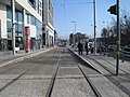
 Belgard tram stop, Belgard - geograph.org.uk - 2108176.jpg 1,024 × 661; 166 KB
-
 Belgard tram stop, Belgard - geograph.org.uk - 2108223.jpg 1,024 × 673; 188 KB
-
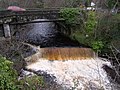 Bridge at Bohernabreena - geograph.org.uk - 304231.jpg 640 × 479; 125 KB
-
 Castletymon Public Library - geograph.org.uk - 477643.jpg 640 × 480; 116 KB
-
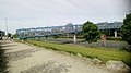
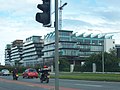
 CentralTallaght.jpg 800 × 534; 141 KB
-
-
 Coláiste de hÍde - Tamhlacht - Tallaght.jpg 640 × 480; 111 KB
-

-
 Construction work at Belgard tram stop, Belgard - geograph.org.uk - 2108128.jpg 1,024 × 666; 210 KB
-
 Cookstown Court, Old Belgard Road, Belgard - geograph.org.uk - 2107960.jpg 1,024 × 666; 166 KB
-
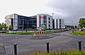
 County Hall South Dublin County Council Tallaght (2019).jpg 1,450 × 1,876; 817 KB
-
 County Hall Tallaght.jpg 5,184 × 3,456; 6.95 MB
-
-
 D.I.D Electrical store in Tallaght.jpg 1,024 × 675; 272 KB
-
 Dollymount House, Tallaght.jpg 1,592 × 782; 131 KB
-
 Down Bawnlea Avenue - geograph.org.uk - 809903.jpg 640 × 480; 65 KB
-
 Dublin Mountains Way Tallaght Trailhead.jpg 3,097 × 2,752; 4.6 MB
-
 End of the line at Tallaght, Dublin - geograph.org.uk - 2540440.jpg 1,024 × 663; 188 KB
-
 Fortunestown Way - geograph.org.uk - 809885.jpg 640 × 480; 66 KB
-
 General View, Tallaght, Co. Dublin (19702910292).jpg 2,000 × 1,318; 1.28 MB
-
 Harper's weekly (1867) (14759904866).jpg 2,800 × 1,892; 1.23 MB
-
 Looking east by Tallaght tram stop, Dublin - geograph.org.uk - 2586764.jpg 1,024 × 683; 213 KB
-
 LUAS Red Line terminus in Tallaght.jpg 2,386 × 1,435; 1.2 MB
-
 LUAS Red Line tramway at Cookstown - geograph.org.uk - 2109169.jpg 1,024 × 650; 191 KB
-

-
 LUAS tram no. 3013 at Tallaght, Dublin - geograph.org.uk - 2540478.jpg 1,024 × 669; 182 KB
-
 McDonald's, Belgard Road, Tallaght, Dublin - geograph.org.uk - 2655189.jpg 1,024 × 678; 170 KB
-

-

-
 Old bawn Tallaght McInerney builders for sale sign October 1975.png 1,334 × 750; 2.16 MB
-
 OldBawnBridge.JPG 5,184 × 3,456; 7.8 MB
-
 Out me attic.jpg 640 × 480; 89 KB
-
 PARK TALLAGHT.jpg 1,600 × 706; 473 KB
-
 Postcard Tallaght probably the latter end of 1900-1914.jpg 1,794 × 1,154; 581 KB
-
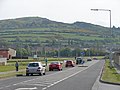
 Roundabout Near Jobstown - geograph.org.uk - 809910.jpg 640 × 480; 55 KB
-
 Roundabout on Old Belgard Road, Belgard - geograph.org.uk - 2108026.jpg 1,024 × 668; 164 KB
-
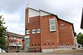
 Rua Red Arts Centre Tallaght (2019).jpg 2,590 × 1,454; 1,009 KB
-
 Second Avenue, Cookstown - geograph.org.uk - 2109179.jpg 1,024 × 649; 143 KB
-

-

-
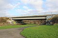 SpawellBridge.JPG 5,184 × 3,456; 7.12 MB
-
 St. Maelruan's Font, Tallaght, Co. Dublin.jpg 2,000 × 1,669; 1.9 MB
-
 Tallacht LUAS tram terminus - geograph.org.uk - 3361246.jpg 1,024 × 768; 183 KB
-
 Tallaght - aerial view 170808.jpg 2,930 × 1,953; 2.78 MB
-
 Tallaght - LUAS Tram terminus - geograph.org.uk - 4634923.jpg 1,024 × 768; 210 KB
-
 Tallaght - View N along Belgard Square W - geograph.org.uk - 4634935.jpg 1,024 × 768; 237 KB
-
 Tallaght BridgeN81-2.jpg 2,736 × 4,864; 5.27 MB
-
 Tallaght BridgeN81.jpg 4,864 × 2,736; 4.56 MB
-
 Tallaght Centre, South Dublin, 2007.jpg 2,589 × 1,741; 1.21 MB
-
 Tallaght Hospital (2019).jpg 2,574 × 1,446; 1.37 MB
-
 Tallaght Hospital.jpg 1,198 × 854; 204 KB
-
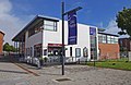
 Tallaght Library (2019).jpg 2,590 × 1,454; 1.16 MB
-
 Tallaght Library - Tamhlacht Leabharlann (48060521808).jpg 5,184 × 3,456; 6.13 MB
-
 Tallaght Luas stop bilingual sign (2019).jpg 2,586 × 1,454; 1.3 MB
-
 Tallaght Luas Stop.jpg 5,184 × 3,456; 6.36 MB
-
 Tallaght N81.jpg 4,864 × 2,736; 4.83 MB
-
 Tallaght PlazaHotel.jpg 4,864 × 2,736; 4.29 MB
-

-
 Tallaght Stadium main stand (2017).jpg 2,048 × 1,536; 718 KB
-
 Tallaght Tamhlacht (48060476146).jpg 5,184 × 3,456; 9.36 MB
-
 Tallaght Tamhlacht (48060476516).jpg 5,184 × 3,456; 8 MB
-
 Tallaght Tamhlacht (48060520973).jpg 5,032 × 3,320; 9.45 MB
-
 Tallaght Tamhlacht (48060522703).jpg 5,184 × 3,456; 6.21 MB
-
 Tallaght Tamhlacht (48060572007).jpg 5,120 × 3,432; 10.94 MB
-
 Tallaght Tamhlacht (48060572652).jpg 5,184 × 3,456; 6.42 MB
-
 Tallaght village with steam tram in 1907.jpg 1,622 × 1,023; 407 KB
-
 The approach to Belgard tram stop, Belgard - geograph.org.uk - 2108148.jpg 1,024 × 678; 170 KB
-
 The Dragon Inn, Tallaght - geograph.org.uk - 730994.jpg 640 × 414; 95 KB
-
 The Square Shopping Centre, Tallaght, Dublin - geograph.org.uk - 2586485.jpg 1,024 × 667; 262 KB
-
The Tallaght Drug & Alcohol Task Force in early 2023 - Near FM (2023).ogg 20 min 5 s, 1,280 × 720; 53.88 MB
-
 The Tallaght Stadium (2017).jpg 2,048 × 1,536; 466 KB
-
 The Tallaght Stadium in 2017.jpg 2,048 × 1,536; 614 KB
-
 The Whitestown Way - geograph.org.uk - 2133563.jpg 3,456 × 2,304; 2.6 MB
-

-
 Tower hotel tallaght.JPG 2,304 × 1,728; 684 KB
-
 Tram at Tallaght - geograph.org.uk - 125222.jpg 640 × 480; 75 KB
-
 Upper Poddle River (Tymon River), Tymon Park (western division).jpg 2,192 × 2,791; 1.42 MB
-
 View Down Russell Avenue - geograph.org.uk - 809895.jpg 640 × 480; 70 KB
-
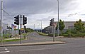
 M50 from the Tallaght Road junction - geograph.org.uk - 477653.jpg 640 × 480; 144 KB
-
 M50 Tallaght Junction - geograph.org.uk - 477656.jpg 640 × 480; 148 KB
_(14787512393).jpg)


.jpg)


.jpg)
_(14759904866).jpg)


.jpg)


.jpg)


.jpg)

.jpg)
.jpg)
.jpg)


.jpg)
.jpg)
.jpg)
.jpg)
.jpg)
.jpg)
.jpg)
.jpg)


.jpg)


,_Tymon_Park_(western_division).jpg)


