Category:Tai Hang Sai Street
Jump to navigation
Jump to search
| Object location | | View all coordinates using: OpenStreetMap |
|---|
中文:大坑西街
| Upload media | |||||
 | |||||
Subcategories
This category has the following 7 subcategories, out of 7 total.
Media in category "Tai Hang Sai Street"
The following 22 files are in this category, out of 22 total.
-
 Hong Kong - panoramio (293).jpg 4,000 × 2,250; 2.9 MB
-
 Hong Kong - panoramio (435).jpg 3,840 × 2,160; 3.65 MB
-
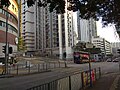
 NamCheongStreet WaiChiStreet TaiHangW.jpg 1,219 × 912; 626 KB
-
 Shek Kip Mei Reporting Centre 01.jpg 4,160 × 3,120; 4.99 MB
-
 Shek Kip Mei Reporting Centre 02.jpg 4,160 × 3,120; 6.11 MB
-
 Shek Kip Mei Reporting Centre 03.jpg 4,160 × 3,120; 4.32 MB
-
 Shek Kip Mei Reporting Centre 04.jpg 4,160 × 3,120; 6.2 MB
-
 Tai Hang Sai Estate 201503.jpg 2,272 × 1,704; 2.99 MB
-
 Tai Hang Sai Street Road sign in August 2021.jpg 3,000 × 4,000; 4.05 MB
-
 The Hong Kong Jockey Club Centre for the Blind 03.jpg 4,160 × 3,120; 6.18 MB
-
 The Hong Kong Jockey Club Centre for the Blind 04.jpg 4,160 × 3,120; 6.84 MB
-
 The Hong Kong Jockey Club Centre for the Blind 05.jpg 4,160 × 3,120; 5.58 MB
-
 The Hong Kong Jockey Club Centre for the Blind 06.jpg 4,160 × 3,120; 5.46 MB
-
 The Hong Kong Jockey Club Centre for the Blind 07.jpg 4,160 × 3,120; 5.85 MB
-
 The Hong Kong Jockey Club Centre for the Blind 08.jpg 4,160 × 3,120; 6.73 MB
-
 The Hong Kong Jockey Club Centre for the Blind 09.jpg 4,160 × 3,120; 6.14 MB
-
 The Hong Kong Jockey Club Centre for the Blind 10.jpg 4,160 × 3,120; 6.91 MB
-
 The Hong Kong Jockey Club Centre for the Blind 11.jpg 4,160 × 3,120; 7.03 MB
-
 The Hong Kong Jockey Club Centre for the Blind 12.jpg 4,160 × 3,120; 6.38 MB
-
 The Hong Kong Jockey Club Centre for the Blind 13.jpg 4,160 × 3,120; 6.11 MB
-
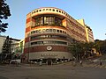
 TheHongKongSocietyForTheBlind HQ in January 2023.jpg 4,000 × 2,525; 2.33 MB
-
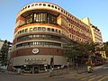
 TheHongKongSocietyForTheBlind HQ.jpg 1,424 × 1,068; 227 KB
.jpg)
.jpg)


