Category:Table Mountain, Powys
Jump to navigation
Jump to search

Table Mountain is an outlier of Pen Cerrig-calch near Crickhowell, Powys. Its peak is an iron-age hill fort known as Crug Hywel; this is used interchangeably with Table Mountain as the name of the hill.
Media in category "Table Mountain, Powys"
The following 35 files are in this category, out of 35 total.
-
 Above Pengilfach - geograph.org.uk - 1299274.jpg 640 × 427; 204 KB
-
 Arable land in the Usk Valley - geograph.org.uk - 1323605.jpg 640 × 426; 91 KB
-
 Bridge over River Usk at Crickhowell - geograph.org.uk - 609494.jpg 640 × 480; 90 KB
-
 Bridleway to Sugarloaf (Y Fal) 5 - geograph.org.uk - 1298481.jpg 640 × 480; 98 KB
-
 Cribyn summit - geograph.org.uk - 1110039.jpg 640 × 342; 128 KB
-
 Crug Hywel.jpg 2,076 × 1,195; 438 KB
-
 Darren - geograph.org.uk - 355917.jpg 640 × 480; 116 KB
-
 Dol-y-gaer below Crug Hywel - geograph.org.uk - 872063.jpg 640 × 404; 85 KB
-
 Fields by Ty-yn-y-wlad - geograph.org.uk - 820897.jpg 640 × 425; 87 KB
-

-
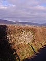 Old wall and hedge - geograph.org.uk - 670839.jpg 480 × 640; 124 KB
-
 Pen Cerrig-calch and Table Mountain - geograph.org.uk - 1320750.jpg 640 × 426; 90 KB
-
 Pen Cerrig-calch and Table Mountain - geograph.org.uk - 1320753.jpg 640 × 426; 105 KB
-
 Pen Cerrig-calch and Table Mountain - geograph.org.uk - 1323042.jpg 640 × 426; 86 KB
-
-

-
 Sugar Loaf viewed from Ffawyddog - geograph.org.uk - 1323035.jpg 426 × 640; 94 KB
-
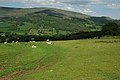
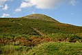 Table Mountain - geograph.org.uk - 820885.jpg 640 × 425; 84 KB
-
 Table Mountain in relief - geograph.org.uk - 1300149.jpg 640 × 481; 126 KB
-
 Table Mountain near Crickhowell - geograph.org.uk - 122049.jpg 640 × 493; 126 KB
-
 The Usk Valley - geograph.org.uk - 1323717.jpg 640 × 426; 77 KB
-
 The Usk valley - geograph.org.uk - 1444452.jpg 640 × 392; 62 KB
-
 Track near Llwynon Farm - geograph.org.uk - 1324029.jpg 640 × 426; 105 KB
-
 View east along Twyn Du - geograph.org.uk - 1100273.jpg 640 × 480; 81 KB
-
 View northwest towards Crug Hywel - geograph.org.uk - 1208778.jpg 640 × 480; 60 KB
-
 View to The Sugarloaf (Y Fal) - geograph.org.uk - 1109364.jpg 640 × 480; 50 KB
-
 Webbs of Crickhowell - geograph.org.uk - 1299537.jpg 640 × 426; 193 KB
-

-
 Crickhowell from the south - geograph.org.uk - 724598.jpg 640 × 359; 86 KB
-
 Darren View - geograph.org.uk - 292833.jpg 640 × 436; 61 KB
-
 Dead Tree in Valley Woodland - geograph.org.uk - 333900.jpg 640 × 480; 78 KB
-
 Farmland northeast of Dardy - geograph.org.uk - 521482.jpg 640 × 480; 136 KB
-
 Llanbedr Church and Table Mountain - geograph.org.uk - 333831.jpg 640 × 480; 126 KB
-
 View from Twyn Du - geograph.org.uk - 222215.jpg 640 × 480; 54 KB
-
 Views from Buckland Hill - geograph.org.uk - 350841.jpg 640 × 480; 168 KB


_5_-_geograph.org.uk_-_1298481.jpg)


_viewed_from_below_Twyn_Du_-_geograph.org.uk_-_1106771.jpg)


_-_geograph.org.uk_-_1109364.jpg)


