Category:TIFF versions of Sanborn maps of the Bronx published in 1896
Jump to navigation
Jump to search
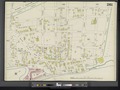
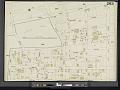
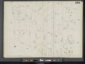
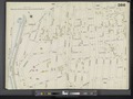
Maps from: Insurance Maps of The City of New York. Volume 12. (New York: Sanborn–Perris Map Co., Limited; 1896), including title page, double-page volume key, two-page street index, and 33 maps numbered 255–284, 260½, 263½, and 266½ (all double-page plates except 279; the left and right halves of 284 are evidently switched, with the right half on the left and the left half on the right).
Source: The New York Public Library Digital Collections website, Atlas 50. Vol. 12, 1896.
Media in category "TIFF versions of Sanborn maps of the Bronx published in 1896"
The following 37 files are in this category, out of 37 total.
-

-
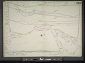
 Key NYPL2001511.tiff 8,982 × 6,730, 2 pages; 173.01 MB
-
 Index NYPL2001509.tiff 6,659 × 8,886, 2 pages; 169.35 MB
-
 Index Continued NYPL2001510.tiff 6,718 × 8,966, 2 pages; 172.39 MB
-

-

-
 Bronx, V. 12, Double Page Plate No. 257 (Map bounded by Walton Ave., Webster Ave., Clay Ave., E. 170th St.) NYPL2001514.tiff 8,965 × 6,718, 2 pages; 172.37 MB
-
 Bronx, V. 12, Double Page Plate No. 258 (Map bounded by Fleetwood Ave., Burnside Ave., Webster Ave., E. 173rd St.) NYPL2001515.tiff 8,943 × 6,701, 2 pages; 171.51 MB
-

-
 Bronx, V. 12, Double Page Plate No. 260 (Map bounded by Freeman St., Bronx River, Dongan St., Prospect Ave.) NYPL2001517.tiff 8,971 × 6,722, 2 pages; 172.59 MB
-
 Bronx, V. 12, Double Page Plate No. 260 1-2 (Map bounded by Prospect Ave., Woodruff St., Bronx River, W. Farms Rd.) NYPL2001518.tiff 8,971 × 6,722, 2 pages; 172.59 MB
-
 Bronx, V. 12, Double Page Plate No. 261 (Map bounded by Honeywell Ave., E. 182nd St., Bronx River, E. 176th St.) NYPL2001519.tiff 8,966 × 6,719, 2 pages; 172.42 MB
-

-
 Bronx, V. 12, Double Page Plate No. 263 (Map bounded by 3rd Ave., E. 180th St., Clinton Ave., Crotona Park N.) NYPL2001521.tiff 8,973 × 6,724, 2 pages; 172.68 MB
-

-
 Bronx, V. 12, Double Page Plate No. 264 (Map bounded by Pelham Ave., Bronx River, Samuel St., 3rd Ave., Lorillard Pl.) NYPL2001523.tiff 8,949 × 6,706, 2 pages; 171.76 MB
-
-
-

-

-

-
 Bronx, V. 12, Double Page Plate No. 269 (Map bounded by Kip St., Bronx River, Pelham Ave., Webster Ave.) NYPL2001529.tiff 8,908 × 6,675, 2 pages; 170.18 MB
-

-

-
 Bronx, V. 12, Double Page Plate No. 272 (Map bounded by Warren Ave., Spuyten Duyvil Creek, Hudson River) NYPL2001532.tiff 8,937 × 6,697, 2 pages; 171.3 MB
-
 Bronx, V. 12, Double Page Plate No. 273 (Map bounded by Whiting Ave., Ewen Ave., Warren Ave., Hudson River) NYPL2001533.tiff 8,937 × 6,697, 2 pages; 171.3 MB
-

-

-
 Bronx, V. 12, Double Page Plate No. 276 (Map bounded by Briggs Ave., E. 206th St., Woodlawn Rd., E. 198th St.) NYPL2001536.tiff 8,937 × 6,697, 2 pages; 171.3 MB
-
 Bronx, V. 12, Double Page Plate No. 277 (Map bounded by E. 211th St., Bronx River, Woodlawn Rd., Jerome Ave.) NYPL2001537.tiff 8,886 × 6,659, 2 pages; 169.35 MB
-
 Bronx, V. 12, Double Page Plate No. 278 (Map bounded by Van Cortlandt Park South, Jerome Ave., Heath Ave., Broadway) NYPL2001538.tiff 8,886 × 6,659, 2 pages; 169.35 MB
-
 Bronx, V. 12, Double Page Plate No. 280 (Map bounded by Delafield Ave., Waldo St., Whiting Ave., Hudson River) NYPL2001540.tiff 8,886 × 6,659, 2 pages; 169.35 MB
-

-
 Bronx, V. 12, Double Page Plate No. 282 (Map bounded by Douglas Ave., Schermerhorn Ave., Hudson River) NYPL2001542.tiff 8,886 × 6,659, 2 pages; 169.35 MB
-
-
 Bronx, V. 12, Double Page Plate No. 284 (Map bounded by McLean Ave., E. 233rd St., Martha Ave.) NYPL2001544.tiff 8,835 × 6,620, 2 pages; 167.4 MB
-
 Bronx, V. 12, Plate No. 279 (Map bounded by Broadway, W., 236th St., Fieldston Rd.) NYPL2001539.tiff 6,702 × 8,944, 2 pages; 171.56 MB