Category:Swineshead, Lincolnshire
Jump to navigation
Jump to search
village and civil parish in Lincolnshire, England  | |||||
| Upload media | |||||
| Instance of | |||||
|---|---|---|---|---|---|
| Location | Boston, Lincolnshire, East Midlands, England | ||||
 | |||||
Subcategories
This category has the following 4 subcategories, out of 4 total.
M
S
- Swineshead railway station (5 F)
Media in category "Swineshead, Lincolnshire"
The following 200 files are in this category, out of 229 total.
(previous page) (next page)-
 A17 Approaching Bicker Bar - geograph.org.uk - 4950356.jpg 640 × 427; 354 KB
-
 A17 approaching Bicker Bar Roundabout - geograph.org.uk - 3554366.jpg 2,101 × 1,270; 1.49 MB
-
 A17 at Junction with Station Road - geograph.org.uk - 4950229.jpg 640 × 427; 313 KB
-
 A17 at Swineshead village boundary - geograph.org.uk - 5672657.jpg 640 × 480; 36 KB
-
 A17 Entering Swineshead Bridge - geograph.org.uk - 4945098.jpg 640 × 427; 342 KB
-
 A17 Highbridge Junction, Swineshead - geograph.org.uk - 2020542.jpg 640 × 480; 63 KB
-
 A17 lay-by - geograph.org.uk - 4734386.jpg 640 × 480; 55 KB
-
 A17 lay-by - geograph.org.uk - 4734391.jpg 640 × 480; 50 KB
-
 A17 lay-by - geograph.org.uk - 4741242.jpg 640 × 480; 43 KB
-
 A17 nearing Bicker Bar Roundabout - geograph.org.uk - 3647047.jpg 640 × 480; 42 KB
-
 A17 north of Bicker Bar Roundabout - geograph.org.uk - 3647067.jpg 640 × 480; 39 KB
-
 A17 northbound - geograph.org.uk - 3766663.jpg 640 × 501; 43 KB
-
 A17 northbound - geograph.org.uk - 3766672.jpg 640 × 415; 40 KB
-
 A17 northbound - geograph.org.uk - 3767726.jpg 640 × 234; 31 KB
-
 A17 northbound - geograph.org.uk - 3767731.jpg 640 × 463; 53 KB
-

-
 A17 northbound near High Bridge - geograph.org.uk - 3647089.jpg 640 × 481; 49 KB
-
 A17 northbound near The Steyning - geograph.org.uk - 3647082.jpg 640 × 481; 36 KB
-
 A17 southbound - geograph.org.uk - 4741239.jpg 640 × 480; 54 KB
-
 A17 southbound - geograph.org.uk - 4741241.jpg 640 × 480; 37 KB
-
 A17 southbound towards Hoffleet Stow - geograph.org.uk - 3554371.jpg 2,038 × 1,273; 1.63 MB
-
 A17 southbound towards Swineshead - geograph.org.uk - 3554356.jpg 2,256 × 1,504; 1.77 MB
-
 A17, Swineshead Bridge - geograph.org.uk - 4945106.jpg 640 × 480; 385 KB
-
 Abbey Farm drive, Swineshead, Lincs - geograph.org.uk - 132450.jpg 640 × 480; 506 KB
-
 Abbey Road - geograph.org.uk - 2654553.jpg 640 × 427; 74 KB
-
 Approaching a roundabout - geograph.org.uk - 5752193.jpg 640 × 480; 51 KB
-
 Asperton Road - geograph.org.uk - 6399763.jpg 640 × 387; 38 KB
-
 Asperton Road - geograph.org.uk - 6399764.jpg 640 × 480; 33 KB
-
 Bar Bridge - geograph.org.uk - 2758574.jpg 1,280 × 853; 352 KB
-
 Bar Bridge - geograph.org.uk - 5822504.jpg 1,024 × 768; 179 KB
-
 Barbridge Farmhouse, Swineshead, Lincs - geograph.org.uk - 132796.jpg 640 × 480; 334 KB
-
 Baythorpe Nursery and Cafe - geograph.org.uk - 5752198.jpg 640 × 480; 43 KB
-
 Bicker Bar Roundabout - geograph.org.uk - 3766653.jpg 640 × 374; 48 KB
-
 Black shed on Golden Grove - geograph.org.uk - 4392418.jpg 4,320 × 3,240; 5.29 MB
-
 Blackjack crossroads - geograph.org.uk - 1325892.jpg 640 × 480; 51 KB
-
 Blackjack Road - geograph.org.uk - 6400402.jpg 640 × 480; 37 KB
-
 Boston Road - geograph.org.uk - 3270774.jpg 2,256 × 1,504; 873 KB
-
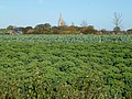
 Brassica crop near Swineshead, Lincolnshire - geograph.org.uk - 4224721.jpg 4,320 × 3,240; 5.6 MB
-
 Brassicas all the way to Swineshead - geograph.org.uk - 6251878.jpg 1,024 × 732; 181 KB
-
 Bridge House, Swineshead Bridge - geograph.org.uk - 4253855.jpg 1,280 × 947; 441 KB
-
 Bridleway and the A17 - geograph.org.uk - 6251907.jpg 1,024 × 768; 182 KB
-

-
 Brown's Drove towards Caitlin's Farm - geograph.org.uk - 2719601.jpg 640 × 499; 63 KB
-
 Brown's Drove, Swineshead, Lincs - geograph.org.uk - 132215.jpg 640 × 480; 343 KB
-

-
 Cast Iron Milepost - geograph.org.uk - 2781848.jpg 768 × 1,024; 303 KB
-
 College Farm, Swineshead, Lincs - geograph.org.uk - 132206.jpg 640 × 480; 286 KB
-
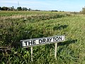
 Coney Hill, Drayton south of Swineshead - geograph.org.uk - 5604389.jpg 2,965 × 2,224; 1.41 MB
-
 Cope Court - geograph.org.uk - 5225635.jpg 1,024 × 768; 151 KB
-
 Creaseyplot Lane - geograph.org.uk - 6251845.jpg 1,024 × 768; 192 KB
-
 Creaseyplot Lane, Swineshead - geograph.org.uk - 2020496.jpg 640 × 407; 45 KB
-
 Crop of brassica near Swineshead, Lincolnshire - geograph.org.uk - 4224584.jpg 4,320 × 3,240; 5.77 MB
-
 Crops on Mill Hill Lane near Swineshead - geograph.org.uk - 4224713.jpg 4,320 × 3,240; 5.78 MB
-
 Crossroads - geograph.org.uk - 6399761.jpg 640 × 480; 50 KB
-
 Dale's Lane - geograph.org.uk - 6251945.jpg 1,024 × 768; 154 KB
-
 Dales Lane at Junction with Golden Grove - geograph.org.uk - 2766628.jpg 1,280 × 853; 316 KB
-
 Demolition at The Drayton, Swineshead - geograph.org.uk - 4224727.jpg 4,320 × 3,240; 5.55 MB
-
 Donington 3 ½ Miles - geograph.org.uk - 2781896.jpg 768 × 1,024; 410 KB
-
 Donington 4 ½ Miles - geograph.org.uk - 2781911.jpg 768 × 1,024; 385 KB
-
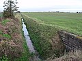
 Drain near Swineshead Bridge - geograph.org.uk - 3267614.jpg 1,024 × 768; 145 KB
-
 Drain off Tilebarn Lane - geograph.org.uk - 6251868.jpg 1,024 × 768; 205 KB
-
 Drain running north from Hallam's Drove - geograph.org.uk - 2719609.jpg 1,280 × 960; 437 KB
-
-
 Entrance to farmland off Dances Bank - geograph.org.uk - 4328317.jpg 4,320 × 3,240; 5.73 MB
-
 Entrance to Swineshead Bridge - geograph.org.uk - 3767730.jpg 640 × 445; 62 KB
-
 Farm access road - geograph.org.uk - 5822509.jpg 640 × 480; 66 KB
-
 Farm track, Hardwick Plot - geograph.org.uk - 6251855.jpg 1,024 × 768; 155 KB
-
 Farmland near Algarkirk Fen - geograph.org.uk - 1533880.jpg 640 × 432; 94 KB
-
 Farmland near Bicker Bar, Lincs - geograph.org.uk - 84502.jpg 600 × 421; 323 KB
-
 Farmland near Blackjack, Lincolnshire - geograph.org.uk - 4225521.jpg 4,320 × 3,240; 5.56 MB
-
 Farmland, Royalty Farm - geograph.org.uk - 3598465.jpg 640 × 480; 41 KB
-
 Fenhouses Drove - geograph.org.uk - 6399754.jpg 640 × 480; 43 KB
-
 Fenhouses Drove junction - geograph.org.uk - 1325906.jpg 640 × 480; 60 KB
-
 Fenhouses Lane - geograph.org.uk - 6399741.jpg 640 × 480; 65 KB
-
 Fenhouses Lane - geograph.org.uk - 6399744.jpg 640 × 480; 42 KB
-
 Fenhouses Lane - geograph.org.uk - 6399747.jpg 640 × 480; 44 KB
-
 Fenhouses Lane Junction - geograph.org.uk - 1325921.jpg 640 × 480; 96 KB
-
 Ferndale - geograph.org.uk - 948950.jpg 640 × 427; 68 KB
-
 Field of brassica near Swineshead - geograph.org.uk - 4224581.jpg 4,320 × 3,240; 5.74 MB
-
 Field of oilseed rape off Creaseyplot Lane - geograph.org.uk - 6251849.jpg 1,024 × 768; 212 KB
-
 Field of sugar beet and Barnd End Farm - geograph.org.uk - 6251858.jpg 1,024 × 768; 160 KB
-
 Fields off Creaseyplot Lane - geograph.org.uk - 3270771.jpg 2,256 × 1,504; 1.06 MB
-
 First Cattle Holme, Swineshead - geograph.org.uk - 2020577.jpg 640 × 350; 35 KB
-
 Footpath through cornfield - geograph.org.uk - 416265.jpg 640 × 480; 97 KB
-
 Fore Fen Lane - geograph.org.uk - 6399759.jpg 640 × 480; 57 KB
-
 Four Towns Drain with bridge along Dances Bank - geograph.org.uk - 2766725.jpg 1,280 × 853; 296 KB
-
 Golden Grove - geograph.org.uk - 4640826.jpg 640 × 480; 66 KB
-
 Graveyard shelter - geograph.org.uk - 948960.jpg 640 × 427; 119 KB
-
 HGV on the A17 near Drayton - geograph.org.uk - 4950351.jpg 640 × 427; 311 KB
-
 House on Golden Grove - geograph.org.uk - 4392428.jpg 4,320 × 3,240; 5.47 MB
-
 Junction of Brown's Drove and Hallam's Drove - geograph.org.uk - 2719595.jpg 1,280 × 960; 255 KB
-
 Junction of Tilebarn Lane and Timm's Drove - geograph.org.uk - 2758568.jpg 1,280 × 853; 576 KB
-
 King Johns Road - geograph.org.uk - 5752171.jpg 640 × 480; 45 KB
-
 La Milesse Way - geograph.org.uk - 5712069.jpg 640 × 573; 47 KB
-
 Lane passing Blackjack Farm - geograph.org.uk - 6400408.jpg 640 × 471; 48 KB
-
 Lane past Blackjack Farm - geograph.org.uk - 2766772.jpg 1,280 × 853; 293 KB
-
 Lane south of Blackjack Farm - geograph.org.uk - 6400414.jpg 640 × 480; 47 KB
-
 Lay-by for lorries ahead of level crossing - geograph.org.uk - 5986963.jpg 1,600 × 1,200; 953 KB
-

-
 Layby on the A17 near to Swineshead - geograph.org.uk - 4950231.jpg 640 × 427; 342 KB
-
 Layby on Westbound A17 - geograph.org.uk - 4958619.jpg 640 × 427; 320 KB
-
 Level Crossing - geograph.org.uk - 5187844.jpg 640 × 480; 57 KB
-
 Level crossing at Swineshead railway station - geograph.org.uk - 5986966.jpg 1,600 × 1,200; 883 KB
-
 Lincolnshire, United Kingdom (Unsplash).jpg 5,184 × 3,456; 2.77 MB
-
 Lone tree, Taumberland, Swineshead, Lincs - geograph.org.uk - 132684.jpg 640 × 477; 280 KB
-
 Lorry depot - geograph.org.uk - 4376922.jpg 4,896 × 3,672; 6.77 MB
-
 Manwar Ings, aerial 2014 - geograph.org.uk - 4058302.jpg 640 × 427; 47 KB
-
 Manwar Ings, Swineshead, aerial 2014 - geograph.org.uk - 4058296.jpg 640 × 427; 43 KB
-

-
 Near Sparrow Hall south of Blackjack in Lincolnshire - geograph.org.uk - 4328239.jpg 4,320 × 3,240; 5.51 MB
-
 New development - geograph.org.uk - 6194128.jpg 480 × 640; 52 KB
-
 New development - geograph.org.uk - 6194131.jpg 480 × 640; 54 KB
-
 Nowhere Farm - geograph.org.uk - 6400419.jpg 640 × 480; 52 KB
-
 Old Cast Iron Milepost - geograph.org.uk - 2781883.jpg 1,024 × 768; 263 KB
-
 Old Cast Iron Milepost - geograph.org.uk - 2781909.jpg 1,024 × 768; 346 KB
-
 Old Milepost - geograph.org.uk - 2781845.jpg 1,024 × 768; 331 KB
-
 Old Milestone - geograph.org.uk - 2781928.jpg 1,024 × 768; 272 KB
-
 Old signpost in a roundabout - geograph.org.uk - 4809390.jpg 4,608 × 3,456; 6.09 MB
-
 Park Lane facing south - geograph.org.uk - 2758584.jpg 1,280 × 853; 357 KB
-
 Pond off Hardwick Plot Lane, Swineshead - geograph.org.uk - 6251837.jpg 1,024 × 768; 324 KB
-
 Possible wind farm site^ - geograph.org.uk - 5856198.jpg 640 × 454; 45 KB
-
 Potato field, Drayton, Swineshead - geograph.org.uk - 6251938.jpg 1,024 × 768; 219 KB
-
 Pumping station, Skerth Drain - geograph.org.uk - 3598458.jpg 640 × 485; 35 KB
-
 Railway at Swineshead - geograph.org.uk - 6211864.jpg 3,262 × 2,174; 2.4 MB
-
 Reflection on a muddy track - geograph.org.uk - 4225463.jpg 4,320 × 3,240; 5.56 MB
-
 Road junction - geograph.org.uk - 5752175.jpg 640 × 480; 67 KB
-
 Road junction - geograph.org.uk - 5983211.jpg 640 × 480; 101 KB
-
 Road junction - geograph.org.uk - 5983213.jpg 640 × 503; 70 KB
-
 Road junction - geograph.org.uk - 6399757.jpg 640 × 480; 52 KB
-
 Roadside pond - geograph.org.uk - 5752186.jpg 640 × 480; 92 KB
-
 Royalty Farm - geograph.org.uk - 3598462.jpg 640 × 521; 55 KB
-
 Shrouded crop, Mill Hill - geograph.org.uk - 6251898.jpg 1,024 × 768; 133 KB
-
 Sign for 'The Green Dragon' - geograph.org.uk - 5604370.jpg 2,592 × 3,456; 3 MB
-
 Sleaford 13 Miles - geograph.org.uk - 2781935.jpg 768 × 1,024; 440 KB
-
 Sometimes your greens are purple - geograph.org.uk - 4224588.jpg 4,320 × 3,240; 5.6 MB
-

-
 South Bank, South Forty Foot Drain - geograph.org.uk - 3598454.jpg 640 × 465; 37 KB
-
 South Bank, South Forty Foot Drain - geograph.org.uk - 3598457.jpg 640 × 433; 33 KB
-
 South Forty Foot Drain - geograph.org.uk - 3598451.jpg 640 × 480; 44 KB
-
 South Forty Foot Drain - geograph.org.uk - 3598455.jpg 640 × 480; 41 KB
-
 South Forty Foot Drain - geograph.org.uk - 3598459.jpg 640 × 586; 39 KB
-
 South Forty Foot Drain - geograph.org.uk - 3598461.jpg 640 × 480; 79 KB
-
 South Forty Foot Drain - geograph.org.uk - 3598464.jpg 480 × 640; 44 KB
-
 South Forty Foot Drain at Swineshead Bridge - geograph.org.uk - 4253852.jpg 1,280 × 960; 231 KB
-
 South Street - geograph.org.uk - 948962.jpg 640 × 427; 71 KB
-
 Stubble field at Swineshead - geograph.org.uk - 6251832.jpg 1,024 × 768; 214 KB
-
 Stubble field near Sykemouth Farm - geograph.org.uk - 6251840.jpg 1,024 × 768; 215 KB
-
 Stump Cross - geograph.org.uk - 1741596.jpg 426 × 640; 118 KB
-
 Stump Cross at Swineshead - geograph.org.uk - 5604378.jpg 3,456 × 2,592; 3.99 MB
-
 Stump Cross Lane - geograph.org.uk - 5752180.jpg 640 × 480; 65 KB
-
 Stump Cross, Swineshead, Lincs - geograph.org.uk - 86542.jpg 640 × 430; 355 KB
-
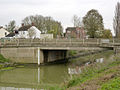
 Swineshead Bridge (A17) - geograph.org.uk - 4945111.jpg 640 × 480; 430 KB
-

-
 Swineshead Bridge Crossing - geograph.org.uk - 2020547.jpg 640 × 480; 55 KB
-
 Swineshead Bridge Level Crossing - geograph.org.uk - 4950227.jpg 640 × 480; 367 KB
-
 Swineshead Bridge over the South Forty Foot Drain (geograph 4253853).jpg 1,280 × 960; 326 KB
-
 Swineshead Pumping Station - geograph.org.uk - 3271087.jpg 2,256 × 1,504; 806 KB
-
 Swineshead Railway Station - geograph.org.uk - 5410167.jpg 640 × 480; 86 KB
-
 Swineshead St. Mary's church - geograph.org.uk - 5604359.jpg 3,456 × 2,592; 3.95 MB
-
 Swineshead village sign - geograph.org.uk - 5604375.jpg 2,592 × 3,456; 3.12 MB
-
 Swineshead village sign, detail - geograph.org.uk - 5604384.jpg 684 × 726; 181 KB
-
 Swineshead War Memorial - geograph.org.uk - 5604363.jpg 3,456 × 2,592; 3.88 MB
-
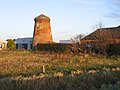 Swineshead, North End Mill.jpg 640 × 480; 303 KB
-
 Sykemouth Drove blocked by trailer - geograph.org.uk - 3237146.jpg 2,256 × 1,504; 677 KB
-
 The Barge - geograph.org.uk - 4253856.jpg 1,280 × 960; 270 KB
-
 The Barge Hotel, Swineshead Bridge, Lincs - geograph.org.uk - 142272.jpg 640 × 480; 265 KB
-
 The Barge Pub restaurant at Swineshead Bridge - geograph.org.uk - 5604353.jpg 3,456 × 2,592; 3.78 MB
-
 The churchyard, Swineshead - geograph.org.uk - 5225653.jpg 1,024 × 768; 199 KB
-
 The Drayton near Swineshead - geograph.org.uk - 4224724.jpg 4,320 × 3,240; 5.62 MB
-
 The Golden Cross - geograph.org.uk - 948894.jpg 640 × 427; 59 KB
-
 The Green Dragon, Swineshead - geograph.org.uk - 5604368.jpg 3,456 × 2,592; 3.59 MB
-
 The Hammond Beck at Bar Bridge - geograph.org.uk - 6251856.jpg 1,024 × 768; 174 KB
-
 The Millenium - geograph.org.uk - 5983201.jpg 640 × 480; 92 KB
-
 The sign of 'The Barge' - geograph.org.uk - 5604356.jpg 3,456 × 2,592; 3.92 MB
-
 The way to Swineshead Station - geograph.org.uk - 4253857.jpg 1,280 × 960; 313 KB
-
 Tilebarn Lane - geograph.org.uk - 5822512.jpg 640 × 480; 65 KB
-
 Tilebarn Lane - geograph.org.uk - 5822529.jpg 640 × 480; 61 KB
-
 Tilebarn Lane near Swineshead - geograph.org.uk - 2758558.jpg 1,280 × 853; 646 KB
-
 Timm's Drove - geograph.org.uk - 6251862.jpg 1,024 × 768; 185 KB
-
 Timm's Drove facing west - geograph.org.uk - 2758529.jpg 1,280 × 853; 274 KB
-
 Timm's Drove, Swineshead, Lincs - geograph.org.uk - 132269.jpg 640 × 479; 296 KB
-
 Timms's Drove - geograph.org.uk - 5822519.jpg 640 × 480; 59 KB
-
 Timms's Drove - geograph.org.uk - 5822523.jpg 640 × 480; 78 KB
-
 Town Field - geograph.org.uk - 2654549.jpg 640 × 427; 85 KB
-
 Track off Millhill Lane - geograph.org.uk - 2766947.jpg 1,280 × 853; 324 KB
-
 Track to Pyewipe near Sparrow Hall - geograph.org.uk - 4328237.jpg 4,320 × 3,240; 5.59 MB
-
 Track to Rakes Farm - geograph.org.uk - 2719589.jpg 1,240 × 733; 534 KB
-
 Track towards Sparrow Hall Farm - geograph.org.uk - 2766708.jpg 1,280 × 853; 350 KB
-
 Tractor at work near Blackjack, Lincolnshire - geograph.org.uk - 4225539.jpg 4,320 × 3,240; 5.56 MB
-

-
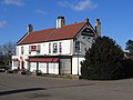
 Wheatsheaf Hotel - geograph.org.uk - 949023.jpg 640 × 427; 64 KB
-
 White house in Blackjack, Lincolnshire - geograph.org.uk - 4225472.jpg 4,320 × 3,240; 5.42 MB
-
 Abbey Gates, Swineshead, Lincs - geograph.org.uk - 171341.jpg 640 × 470; 472 KB
-
 Bar Bridge, Swineshead, Lincs - geograph.org.uk - 132807.jpg 640 × 480; 309 KB
-
 Baythorpe Farm, Swineshead, Lincs - geograph.org.uk - 351713.jpg 640 × 480; 272 KB
-
 Baythorpe, Swineshead, Lincs - geograph.org.uk - 84484.jpg 600 × 450; 249 KB
-
 Boston Road, North End, Swineshead, Lincs - geograph.org.uk - 217010.jpg 640 × 480; 152 KB
-
 Brand End Farm, Swineshead, Lincs - geograph.org.uk - 132259.jpg 640 × 480; 328 KB
-
 East Lowgrounds, Swineshead, Lincs - geograph.org.uk - 84482.jpg 600 × 450; 291 KB
-
 Fenhouses Drove, Swineshead, Lincs - geograph.org.uk - 132490.jpg 640 × 480; 401 KB


.jpg)


_-_geograph.org.uk_-_4945111.jpg)


.jpg)


