Category:Swaby, Lincolnshire
Jump to navigation
Jump to search
village in Lincolnshire, England, UK  | |||||
| Upload media | |||||
| Instance of | |||||
|---|---|---|---|---|---|
| Location | East Lindsey, Lincolnshire, East Midlands, England | ||||
 | |||||
Subcategories
This category has only the following subcategory.
S
Media in category "Swaby, Lincolnshire"
The following 92 files are in this category, out of 92 total.
-

-

-

-
 Anyone for a gallop^ - geograph.org.uk - 3859077.jpg 427 × 640; 68 KB
-

-

-
 Belleau, aerial 2017 - geograph.org.uk - 5391039.jpg 640 × 427; 52 KB
-
 Brantsfield, Swaby - geograph.org.uk - 2159759.jpg 1,024 × 768; 221 KB
-
 Bridleway and footpath to Swaby - geograph.org.uk - 3859102.jpg 640 × 427; 60 KB
-

-

-
 Buildings at Glebe Farm, Swaby - geograph.org.uk - 2159742.jpg 1,024 × 768; 248 KB
-
 Calceby cross roads on A16 south - geograph.org.uk - 3004238.jpg 640 × 433; 82 KB
-
 Calceby DMV site, aerial 2018 (2) - geograph.org.uk - 5981768.jpg 640 × 427; 78 KB
-

-
 Chalk outcrop - geograph.org.uk - 1951207.jpg 533 × 800; 183 KB
-
 Church Lane, Swaby - geograph.org.uk - 2159764.jpg 1,024 × 768; 179 KB
-

-
 Corner of Church Lane and the A16 - geograph.org.uk - 3859371.jpg 640 × 427; 63 KB
-
 Cottage in Swaby - geograph.org.uk - 803552.jpg 640 × 428; 108 KB
-
 Cowdyke Lane - geograph.org.uk - 3859057.jpg 800 × 533; 113 KB
-
 Cowdyke Lane bridleway - geograph.org.uk - 3859061.jpg 640 × 427; 77 KB
-
 Cowdyke Lane bridleway - geograph.org.uk - 3859062.jpg 640 × 427; 83 KB
-

-
 Downslope to Great Covert - geograph.org.uk - 3859089.jpg 640 × 427; 62 KB
-
 Elms Farm seen from Swaby churchyard - geograph.org.uk - 2159735.jpg 1,024 × 768; 346 KB
-
 Entrance to Swaby, A16 - geograph.org.uk - 4132242.jpg 640 × 472; 52 KB
-
 Fallen tree by the path to Belleau - geograph.org.uk - 3459648.jpg 640 × 427; 131 KB
-
 Field on the side of the valley - geograph.org.uk - 3859528.jpg 640 × 427; 72 KB
-
 Footpath , footbridge and stile - geograph.org.uk - 3223852.jpg 2,056 × 3,088; 2.52 MB
-
 Footpath at Swaby - geograph.org.uk - 2159753.jpg 1,024 × 768; 384 KB
-

-
 Footpath from Swaby to Belleau - geograph.org.uk - 1951234.jpg 533 × 800; 190 KB
-
 Footpath from the A16 to Swaby - geograph.org.uk - 3859336.jpg 640 × 427; 87 KB
-
 Footpath junction - geograph.org.uk - 803545.jpg 640 × 428; 112 KB
-
 Footpath running through cornfield - geograph.org.uk - 1951258.jpg 533 × 800; 170 KB
-
 Footpath to South Thoresby - geograph.org.uk - 1951213.jpg 683 × 1,024; 290 KB
-

-
 Footpath towards Swaby - geograph.org.uk - 1951243.jpg 800 × 533; 120 KB
-

-
 Great Covert, looking southeastwards - geograph.org.uk - 3859107.jpg 640 × 427; 63 KB
-
 Great Covert, looking westwards - geograph.org.uk - 3859104.jpg 640 × 427; 51 KB
-

-
 Hilly field next to Valley Farm - geograph.org.uk - 3859586.jpg 640 × 427; 35 KB
-

-
 House in Pado Lane - geograph.org.uk - 3859553.jpg 1,024 × 683; 134 KB
-
 Junction of Church Lane with A16 - geograph.org.uk - 3552586.jpg 2,256 × 1,504; 1.64 MB
-
 Junction of Swaby road with A18 - geograph.org.uk - 1961089.jpg 640 × 480; 66 KB
-
 Lane outside Swaby church - geograph.org.uk - 1961087.jpg 640 × 480; 109 KB
-

-

-
 Looking down on the Valley - geograph.org.uk - 803528.jpg 640 × 427; 109 KB
-
 Looking eastwards from High Barn - geograph.org.uk - 3859569.jpg 640 × 427; 39 KB
-

-
 Mercury and moss - geograph.org.uk - 3859517.jpg 640 × 427; 96 KB
-
 Mill Row, by the A16 - geograph.org.uk - 3859320.jpg 640 × 427; 58 KB
-
 Mill Row, by the A16 - geograph.org.uk - 3859328.jpg 640 × 427; 47 KB
-
 No unauthorised persons - geograph.org.uk - 3859566.jpg 640 × 427; 74 KB
-
 Old cottage in Valley Lane, Swaby - geograph.org.uk - 3859539.jpg 640 × 427; 66 KB
-

-
 Outbuilding and paddock in Pado Lane - geograph.org.uk - 3859551.jpg 640 × 439; 89 KB
-

-
 Panoramic window in St. Nicholas' Church, Swaby - geograph.org.uk - 5684023.jpg 1,067 × 1,600; 317 KB
-
 Park Farm on the Burwell Estate - geograph.org.uk - 3858549.jpg 640 × 427; 61 KB
-
 Path through the rape - geograph.org.uk - 803536.jpg 640 × 428; 147 KB
-

-

-
 Road to Valley Farm - geograph.org.uk - 3221539.jpg 3,088 × 2,056; 4.32 MB
-

-
 Sheds by Mill Row on the A16 - geograph.org.uk - 3859331.jpg 640 × 427; 52 KB
-
 Signpost, Meagram Top, Belleau - geograph.org.uk - 3761025.jpg 1,024 × 768; 161 KB
-
 Slope down into the valley - geograph.org.uk - 3859130.jpg 640 × 427; 50 KB
-
 Small disused pit, but not white - geograph.org.uk - 3859319.jpg 1,024 × 683; 265 KB
-
 Snowdrops in St. Nicholas' churchyard, Swaby (1) - geograph.org.uk - 5684018.jpg 1,600 × 1,067; 542 KB
-
 Snowdrops in St. Nicholas' churchyard, Swaby (2) - geograph.org.uk - 5684019.jpg 1,024 × 683; 263 KB
-
 Stile by River - geograph.org.uk - 683151.jpg 640 × 480; 115 KB
-

-
 Swaby from the north, aerial 2017 - geograph.org.uk - 5625016.jpg 533 × 800; 73 KB
-
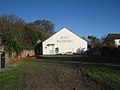 Swaby Village Hall - geograph.org.uk - 2159726.jpg 1,024 × 768; 165 KB
-
 Swaby Village Hall, on the A16 - geograph.org.uk - 482303.jpg 640 × 482; 115 KB
-
 Swaby, aerial 2017 - geograph.org.uk - 5391049.jpg 640 × 427; 64 KB
-

-
 Valley farm, Swaby, aerial 2016 - geograph.org.uk - 4823273.jpg 640 × 427; 45 KB
-

-
 View towards South Thoresby - geograph.org.uk - 2159769.jpg 1,024 × 768; 187 KB
-
 Walking on field path, N of A16 near Swaby - geograph.org.uk - 3761019.jpg 1,024 × 768; 159 KB
-
 Walmsgate, aerial 2016 - geograph.org.uk - 5194780.jpg 640 × 427; 40 KB
-
 Well used track to Walmsgate - geograph.org.uk - 3858595.jpg 640 × 427; 106 KB
-
 White Pit Mill, Swaby.JPG 1,200 × 1,600; 269 KB
-
 White Pit Way alongside the A16 - geograph.org.uk - 3859256.jpg 640 × 427; 70 KB
-
 White Pit, Swaby (2) - geograph.org.uk - 2159718.jpg 1,024 × 768; 163 KB
-
 White Pit, Swaby - geograph.org.uk - 2159710.jpg 1,024 × 768; 158 KB


_-_geograph.org.uk_-_5981768.jpg)
_-_geograph.org.uk_-_3459640.jpg)


_-_geograph.org.uk_-_3459645.jpg)


_-_geograph.org.uk_-_3799066.jpg)


_-_geograph.org.uk_-_5684018.jpg)
_-_geograph.org.uk_-_5684019.jpg)


_-_geograph.org.uk_-_2159718.jpg)
