Category:Sutton cum Duckmanton
Jump to navigation
Jump to search
English: Sutton cum Duckmanton is a civil parish in Derbyshire, England, lying between Bolsover and Chesterfield but in the district of North East Derbyshire.
civil parish in North East Derbyshire, Derbyshire, England | |||||
| Upload media | |||||
| Instance of | |||||
|---|---|---|---|---|---|
| Location | North East Derbyshire, Derbyshire, East Midlands, England | ||||
 | |||||
Subcategories
This category has the following 5 subcategories, out of 5 total.
Media in category "Sutton cum Duckmanton"
The following 200 files are in this category, out of 244 total.
(previous page) (next page)-
 "The Arkwright Arms" west of Long Duckmanton - geograph.org.uk - 3895548.jpg 2,504 × 1,878; 1.42 MB
-
 A busy M1 heading north - geograph.org.uk - 2842907.jpg 640 × 507; 62 KB
-
 A pile of lime - geograph.org.uk - 2282307.jpg 3,648 × 2,736; 4.99 MB
-
 A632 at Long Duckmanton - geograph.org.uk - 4282734.jpg 640 × 481; 55 KB
-

-
 A632 Bridge, M1 - geograph.org.uk - 4667475.jpg 640 × 403; 35 KB
-
 A632 Chesterfield Road heading east - geograph.org.uk - 4282737.jpg 640 × 481; 55 KB
-
 A632 nears The Arkwright Arms - geograph.org.uk - 4282730.jpg 640 × 481; 44 KB
-

-
 Access controls at Allpits Plantation - geograph.org.uk - 5954683.jpg 1,600 × 1,200; 1,023 KB
-
 An old house in Long Duckmanton - geograph.org.uk - 3895561.jpg 2,592 × 1,944; 1.8 MB
-
 Approaching Palterton Lane bridge - geograph.org.uk - 4578870.jpg 640 × 271; 114 KB
-
 Approaching Palterton Lane bridge over M1 - geograph.org.uk - 4618308.jpg 1,600 × 1,067; 1.03 MB
-

-
 Arable land at Sutton Scarsdale - geograph.org.uk - 4070866.jpg 1,024 × 680; 312 KB
-
 Arkwright Arms - geograph.org.uk - 2446995.jpg 950 × 713; 312 KB
-
 Arkwright Arms - geograph.org.uk - 3957699.jpg 800 × 533; 109 KB
-
 Arkwright Arms - geograph.org.uk - 4068277.jpg 4,000 × 2,248; 4.18 MB
-
 Arkwright Arms - geograph.org.uk - 4068280.jpg 4,000 × 2,248; 5.75 MB
-
 Arkwright Town - Miners Welfare Club - geograph.org.uk - 3895439.jpg 2,408 × 1,720; 988 KB
-
 Arkwright Town cycle route - geograph.org.uk - 1930356.jpg 640 × 426; 104 KB
-
 Arkwright Town cycle route - geograph.org.uk - 1930359.jpg 640 × 426; 133 KB
-
 At Bull Paddock Farm off Sutton Lane - geograph.org.uk - 3870805.jpg 4,858 × 3,886; 4.82 MB
-
 Below the M1 near Longcourse Farm - geograph.org.uk - 3786139.jpg 4,000 × 2,248; 5.31 MB
-

-
 Bolsover Castle, seen from Sutton Scarsdale - geograph.org.uk - 2843392.jpg 4,000 × 3,000; 2.52 MB
-
 Bolsover, the Castle and New Bolsover - geograph.org.uk - 2282328.jpg 3,648 × 2,736; 5.18 MB
-
 Bridleway towards Rock Lane - geograph.org.uk - 5149001.jpg 1,600 × 1,065; 950 KB
-
 Bridleway, footpath - geograph.org.uk - 2282358.jpg 3,648 × 2,736; 6.23 MB
-
 Burnt out skip, cattle and pylons - geograph.org.uk - 1952468.jpg 640 × 480; 79 KB
-
 Burton Barn, the M1, and Longcourse Farm - geograph.org.uk - 2449223.jpg 950 × 713; 277 KB
-
 Bus stop on Hardwick Drive - geograph.org.uk - 3895279.jpg 1,024 × 768; 113 KB
-
 Buttermilk Lane, the B6418 - geograph.org.uk - 2448555.jpg 950 × 713; 287 KB
-
 Can you see the public footpath? - geograph.org.uk - 3783037.jpg 533 × 800; 80 KB
-
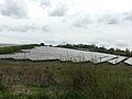 Cherry Tree Solar Farm - geograph.org.uk - 5757017.jpg 800 × 600; 96 KB
-
 Chesterfield Road (A632) - geograph.org.uk - 3643939.jpg 640 × 480; 83 KB
-
 Chesterfield Road (A632) - geograph.org.uk - 3643940.jpg 640 × 480; 71 KB
-
 Chesterfield Road (A632) - geograph.org.uk - 3643953.jpg 640 × 480; 67 KB
-
 Chesterfield Road (A632) - geograph.org.uk - 3643959.jpg 640 × 480; 63 KB
-
 Chesterfield Road (A632) - geograph.org.uk - 3643964.jpg 640 × 480; 73 KB
-
 Chesterfield Road east of Arkwright Town - geograph.org.uk - 2446984.jpg 950 × 603; 258 KB
-
 Chesterfield Round Walk Marker - geograph.org.uk - 5149091.jpg 1,065 × 1,600; 561 KB
-
 Choice of paths near Deepdale Farm - geograph.org.uk - 2321063.jpg 3,648 × 2,736; 5.73 MB
-
 Crop Field near Sutton Scarsdale Hall - geograph.org.uk - 4009164.jpg 4,000 × 3,000; 2.51 MB
-
 Curious sheep - geograph.org.uk - 3957706.jpg 800 × 533; 126 KB
-
 Danger Mine Gases - geograph.org.uk - 4068287.jpg 3,950 × 2,156; 5.84 MB
-
 Danger sign on a former pithead building - geograph.org.uk - 3895535.jpg 2,489 × 1,778; 1.95 MB
-
 Deepdale Farm - geograph.org.uk - 2320875.jpg 3,648 × 2,736; 5.47 MB
-
 Deepdale Farm from the south - geograph.org.uk - 2680254.jpg 1,024 × 683; 306 KB
-
 Deepdale Farm in the spring - geograph.org.uk - 2372860.jpg 950 × 714; 357 KB
-
 Derbyshire UK parish map highlighting Sutton cum Duckmanton.svg 888 × 1,308; 2.35 MB
-
 Dismantled Railway - geograph.org.uk - 2315401.jpg 800 × 531; 126 KB
-
 Distant view towards Bolsover Castle - geograph.org.uk - 3786107.jpg 3,608 × 2,010; 3.62 MB
-
 Disused bridge over Sutton Lane - geograph.org.uk - 5757013.jpg 800 × 587; 111 KB
-
 Disused mine shaft building near Arkwright Town - geograph.org.uk - 3895508.jpg 2,454 × 1,637; 1.33 MB
-
 Disused railway east of Ladybower Wood - geograph.org.uk - 5954680.jpg 1,600 × 1,200; 936 KB
-
 Doe Lea valley scene in winter - geograph.org.uk - 3299938.jpg 1,024 × 468; 240 KB
-
 Duckmanton Moor - geograph.org.uk - 2812543.jpg 640 × 405; 70 KB
-

-

-

-
 Duckmanton Railway Cutting - Former GCR - geograph.org.uk - 2315380.jpg 800 × 531; 175 KB
-
 Duckmanton Railway Cutting - geograph.org.uk - 2315157.jpg 800 × 531; 192 KB
-
 Duckmanton Railway Cutting - geograph.org.uk - 2315418.jpg 800 × 531; 223 KB
-

-
 Duckmanton Railway Cutting - View East - geograph.org.uk - 2315361.jpg 800 × 531; 214 KB
-

-
 Evening spring shower - geograph.org.uk - 2408478.jpg 950 × 551; 221 KB
-
 Exit road, Junction 29a - geograph.org.uk - 2842895.jpg 640 × 506; 48 KB
-

-

-

-
 Farm track near Moor Farm - geograph.org.uk - 2470510.jpg 950 × 582; 235 KB
-
 Farmland east of Sutton Lane - geograph.org.uk - 2149441.jpg 900 × 526; 249 KB
-
 Farmland north of Lodge Farm - geograph.org.uk - 2142666.jpg 900 × 548; 255 KB
-
 Farmland scene in cloud and mist - geograph.org.uk - 3969192.jpg 1,024 × 781; 100 KB
-
 Farmland towards Railway Cottages - geograph.org.uk - 3737920.jpg 1,024 × 768; 241 KB
-
 Farmland, Mill Farm - geograph.org.uk - 3643938.jpg 640 × 480; 99 KB
-
 Farmland, Woodnook Farm - geograph.org.uk - 3643968.jpg 640 × 480; 59 KB
-
 Field and the Doe Lea valley - geograph.org.uk - 3737918.jpg 1,024 × 651; 194 KB
-
 Field footpath and view to Bolsover - geograph.org.uk - 2449216.jpg 950 × 713; 276 KB
-
 Field of barley - geograph.org.uk - 2449245.jpg 950 × 644; 257 KB
-
 Field of barley on a breezy afternoon - geograph.org.uk - 2406469.jpg 950 × 699; 394 KB
-
 Field of Crops off Palterton Lane - geograph.org.uk - 4009171.jpg 4,000 × 3,000; 2.69 MB
-
 Field west of the reserves - geograph.org.uk - 3709428.jpg 750 × 563; 73 KB
-

-
 Fields by the motorway - geograph.org.uk - 2406468.jpg 950 × 520; 275 KB
-
 Fields near Deepdale Farm - geograph.org.uk - 2680245.jpg 1,024 × 562; 235 KB
-
 Fields near Springwood Farm - geograph.org.uk - 2425699.jpg 950 × 650; 293 KB
-
 Fields towards Yewtree Farm - geograph.org.uk - 2149345.jpg 900 × 290; 161 KB
-
 Fields west of Bolsover - geograph.org.uk - 2406466.jpg 950 × 661; 322 KB
-
 Fields west of Bolsover - geograph.org.uk - 2449205.jpg 950 × 713; 270 KB
-
 Fields west of Sutton Scarsdale - geograph.org.uk - 2149336.jpg 900 × 570; 296 KB
-
 Fields, flood and footpath - geograph.org.uk - 2193609.jpg 744 × 900; 330 KB
-
 Fingerpost on Rock Lane - geograph.org.uk - 5149007.jpg 1,600 × 1,065; 722 KB
-
 Fingerpost on Sutton Lane - geograph.org.uk - 5149090.jpg 1,600 × 1,065; 857 KB
-
 Fishing lake at Hall Farm - geograph.org.uk - 2149420.jpg 900 × 600; 340 KB
-
 Fishing pond near Arkwright Town - geograph.org.uk - 3895515.jpg 3,101 × 1,080; 808 KB
-
 Fishing Pond near Arkwright Town - geograph.org.uk - 3957702.jpg 800 × 533; 91 KB
-
 Footbridge over the River Doe Lea - geograph.org.uk - 2680257.jpg 768 × 1,024; 438 KB
-
 Footpath across a large field of barley - geograph.org.uk - 2415071.jpg 713 × 950; 273 KB
-
 Footpath and Field of Barley near Lodge Farm - geograph.org.uk - 4009221.jpg 4,000 × 3,000; 2.21 MB
-
 Footpath east of Calow - geograph.org.uk - 2470504.jpg 950 × 713; 272 KB
-
 Footpath near Arkwright Town - geograph.org.uk - 3245593.jpg 4,000 × 3,000; 2.92 MB
-
 Footpath off Staveley Road - geograph.org.uk - 2134623.jpg 640 × 480; 92 KB
-

-
 Footpath towards Heath - geograph.org.uk - 2415083.jpg 750 × 950; 298 KB
-
 Footpath towards the A632 and Bolsover - geograph.org.uk - 2449198.jpg 950 × 687; 292 KB
-
 Fungi at the edge of a field - geograph.org.uk - 3709430.jpg 750 × 403; 125 KB
-

-
 Grassland near Sutton Springs Wood - geograph.org.uk - 4003228.jpg 4,000 × 3,000; 2.06 MB
-
 Grazing north off Arkwright Town - geograph.org.uk - 4377093.jpg 640 × 480; 69 KB
-
 Half a mile to junction 29 M1 southbound - geograph.org.uk - 4567529.jpg 640 × 291; 123 KB
-
 Harvested field - geograph.org.uk - 2602385.jpg 1,024 × 764; 401 KB
-
 Hillside below Palterton - geograph.org.uk - 2372885.jpg 950 × 689; 369 KB
-
 Hilltop Farm, Long Duckmanton - geograph.org.uk - 2134653.jpg 640 × 480; 77 KB
-
 Houses on School Lane, Arkwright Town - geograph.org.uk - 3895432.jpg 2,484 × 1,863; 1.17 MB
-
 Lake and fields - geograph.org.uk - 3709453.jpg 750 × 563; 96 KB
-
 Little Green, Sutton Springs Wood - geograph.org.uk - 3870962.jpg 5,117 × 3,655; 5.47 MB
-
 Livestock and Barn at Springwood Farm - geograph.org.uk - 4000434.jpg 4,000 × 3,000; 1.96 MB
-

-
 Lodge Farm Ruins and the M1 - a panoramic view - geograph.org.uk - 3870816.jpg 3,758 × 1,080; 850 KB
-
 Lodge Farm ruins by the M1 Motorway - geograph.org.uk - 3870818.jpg 5,106 × 3,404; 4.68 MB
-
 Long Duckmanton, Arkwright Arms - geograph.org.uk - 2240353.jpg 1,024 × 768; 163 KB
-
 Longcourse Farm - geograph.org.uk - 3783039.jpg 800 × 533; 67 KB
-
 Longcourse Lane near Long Duckmanton - geograph.org.uk - 3245672.jpg 3,704 × 2,434; 1.62 MB
-
 M1 1 mile south of junction 29a - geograph.org.uk - 4324324.jpg 640 × 337; 42 KB
-
 M1 heading north - geograph.org.uk - 2842911.jpg 640 × 480; 44 KB
-
 M1 Motorway Viewed from the A632 - geograph.org.uk - 2681770.jpg 3,296 × 2,472; 1.16 MB
-
 M1 near Sutton Scarsdale - geograph.org.uk - 2142656.jpg 900 × 578; 304 KB
-
 M1 north of J29 - geograph.org.uk - 2321252.jpg 3,648 × 2,736; 5.35 MB
-
 M1 northbound towards junction 30 - geograph.org.uk - 4355276.jpg 1,600 × 1,062; 448 KB
-
 M1 south near Burton Barn - geograph.org.uk - 3530269.jpg 640 × 315; 47 KB
-
 M1 southbound - geograph.org.uk - 3643945.jpg 640 × 480; 74 KB
-
 M1, southbound - geograph.org.uk - 4667477.jpg 640 × 373; 31 KB
-
 M1, southbound - geograph.org.uk - 4667484.jpg 640 × 386; 33 KB
-
 M1, southbound - geograph.org.uk - 4667493.jpg 640 × 344; 26 KB
-
 Marshy was here - geograph.org.uk - 1916401.jpg 640 × 197; 58 KB
-
 Methane gas vent north of Arkwright Town - geograph.org.uk - 3895414.jpg 2,253 × 1,802; 1.24 MB
-
 Mill Farm - geograph.org.uk - 3643937.jpg 640 × 480; 78 KB
-
 Motorway from the Palterton Lane bridge - geograph.org.uk - 2222455.jpg 900 × 463; 188 KB
-
 New tree plantation on reclaimed land - geograph.org.uk - 2149447.jpg 900 × 675; 360 KB
-
 New wood springing up on reclaimed coal mine pit heap site - geograph.org.uk - 4068292.jpg 4,000 × 2,248; 5.42 MB
-
 Newly drilled field - geograph.org.uk - 2602343.jpg 1,024 × 768; 275 KB
-
 Newly planted trees and farmland - geograph.org.uk - 4377098.jpg 640 × 480; 51 KB
-
 Northbound M1 near Sutton Scarsdale - geograph.org.uk - 2842916.jpg 640 × 500; 53 KB
-
 Nursery Farm, Duckmanton Moor - geograph.org.uk - 2282268.jpg 3,648 × 2,736; 5.66 MB
-
 Off-Leash Exercise Paddock at the Four Paws Hotel - geograph.org.uk - 4881121.jpg 4,608 × 3,456; 4.22 MB
-
 Old shed in a field - geograph.org.uk - 3870799.jpg 5,024 × 3,589; 4.34 MB
-
 On a lane from Longcourse House - geograph.org.uk - 2321266.jpg 3,648 × 2,736; 5.71 MB
-
 On Chesterfield Road west of Bolsover - geograph.org.uk - 5261568.jpg 4,769 × 3,666; 3.47 MB
-
 On Longcourse Lane near Long Duckmanton - geograph.org.uk - 3895586.jpg 1,944 × 2,592; 2.35 MB
-
 On Palterton Lane - geograph.org.uk - 3870813.jpg 5,010 × 3,758; 4.84 MB
-
 One mile to junction 29 - geograph.org.uk - 4578860.jpg 640 × 284; 117 KB
-
 Palterton Lane - geograph.org.uk - 3786119.jpg 4,000 × 2,527; 5.08 MB
-
 Palterton Lane and Deepdale Farm - geograph.org.uk - 2142659.jpg 900 × 675; 319 KB
-
 Palterton Lane and Doe Lea valley view - geograph.org.uk - 2449240.jpg 950 × 728; 279 KB
-
 Park Farm by Palterton Lane - geograph.org.uk - 2449235.jpg 950 × 630; 287 KB
-
 Parkland at Sutton Scarsdale Hall - geograph.org.uk - 5397575.jpg 1,199 × 1,600; 375 KB
-
 Path at Rock Lane - geograph.org.uk - 2282350.jpg 3,648 × 2,736; 6.01 MB
-
 Path leading to Heath - geograph.org.uk - 5149117.jpg 1,600 × 1,065; 707 KB
-
 Path leading to Heath - geograph.org.uk - 5149121.jpg 1,600 × 1,065; 901 KB
-
 Path leading to Palterton Lane - geograph.org.uk - 5149107.jpg 1,600 × 1,065; 971 KB
-
 Path through the snow - geograph.org.uk - 2184202.jpg 900 × 622; 390 KB
-
 Path towards Allpits Plantation - geograph.org.uk - 4068295.jpg 4,000 × 2,248; 5.79 MB
-
 Path towards disused railway line - geograph.org.uk - 2470506.jpg 950 × 713; 290 KB
-
 Pathway to a pair of ruins - geograph.org.uk - 2415603.jpg 1,024 × 768; 141 KB
-
 Piles of lime on a muddy track - geograph.org.uk - 2282341.jpg 3,648 × 2,736; 5.72 MB
-
 Pond near Blue Lodge Farm - geograph.org.uk - 4377097.jpg 640 × 480; 79 KB
-
 Pond, silted up - geograph.org.uk - 2282298.jpg 3,648 × 2,736; 5.74 MB
-
 Postman's Lane - geograph.org.uk - 2282380.jpg 3,648 × 2,736; 6.06 MB
-
 Public recycling site - geograph.org.uk - 2967573.jpg 3,648 × 2,736; 3.84 MB
-
 Queueing on the M1 - geograph.org.uk - 2842902.jpg 640 × 480; 52 KB
-
 Railway Cottages - geograph.org.uk - 2321151.jpg 3,648 × 2,736; 5.23 MB
-

-
 Ramcroft Hall Farm (4660097482).jpg 2,960 × 1,946; 1.28 MB
-
 Re-planting, Duckmanton Moor - geograph.org.uk - 2282276.jpg 3,648 × 2,736; 5.32 MB
-
 Ready for the off - geograph.org.uk - 2282302.jpg 2,430 × 1,824; 1.01 MB
-
 Reclaimed land, Duckmanton Moor - geograph.org.uk - 3643957.jpg 640 × 480; 76 KB
-

-

-
 Remains of Lodge Farm - geograph.org.uk - 4009211.jpg 4,000 × 3,000; 3.71 MB
-
 River Doe Lea upstream from B6418 bridge - geograph.org.uk - 2448562.jpg 713 × 950; 328 KB
-
 Road to Duckmanton from Long Duckmanton - geograph.org.uk - 4068273.jpg 3,850 × 1,928; 4.24 MB
-
 Rock Farm from Rock Lane - geograph.org.uk - 3870978.jpg 5,040 × 3,600; 3.65 MB
-
 Rock Farm viewed from Rock Lane - geograph.org.uk - 3870984.jpg 3,614 × 5,059; 4.96 MB
-
 Rock Lane towards Woodnook Farm - geograph.org.uk - 5149021.jpg 1,600 × 1,065; 712 KB
-
 Roundabout, A6192 - geograph.org.uk - 2321180.jpg 3,648 × 2,736; 3.83 MB
-
 Ruins at Lodge Farm - geograph.org.uk - 2142664.jpg 900 × 675; 330 KB
-
 Ruins at Lodge Farm - geograph.org.uk - 2222463.jpg 900 × 634; 348 KB
-
 Searching for the path across the newly planted brassica - geograph.org.uk - 3786149.jpg 4,000 × 1,747; 4.38 MB
-
 Selfheal (Prunella vulgaris) - geograph.org.uk - 3895852.jpg 2,428 × 1,942; 898 KB
-
-
 Sheep grazing near Moor Farm - geograph.org.uk - 1952476.jpg 640 × 480; 73 KB
-
 Site of Arkwright Town Colliery - geograph.org.uk - 2315387.jpg 800 × 531; 117 KB
-
 Site of Former Opencast Workings near Arkwright - geograph.org.uk - 3245652.jpg 4,000 × 3,000; 2.82 MB
-
 Snowdrops in Sutton Manor Wood - geograph.org.uk - 3870792.jpg 5,184 × 3,888; 5.7 MB
-
 Snowstorm near Deepdale Farm - geograph.org.uk - 3366784.jpg 4,000 × 3,000; 2.54 MB
-
 Springwood Farm - geograph.org.uk - 2282371.jpg 3,648 × 2,736; 5.24 MB
-
 Staveley Road - geograph.org.uk - 3249703.jpg 1,024 × 540; 90 KB


_-_geograph.org.uk_-_3643939.jpg)
_-_geograph.org.uk_-_3643940.jpg)
_-_geograph.org.uk_-_3643953.jpg)
_-_geograph.org.uk_-_3643959.jpg)
_-_geograph.org.uk_-_3643964.jpg)


_north_of_Arkwright_Town_-_geograph.org.uk_-_4377096.jpg)
_towards_Staveley_Road_-_geograph.org.uk_-_4377100.jpg)


.jpg)


_-_geograph.org.uk_-_3895852.jpg)
_-_geograph.org.uk_-_3643949.jpg)


