Category:Susquehanna River in the 18th century
Jump to navigation
Jump to search
| NO WIKIDATA ID FOUND! Search for Susquehanna River in the 18th century on Wikidata | |
| Upload media |
Subcategories
This category has only the following subcategory.
Media in category "Susquehanna River in the 18th century"
The following 8 files are in this category, out of 8 total.
-
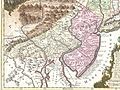 1756 Lotter Map of Eastern Pennsylvania, & New Jersey cropped from Geographicus-1756.jpg 3,600 × 2,700; 4.38 MB
-
 A Map Of The State Of Pennsylvania by Reading Howell, 1792 crop1.png 900 × 675; 1.15 MB
-
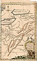 A Map of the Western parts of the Colony of Virginia, 1754.jpg 952 × 1,544; 1.78 MB
-
 Conestoga Manor 1717.jpg 2,280 × 1,820; 1.17 MB
-
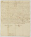 Deed from Indians on the Susquehanna 1700 HSP.jpg 700 × 836; 74 KB
-
 Susquehanna River to Schuylkill River, Chesapeake Bay to Delaware Bay. NYPL484199.tiff 4,991 × 4,117; 58.79 MB
-

-
 Wyoming Forts.jpg 426 × 409; 74 KB


