Category:Surroundings of the Saint Benedict church in Płock
Jump to navigation
Jump to search
| Object location | | View all coordinates using: OpenStreetMap |
|---|
 | |||||
| Upload media | |||||
| Instance of | |||||
|---|---|---|---|---|---|
| Location | Płock, Masovian Voivodeship, Poland | ||||
| Diocese | |||||
| official website | |||||
 | |||||
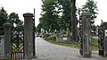
English: Surroundings of the Saint Benedict church in Płock, at 2 Dobrzykowska street
Polski: Płock ul. Dobrzykowska 2 - Parafia pw. św. Benedykta (gł. kościół pw. św. Benedykta). Parafia przynależy do Dekanatu gąbińskiego.
Subcategories
This category has the following 2 subcategories, out of 2 total.
Media in category "Surroundings of the Saint Benedict church in Płock"
The following 4 files are in this category, out of 4 total.
-
 2013 Saint Benedict church in Płock - 03.jpg 4,756 × 3,567; 3.42 MB
-
 2013 Saint Benedict church in Płock - 04.jpg 4,799 × 3,599; 3.03 MB
-
 Płock, zespół kościoła par. p.w. św. Benedykta- cmentarz.JPG 3,584 × 2,016; 2.61 MB
-
 Płock- zespół kościoła par. p.w. św. Benedykta- cmentarz.JPG 3,584 × 2,016; 2.84 MB


