Category:Supetarska Draga
Jump to navigation
Jump to search
| Object location | | View all coordinates using: OpenStreetMap |
|---|
settlement in the Town of Rab, Primorje-Gorski Kotar County, Croatia  | |||||
| Upload media | |||||
| Instance of | |||||
|---|---|---|---|---|---|
| Location | |||||
| Population |
| ||||
| Area |
| ||||
 | |||||
Subcategories
This category has the following 7 subcategories, out of 7 total.
Media in category "Supetarska Draga"
The following 70 files are in this category, out of 70 total.
-
 *Draski tanac* - Tunera Supetarska Draga - St Peters Basilica - panoramio.jpg 2,560 × 1,920; 2.38 MB
-
 2014-12-08 09-34-56 11113.0 Croatia Supetarska draga.jpg 600 × 450; 182 KB
-
 Amphoraes - panoramio.jpg 1,120 × 840; 80 KB
-
 Amphoraes - Rt. Sorinj,Supetarska Draga - panoramio.jpg 1,120 × 840; 33 KB
-
 Apartments Kurelić - Rabko, Rab, Supetarska Draga 426, Croatia - panoramio (1).jpg 2,000 × 1,499; 340 KB
-
 Apartments Kurelić - Rabko, Rab, Supetarska Draga 426, Croatia - panoramio (2).jpg 1,600 × 1,200; 450 KB
-
 Apartments Kurelić - Rabko, Rab, Supetarska Draga 426, Croatia - panoramio (3).jpg 2,000 × 1,110; 568 KB
-
 Apartments Kurelić - Rabko, Rab, Supetarska Draga 426, Croatia - panoramio.jpg 1,024 × 768; 209 KB
-

-
 Apartments Kurelić - Supetarska Draga, Rab - panoramio.jpg 1,600 × 1,203; 436 KB
-
 Bert for boat, Apartments Kurelić - panoramio.jpg 1,280 × 960; 140 KB
-
-
 Cherry flower, sea, and ship ... - panoramio.jpg 1,600 × 1,200; 415 KB
-
 Church St Peters Basilica - Supetarska Draga 29. 06. 06. - panoramio.jpg 2,560 × 1,920; 786 KB
-
 Cvijet - Flover ( Garden Rab - panoramio.jpg 1,600 × 1,200; 290 KB
-
 Cvijet - Flover ( Garden Rab) - panoramio (1).jpg 1,600 × 1,200; 314 KB
-
 Cvijet - Flover ( Garden Rab) - panoramio.jpg 1,600 × 1,200; 262 KB
-
 Garden - rose in the may, Apartments Kurelić - panoramio.jpg 1,600 × 1,200; 580 KB
-
 Island Rab, Croatia - My boat - panoramio.jpg 1,280 × 954; 207 KB
-
 Island Rab, Croatia - My Landscape - panoramio.jpg 2,000 × 1,500; 643 KB
-
 Japanese Persimon (or Kaki) in Supetarska Draga - panoramio.jpg 960 × 1,280; 299 KB
-
 Kampor - Supetarska Draga - panoramio.jpg 2,000 × 1,503; 470 KB
-

-
 Kažust - Kanat, Supetarska Draga - panoramio.jpg 1,600 × 1,201; 476 KB
-
 Lepers , Croatia - panoramio.jpg 1,500 × 1,004; 933 KB
-
 Lepers group - Rab, Croatia - panoramio.jpg 1,500 × 1,004; 935 KB
-
 Lepers show - panoramio.jpg 1,500 × 1,004; 988 KB
-
 Maskare - organizations Tunera(2007) - panoramio.jpg 1,600 × 1,200; 165 KB
-
 May Garden - Apartments Kurelić, Supetarska Draga, Rab - panoramio.jpg 1,600 × 1,200; 595 KB
-
 Mill( Mlinica) - Supetarska draga - panoramio.jpg 840 × 1,120; 177 KB
-
 Old tool for calamary (squid) - RabTunera - panoramio.jpg 1,120 × 839; 76 KB
-
 Olives, Supetarska Draga - panoramio.jpg 842 × 1,150; 203 KB
-
 Panorama, Mandarine, Supetarska draga - panoramio.jpg 1,280 × 960; 267 KB
-
 Parliament DSM Tunera - 06.11. 2004 - panoramio.jpg 1,120 × 840; 59 KB
-
 Pink rose - Rab Supetarska Draga 426 - panoramio.jpg 1,120 × 840; 147 KB
-
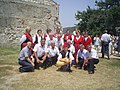
 Rab - Medieval sammer festival -Tunera and Fjera - panoramio.jpg 1,600 × 1,200; 130 KB
-
 Rab - Supetarska Draga - After the rain 08. 09. - panoramio.jpg 1,400 × 1,050; 128 KB
-
 Rab Küste Norden.jpeg 2,304 × 1,728; 970 KB
-
 Rab, Supetarska Draga - panoramio.jpg 2,000 × 1,500; 321 KB
-
 Reconstruction - Tunera - panoramio.jpg 1,120 × 840; 138 KB
-
 Reconstruction Tunera 2 - panoramio.jpg 1,280 × 960; 209 KB
-
 Red rose - Rab Supetarska Draga 426 - panoramio.jpg 1,120 × 840; 100 KB
-
 Renovation Tunere (Supetarska Draga) - View from Tunera - panoramio.jpg 1,120 × 839; 288 KB
-
 Rose and mandarin in garden - panoramio.jpg 840 × 1,120; 185 KB
-
 Sailboats in Supetarska Draga.jpg 1,600 × 1,200; 220 KB
-

-

-
 St Peters Basilica,Supetarska Draga-Rab - panoramio.jpg 600 × 800; 72 KB
-
 Supetarska Draga - Butterfly and flower(Leptir i cvijet) - panoramio.jpg 1,280 × 960; 179 KB
-
 Supetarska Draga - flower(cvijet) - panoramio.jpg 1,280 × 960; 289 KB
-
 Supetarska Draga - Island Rab - panoramio.jpg 2,000 × 1,204; 592 KB
-
 Supetarska Draga - Kampor - panoramio.jpg 2,000 × 1,500; 386 KB
-
 Supetarska Draga - panoramio (1).jpg 2,048 × 1,229; 629 KB
-
 Supetarska Draga Gornja - panoramio.jpg 2,000 × 1,476; 358 KB
-
 Supetarska Draga, Rab - Kroatien, Apartments........... - panoramio.jpg 1,024 × 768; 194 KB
-
 Supetarska Draga, Rab - panoramio (1).jpg 1,600 × 1,199; 349 KB
-
 Supetarska Draga, Rab - panoramio (2).jpg 2,000 × 1,500; 279 KB
-
 Supetarska Draga, Rab - panoramio (3).jpg 2,000 × 1,500; 384 KB
-
 Supetarska Draga, Rab - panoramio (4).jpg 2,048 × 1,228; 1.07 MB
-
 Supetarska Draga, Rab - panoramio.jpg 1,600 × 1,203; 322 KB
-
 Supetarska Draga, Rab - South wind blows - panoramio.jpg 1,600 × 1,200; 316 KB
-
 Supetarska Draga-Mill on the sea - panoramio (1).jpg 2,000 × 1,502; 709 KB
-
 Supetarska Draga-Mill on the sea - panoramio.jpg 2,000 × 1,499; 545 KB
-
 Tunera - View from Supetarska Draga and island Maman - panoramio.jpg 1,280 × 960; 152 KB
-
 Tunera View from Supetarska Draga - panoramio.jpg 1,280 × 960; 184 KB
-
 TUNERA, SEA-RELATED SPORTS ASSOCIATION - Fishing - panoramio.jpg 1,120 × 840; 77 KB
-

-
 View from Kažust, Kanat on Supetarska Draga - panoramio.jpg 1,600 × 1,205; 397 KB
-

-
 Zlatni zalaz - panoramio.jpg 1,600 × 1,200; 386 KB


.jpg)
.jpg)
.jpg)


_-_panoramio_(1).jpg)
_-_panoramio.jpg)


_in_Supetarska_Draga_-_panoramio.jpg)


_-_panoramio.jpg)

_-_Supetarska_draga_-_panoramio.jpg)
_-_RabTunera_-_panoramio.jpg)


_-_View_from_Tunera_-_panoramio.jpg)

.jpg)


_-_panoramio.jpg)
_-_panoramio.jpg)


.jpg)


.jpg)
.jpg)
.jpg)
.jpg)


.jpg)


_-Apartments_Kureli%C4%87_-_Rabko,_Rab,_Supetarska_Draga_426,_Croatia_-_panoramio.jpg)


