Category:Sultan Ibrahim Building
Jump to navigation
Jump to search
| Object location | | View all coordinates using: OpenStreetMap |
|---|
|
This is a category about a monument in Malaysia, identified by ID 01-JHR/21
|
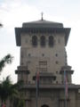
former state secretariat building of Johor  | |||||
| Upload media | |||||
| Instance of | |||||
|---|---|---|---|---|---|
| Location | Johor Bahru, Johor Bahru District, Johor, Malaysia | ||||
| Architectural style | |||||
| Inception |
| ||||
 | |||||
Bahasa Melayu: Bangunan Sultan Ibrahim
Media in category "Sultan Ibrahim Building"
The following 20 files are in this category, out of 20 total.
-
 Bangunan Sultan Ibrahim 2.JPG 1,200 × 1,600; 344 KB
-
 Bangunan Sultan Ibrahim 3.JPG 1,600 × 1,200; 490 KB
-
 Bangunan Sultan Ibrahim Johor Bahru.JPG 612 × 487; 48 KB
-
 Bangunan Sultan Ibrahim.JPG 1,200 × 1,600; 390 KB
-
 Front View of Sultan Ibrahim Building.jpg 5,383 × 3,589; 7.07 MB
-
 IBSJB.jpg 1,280 × 906; 184 KB
-
 Johor Bahru - Bangunan Sultan Ibrahim 0002.jpg 845 × 1,200; 222 KB
-
 Johor Old Palace, Malaysia.jpg 4,080 × 3,072; 5.06 MB
-
 Legoland Malaysia Resort (23148108049).jpg 5,184 × 3,456; 4.76 MB
-
 Legoland Malaysia Resort (23198168290).jpg 5,184 × 3,456; 2.57 MB
-
 Legoland Malaysia Resort (23222248640).jpg 5,184 × 3,456; 4.39 MB
-
 Legoland Malaysia Resort (23491314396).jpg 5,184 × 3,456; 3.2 MB
-
 Malaysia - Legoland (25947592094).jpg 2,500 × 1,667; 1.96 MB
-
 Malaysia - Legoland (26460225212).jpg 2,500 × 1,667; 2.26 MB
-
 Meriam Kecil JMF - panoramio.jpg 2,048 × 1,536; 519 KB
-
 Perspective View of Sultan Ibrahim Building.jpg 5,472 × 3,648; 8.32 MB
-
 Sultan Ibrahim Building - JB.jpg 5,975 × 3,983; 11.75 MB
-
 Sultan Ibrahim Building look from Arulmigu Rajamariamman Devasthanam Temple.jpg 2,000 × 2,992; 2.48 MB
-
 Sultan Ibrahim Building, Johor, Malaysia; 2012.jpg 2,400 × 1,585; 1.96 MB
-
 Sultan Ibrahim Building.jpg 6,000 × 4,000; 10.24 MB


.jpg)
.jpg)
.jpg)
.jpg)
.jpg)
.jpg)


